Berwick Bridge
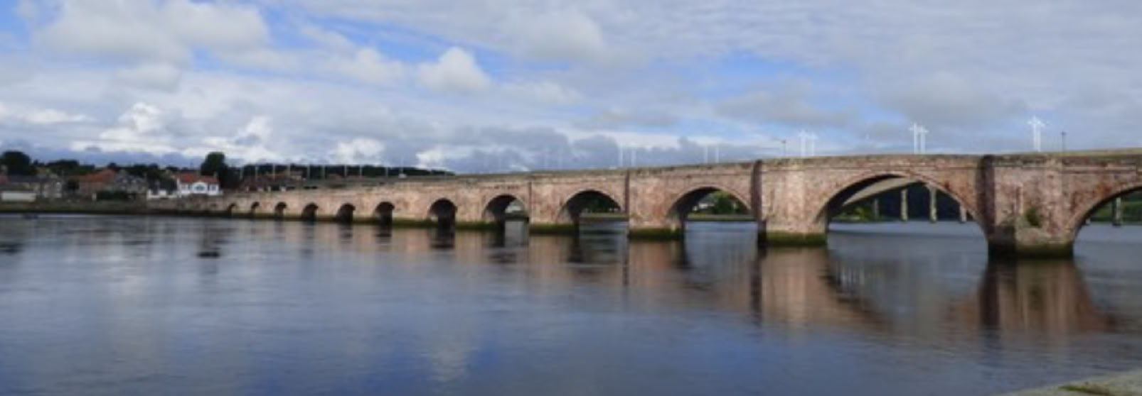
A bridge certainly existed at Berwick in the 12th century, and it seems there have been seven or eight rebuilds since then although this number may be disputed. The last of these, completed in 1624, was the first to be in stone and survives today. There is no knowledge of any Roman crossing at the mouth of the Tweed, but a Roman road was outlined in the 19th century and confirmed by Margary (Ref): Road 87. It ran from Corbridge on the 'Wall’, and traces have been found through Whittingham and on to just north of Lowick where it appears to peter-out. No road north out of Berwick has been identified, but a very ancient river crossing of the Tweed can be presumed on geographical grounds. The town was made a Royal Burgh by David I (1113-1124).
Bridge 1. The Scalacronica (Ref) , 14th century, records that the bridge at Berwick collapsed in 1195 because the arches were too low. Leland's Collectanea (Ref), 16th century, claims the first record of a bridge in 1198: “Hoc tempore ponte de Berwic inundiate asporta..’; at this time, the bridge having been carried away by floods… The text follows with a note that Bishop Phillipus initially refused to permit a rebuild (the south bank belonged to the see of Durham.) Leland’s Itinerary notes, ‘1199 The bridge of Berwike brake aboute this tyme with great force of water, bycause the arches of it were to low, and after the making of it, as it was then, it durid scars IX heres.’ These three records may well refer to the same event, and suggest that the rebuild lasted a mere 9 years. Charters of the Yesterwrits in 1202 describe a hospital at the 'bridge of berewick' and describe the road leading to the bridge at Haddington. This is the first mention of the old post road going North.
Bridge 2. We know of nationwide storms in 1210 which destroyed the bridge at Berwick and also demolished the bridge at Perth. In 1211 a huge galley (possibly a raft) was used to transport King John across the Tweed when meeting William the Lion of Scotland.
Bridge 3. must have been built a little after 1211 because, despite these summit discussions, King John sacked the town of Berwick in 1216 with unusual cruelty, re-took the castle and destroyed the bridge (Fordun (Ref)).
Bridge 4. There was an immediate rebuild by William the Lion, in 1216: recorded as built of wood but with stone piers. In the first roll of the Acts of Parliament of Scotland (John Baliol) there is a memorandum about a chain made above the bridge of Berwick by the lord bishop of Durham. A year later, in 1294, the bridge was was washed away by floods. The Lanercost reports that the floods smashed the bridge at Berwick and brought down the tower.
Bridge 5. There would be little time for a rebuild because in 1296 Edward I signalled the start of the Wars of Independence by retaliating for a Scottish alliance with France. He destroyed Berwick and slaughtered 8,000 of its people. There is no record of the building of the next bridge, but it is inconceivable, through the Wars of Independence, that the Tweed would not have been bridged. Too many armies required a crossing. Furthermore, we also know that in 1305 William Wallace was captured and cruelly executed. Edward ordered that parts of his body be exhibited on Berwick Bridge. Edward II had a small wooden church built on the wooden decking. The town was recaptured by the Scots in 1318, and then retaken by the English in 1333.
Bridge 6. A new bridge at Berwick was built in the very last year of Edward III's reign in 1376. It was said that the King ordered taxation of local fisheries to be redirected to funds for the construction.
It has to be noted that these last two constructions are disputed. At the battle of Halidon Hill (1333) the bridge was certainly ‘down’ and at this time it was proposed that only ferries, along with a nearby ford, had operated for the whole period between 1294 and 1492. This profile is incompatible with the details of section 5. However, Chalmers (Ref) notes (Caledonia 3) that in 1337 there was a grant of rents ‘for building the bridge at berwick’.
Bridge 7. Berwick had exchanged hands in anger eight times since 1150. In 1482, it was captured by Richard, Duke of Gloucester (later Richard III), and remained in English hands thereafter. Conway(Ref) notes that in 1498 the Venetian ambassador wrote in his report that Henry VII had built a magnificent bridge at Berwick, in 1492, and now had command of all the eastern coast. ( Henry VII's relations with Scotland and Ireland. 1932). Henry's daughter Margaret was married to James IV in 1502, and the new bride's impressive wedding train took the journey north via Durham, Newcastle and Berwick, crossing the new bridge on August 1st 1503. Her official reception into Scotland was conducted at Lamberton Church, a few miles north of the bridge. In 1584 this bridge was still intact; Von Wedel (Ref) described Berwick as having a long wooden bridge across the Tweed, “ whilst in England they always have fine stone bridges, even across small rivers. “ Finally, in 1603, James VI while travelling south to his coronation in London, complained about the dilapidated wooden bridge which was now 111 years old: "Is there ne'er a man in Berwick whae can boo stanes to mak' a brig ower the Tweed?"
Bridge 8. Work on the new bridge did not start until 1610. This was Berwick's first vaulted stone bridge, and it is the one that remains today. It was built 100 yards downstream. Red sandstone from Tweedmouth was brought across. Thirteen arches, were planned, with Doric columns. In 1611 there were 170 workers employed. Progress was slow. In 1620 it was still unfinished and Richard Neile, the Bishop of Durham, observed that “expenses of his Majestie's monies rise apace, but the bridge riseth slowly.” The principal engineer, James Burrell, had to cope with severe storms and flooding, in 1621, which washed away part of the works as well as the old existing wooden bridge of which the debris caused some of the damage. The workers doggedly continued, and the new bridge was completed in 1624 at a total cost of £15,000. It was the largest bridge in Britain. This sum amounts to £2.5M in terms of comparative RPI; compared to average earnings it is £38M; as a ratio to per-capita GDP it is £80M.
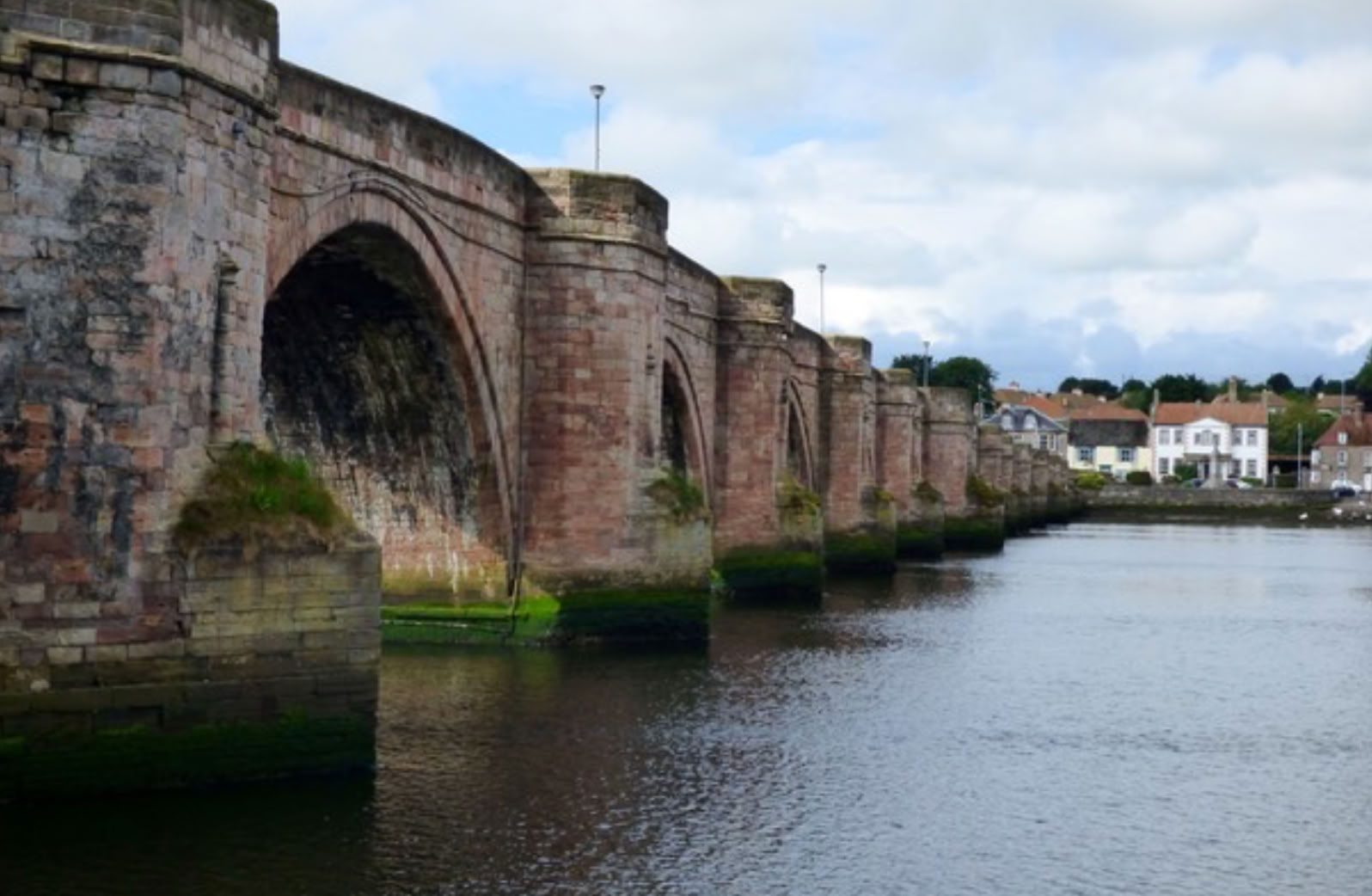
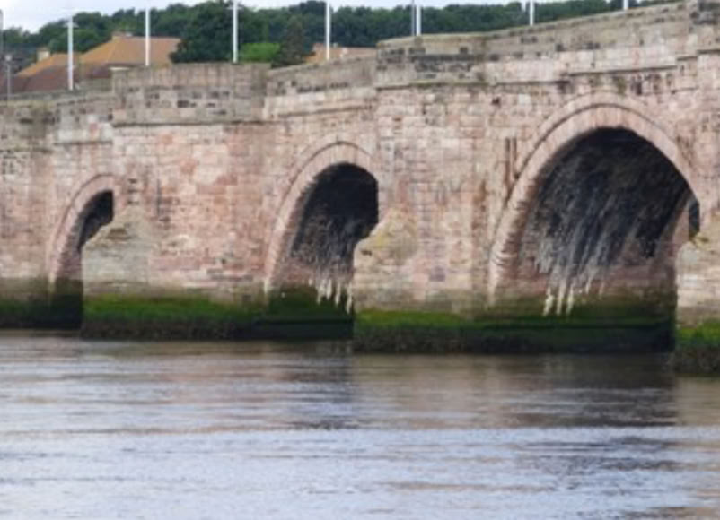
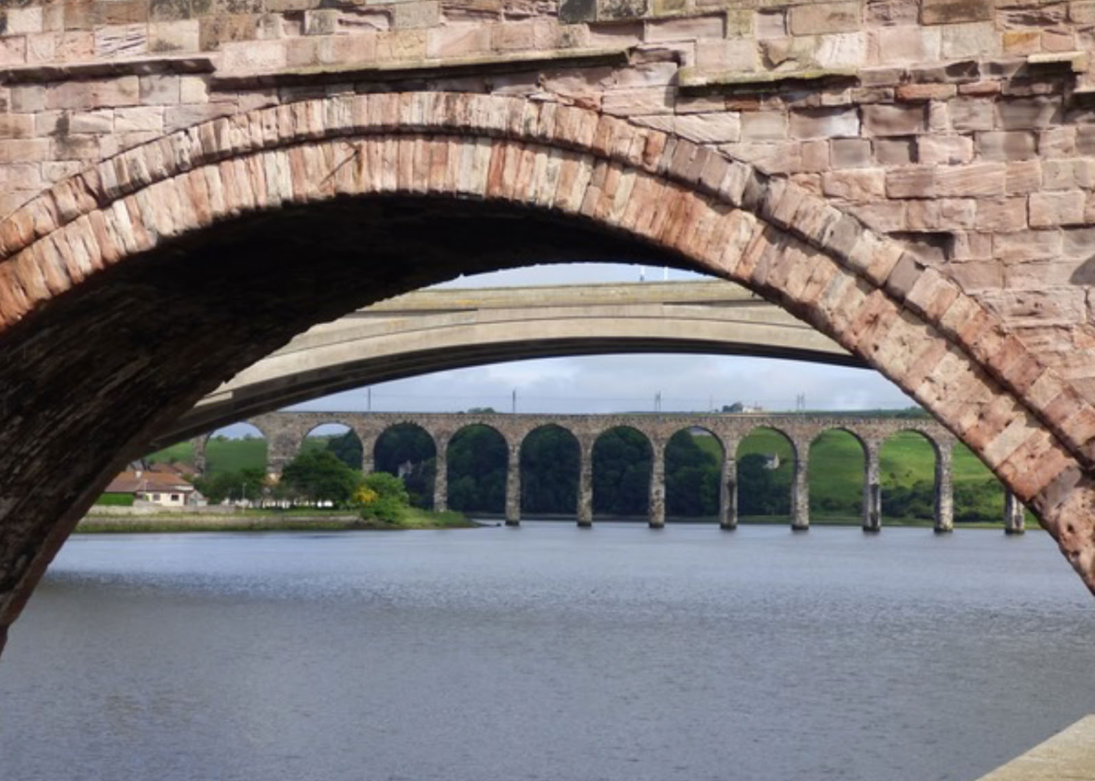
Today, the Old Bridge of Berwick has 15 arches which is more than were planned. There are two orders of red sandstone un-chamfered voussoirs, the lower one being a little recessed. The arches are un-ribbed, almost semicircular at the northern end and clearly segmental at the southern part, beyond the pier six. Refuges and spandrels are in well squared, dressed, red sandstone rubble. Parapets have been repaired and improved at several stages, in grey sandstone. There is a decorative stepped string course and Doric columns on each refuge. It is 1164 ft long and 17 ft wide, and the refuges at each pier arise out of the cutwaters. Pier number six was deemed to be the border between Berwick and Durham, and signalled by a wider refuge (photo, right). The bridge was built on a foundation of oak piles bound with iron; it is bedded on wide starlings with 3-6ft surrounding the masonry piers. These can be seen at low tide and are in remarkably good condition. The bridge remains an unusually strong, well-preserved construction despite being 350 years old.
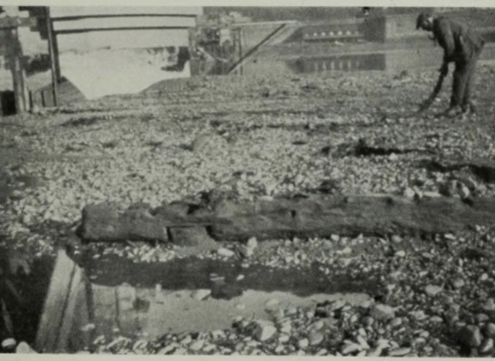
It was bypassed in 1923 when the Royal Tweed Bridge was completed, 100m upstream, at about the spot where the old 1498 bridge had been. During the preliminary work, some wooden remains of this old structure were found (left). In the 1980s, the A1 was redirected outside the town thus bypassing both older bridges. Despite this, the oldest bridge remains open to local traffic in one direction, only.
The bridge is on Roy's map of 1750 and on Blaeu's Atlas. In the latter, it appears a little upstream of the present bridge, more adjacent to the Castle, where the old 1492 bridge was located. This is expected; Blaeu was published in 1640, but the material for his map was gathered well before 1624.
Page last updated Oct.2020