Scotland’s Oldest Bridges.
A map-based catalogue of the oldest masonry bridges in Scotland.
KL - Alphabetical List
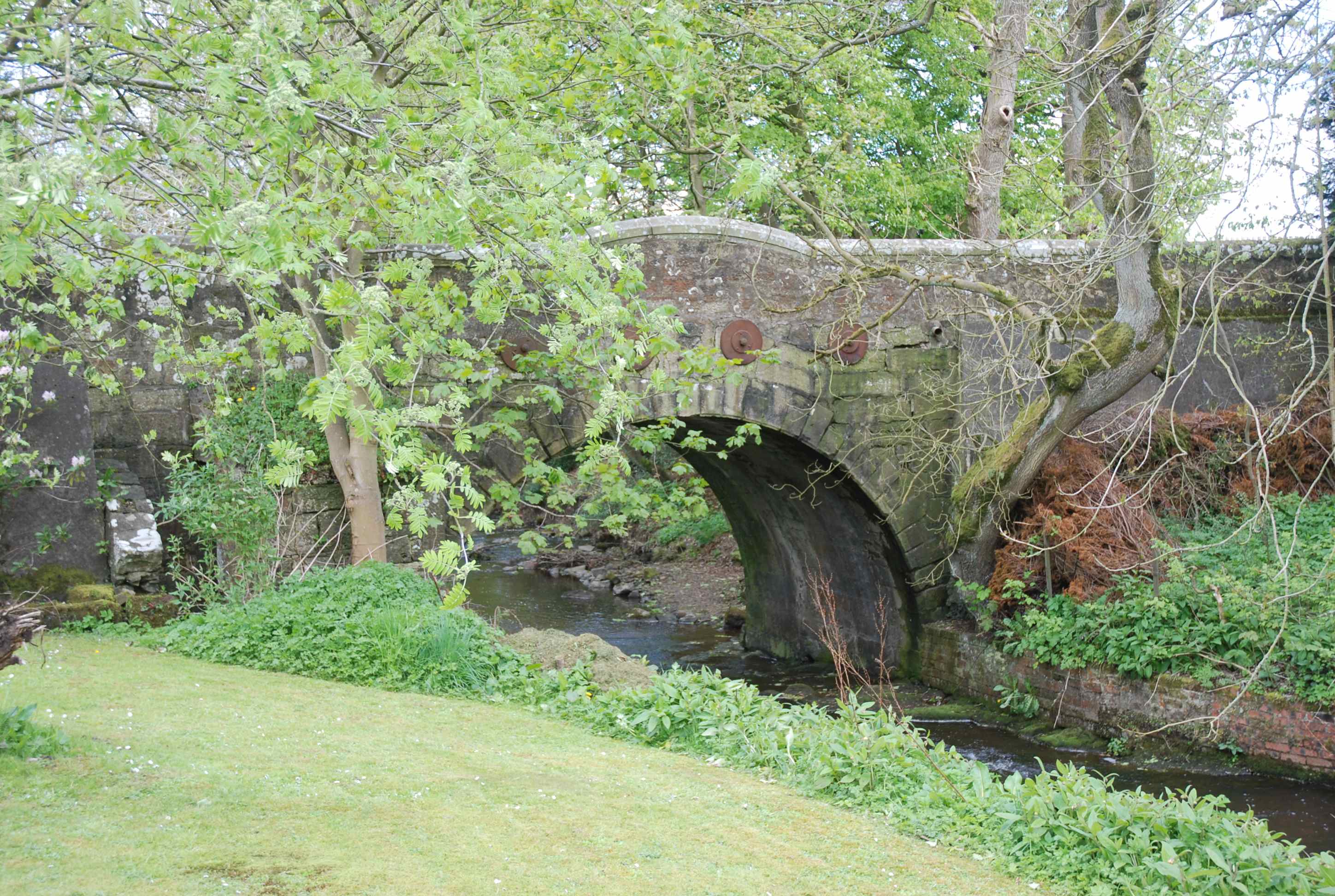
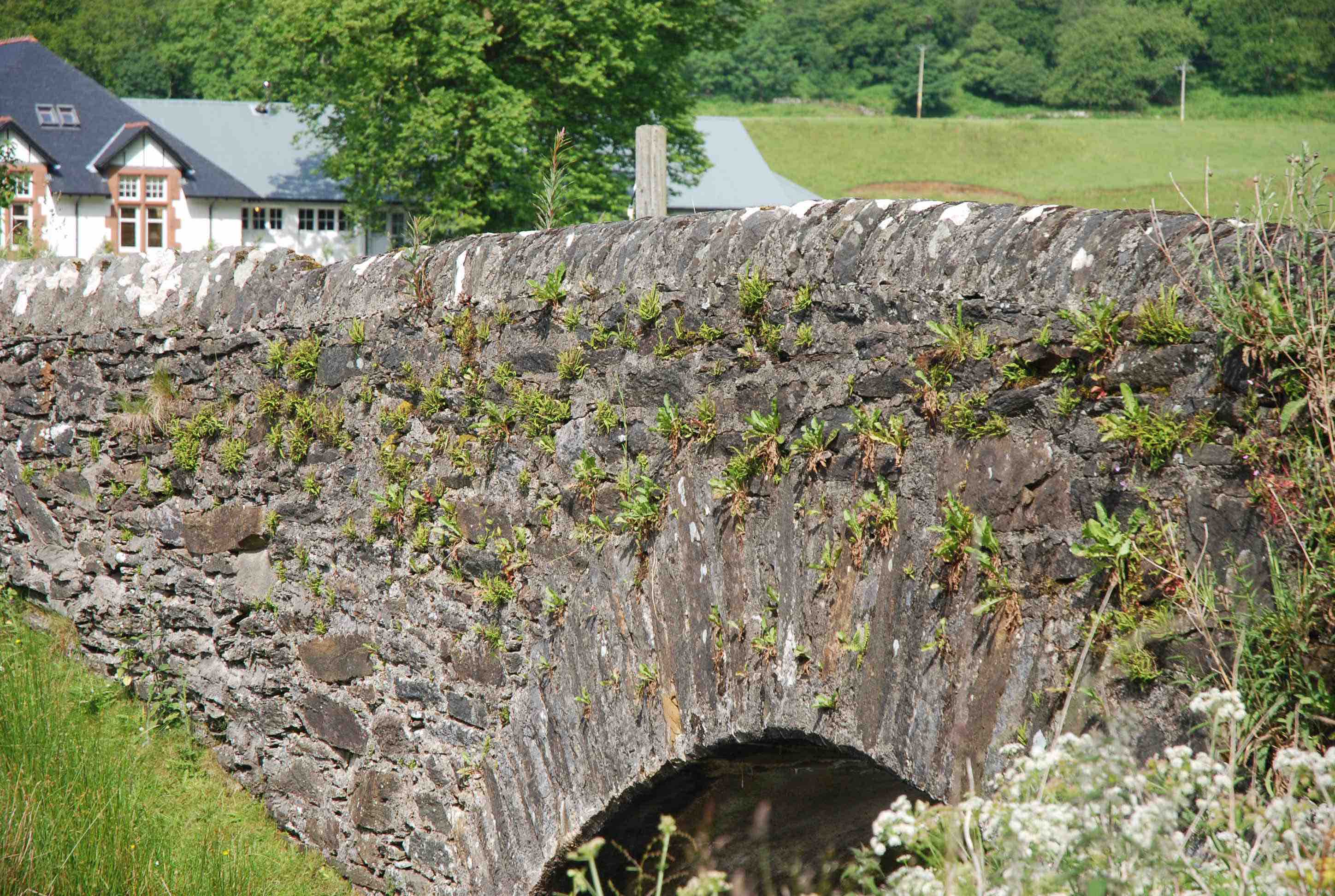
KEITH AULD BRIG.
C.Moray R.Isla 342762,850795
History: This little bridge was built in 1609 by Thomas Moray and Janet Lindsay, his wife. Sometimes called "Bridge of Grange", it has been in constant use since that period. It was involved in the 1746 skirmish between Highlanders and Government troops in the run-up to the Battle of Culloden. Repairs in 1724 and in 1822. Bypassed in 1770. Stone steps on both approaches are from a later date. Maps: Very firmly on Gordon (1636) but not on Blaeu and indistinct on Roy.
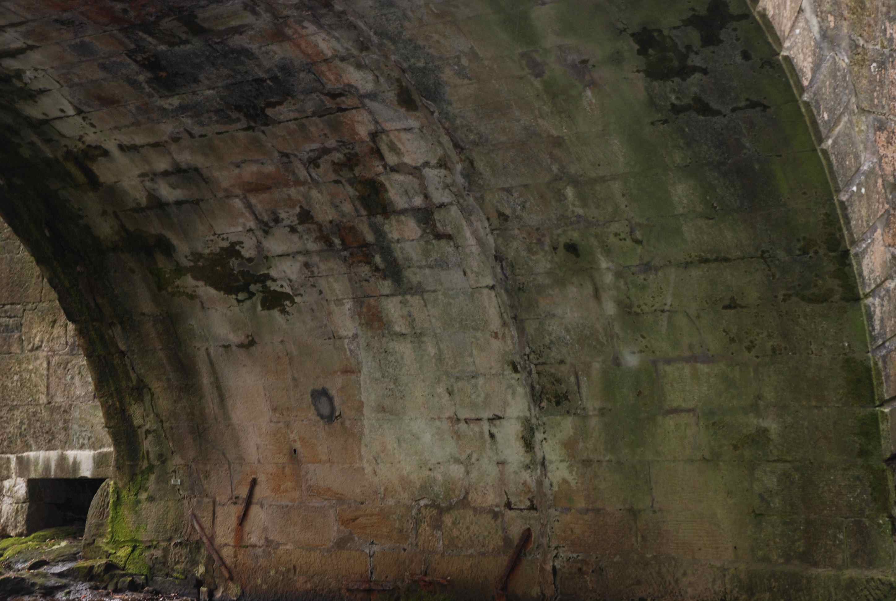
Currently: A small 17th century apex-humped bridge with a single almost semicircular arch in rather crude granite rubble. 27 ft span and 7/8ft wide. Spandrels and side-walls are in random rubble. Both approaches are now stepped. Also splayed. Arms of the Moray couple on one side. Date-stone (1609) on the other.
_______________________________________________
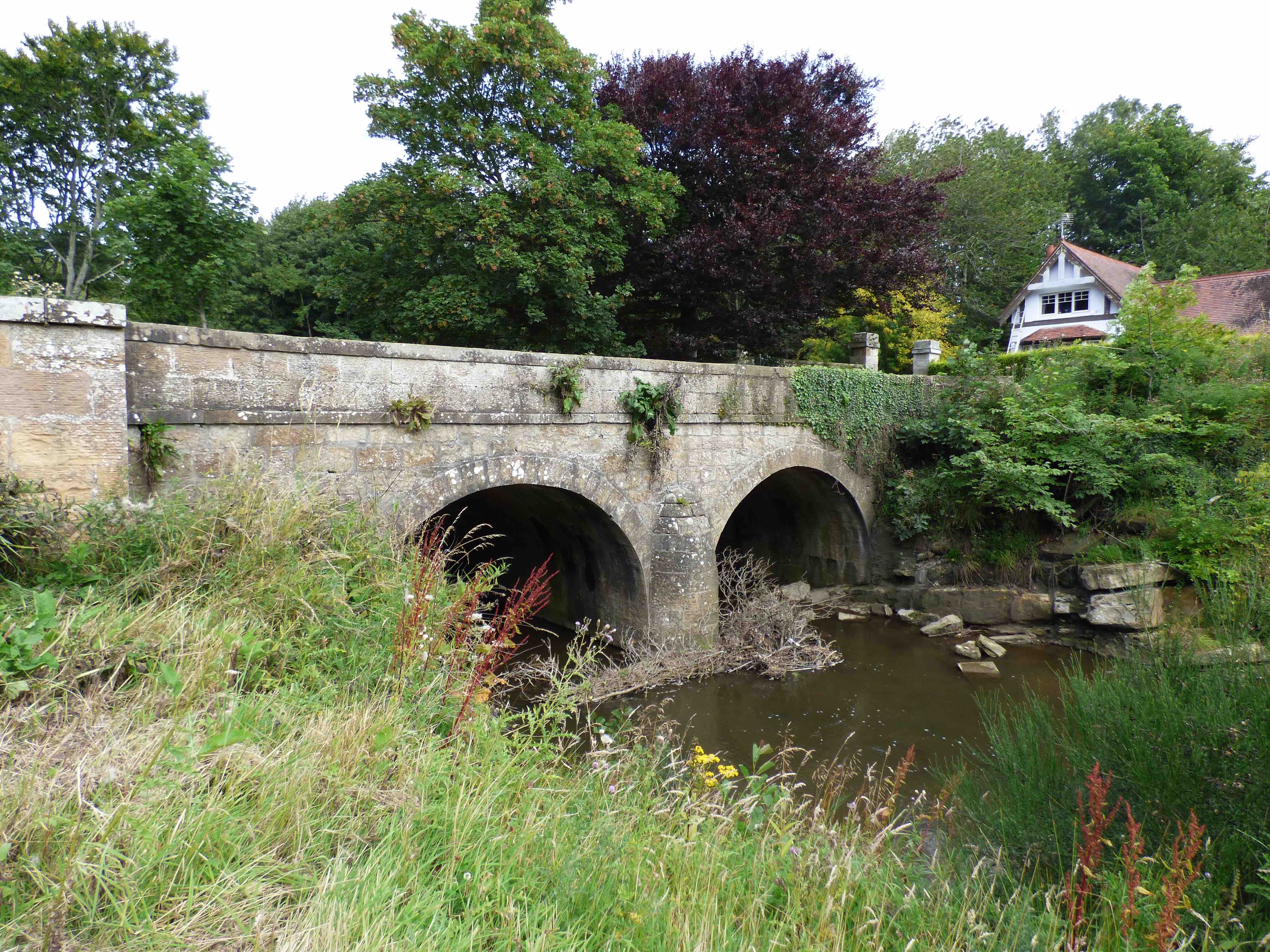
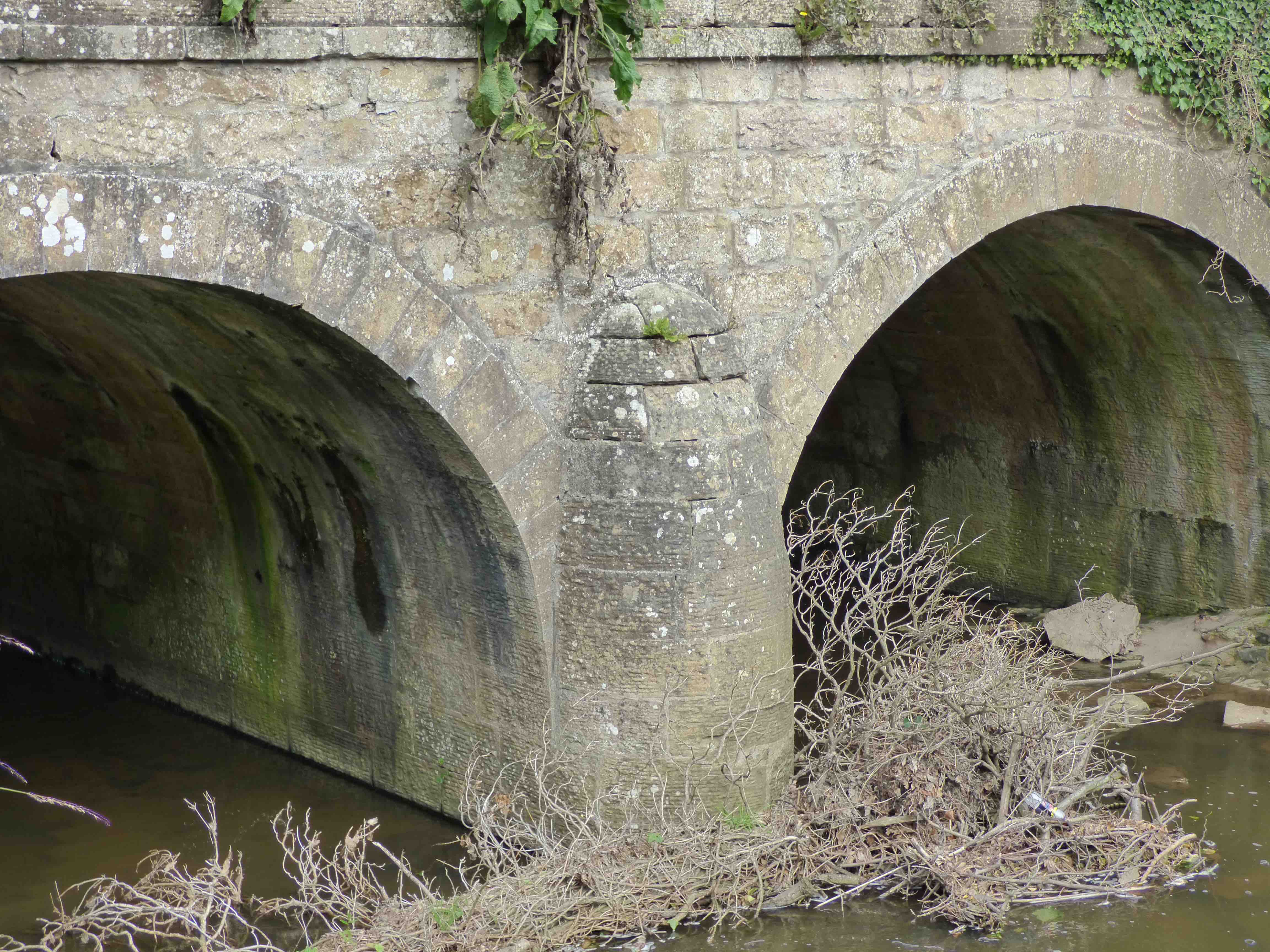
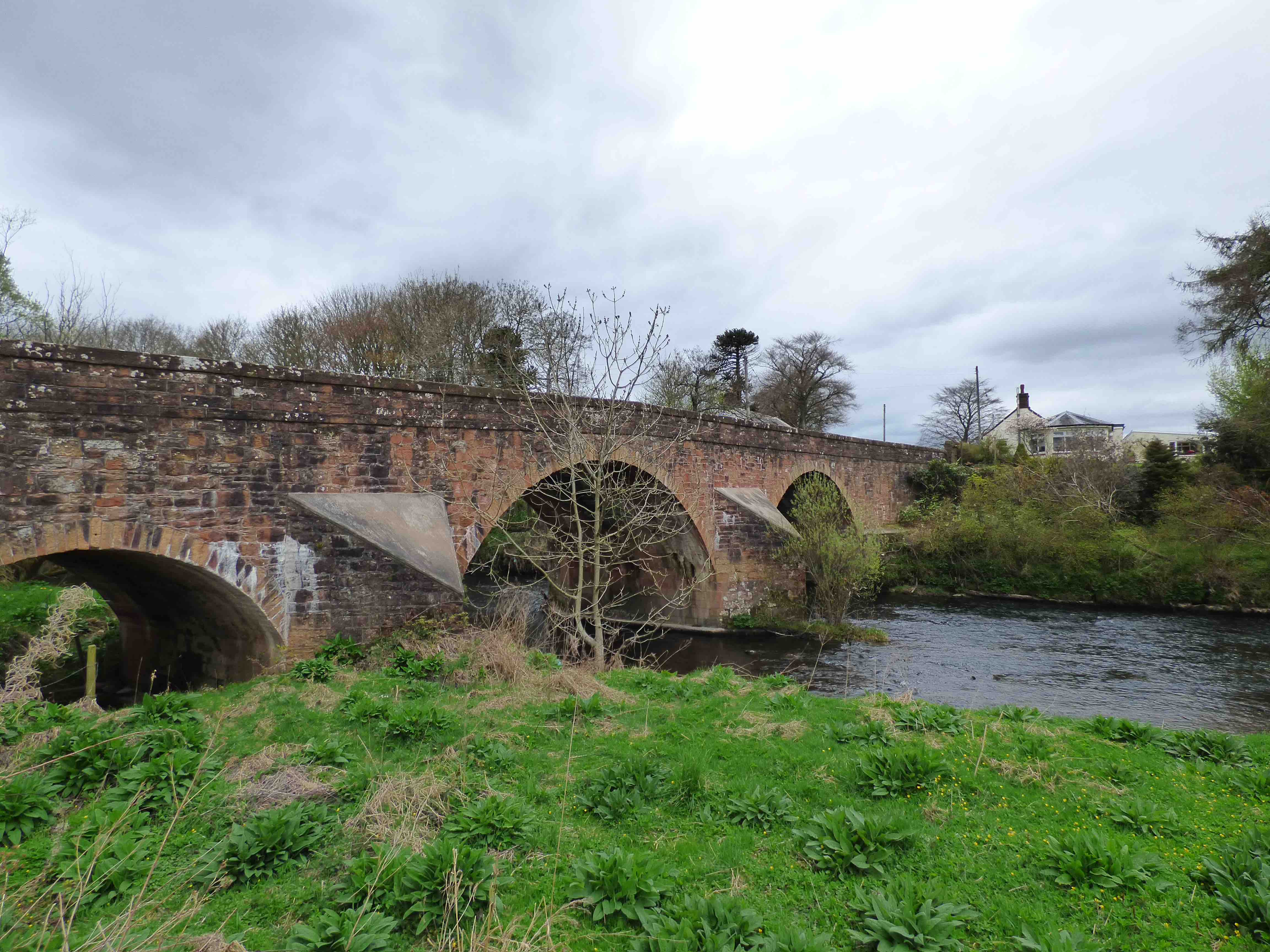
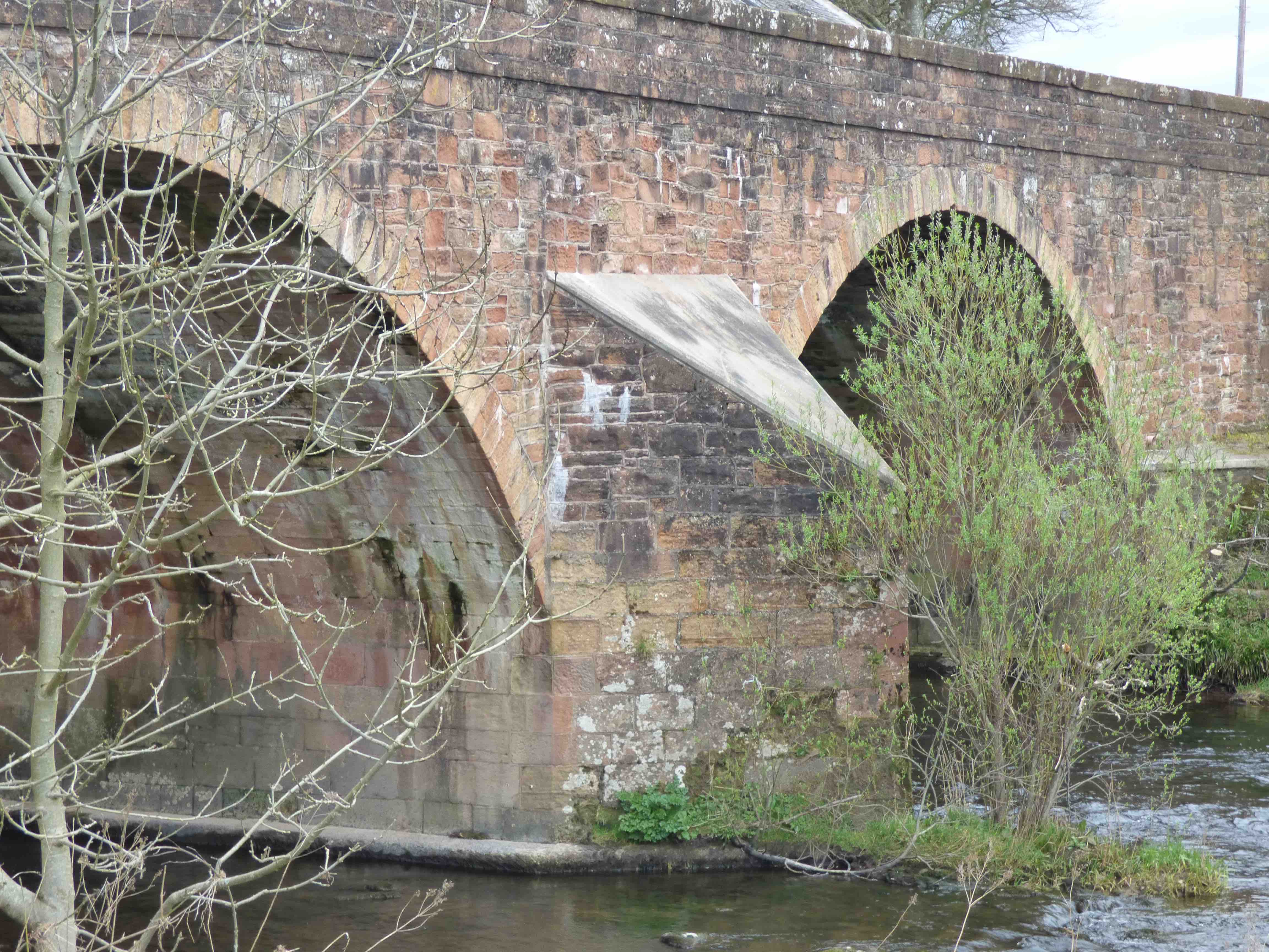
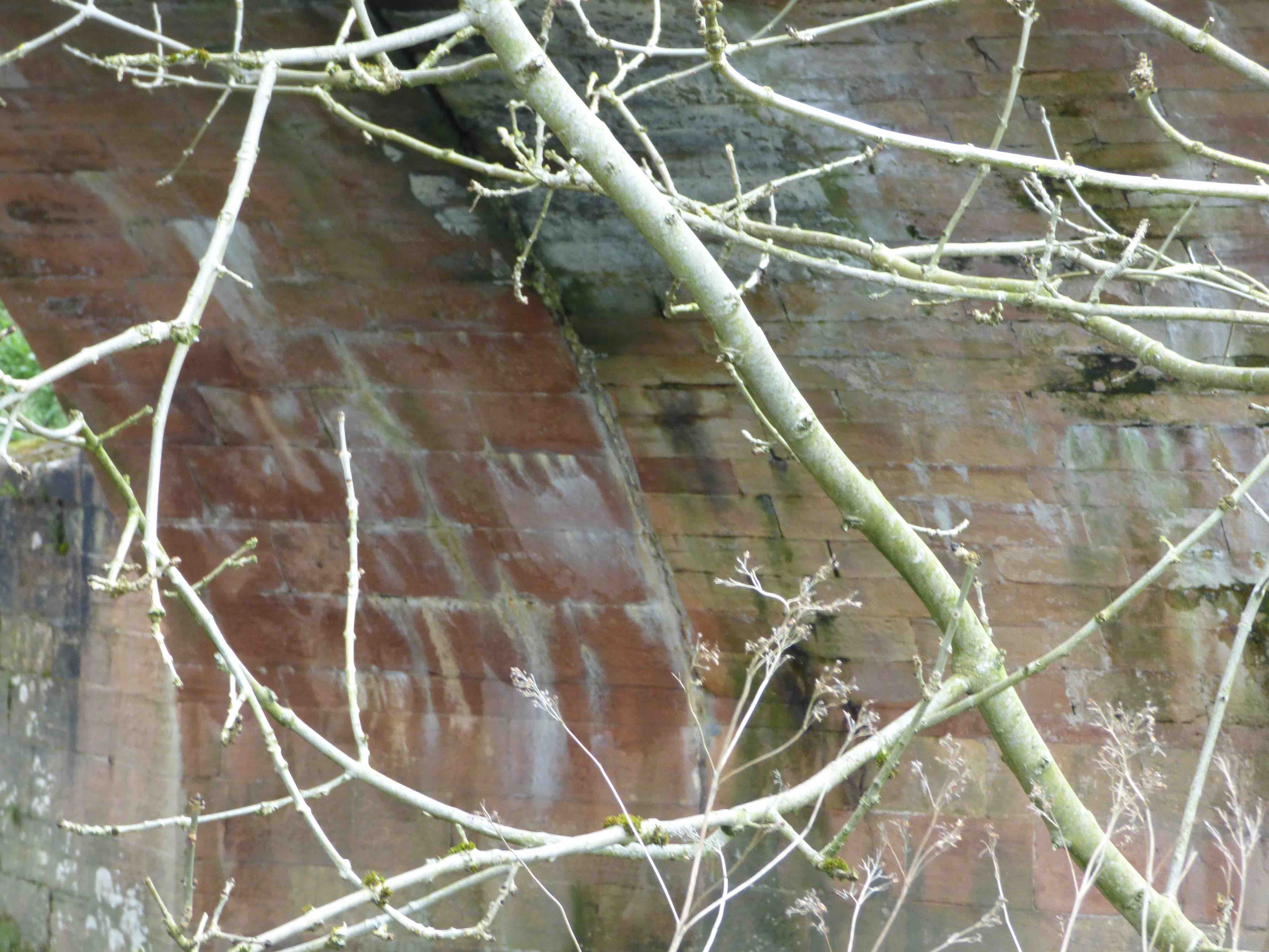
KELTY BRIDGE
C. Fife R. Kelty 313927,695304
History: This little bridge has an OS Named Book entry for 1853, 'one arch on the west side of which is the date 1696'. It was described in 1724 by a Mr. Stevensone, who writes "The King's highway from Edr to Perth.. leading N. hard by the church to Kelty bridge which divides Fifeshire from Kinross shire." This was the ancient post road, from Inverkeithing going north to Perth.
Maps:1750. Not on Blaeu.
Currently: Single semicircular arch of well dressed lightly rusticated voussoirs. It appears humped but this is only a parapet feature. Coursed squared rubble, well dressed, may be ashlar in some parts. Ties and pattress plates. Clear evidence of widening. Original width about 12ft with a 6ft extension. Possible refacing on both sides. Parapets in red sandstone are more recent. Very fine coping. Late 17th century with probable widening in the 19th century. A beautiful little bridge.
photo photo.
_______________________________________________
KEN BRIDGE see HIGH BRIDGE OF KEN
_______________________________________________
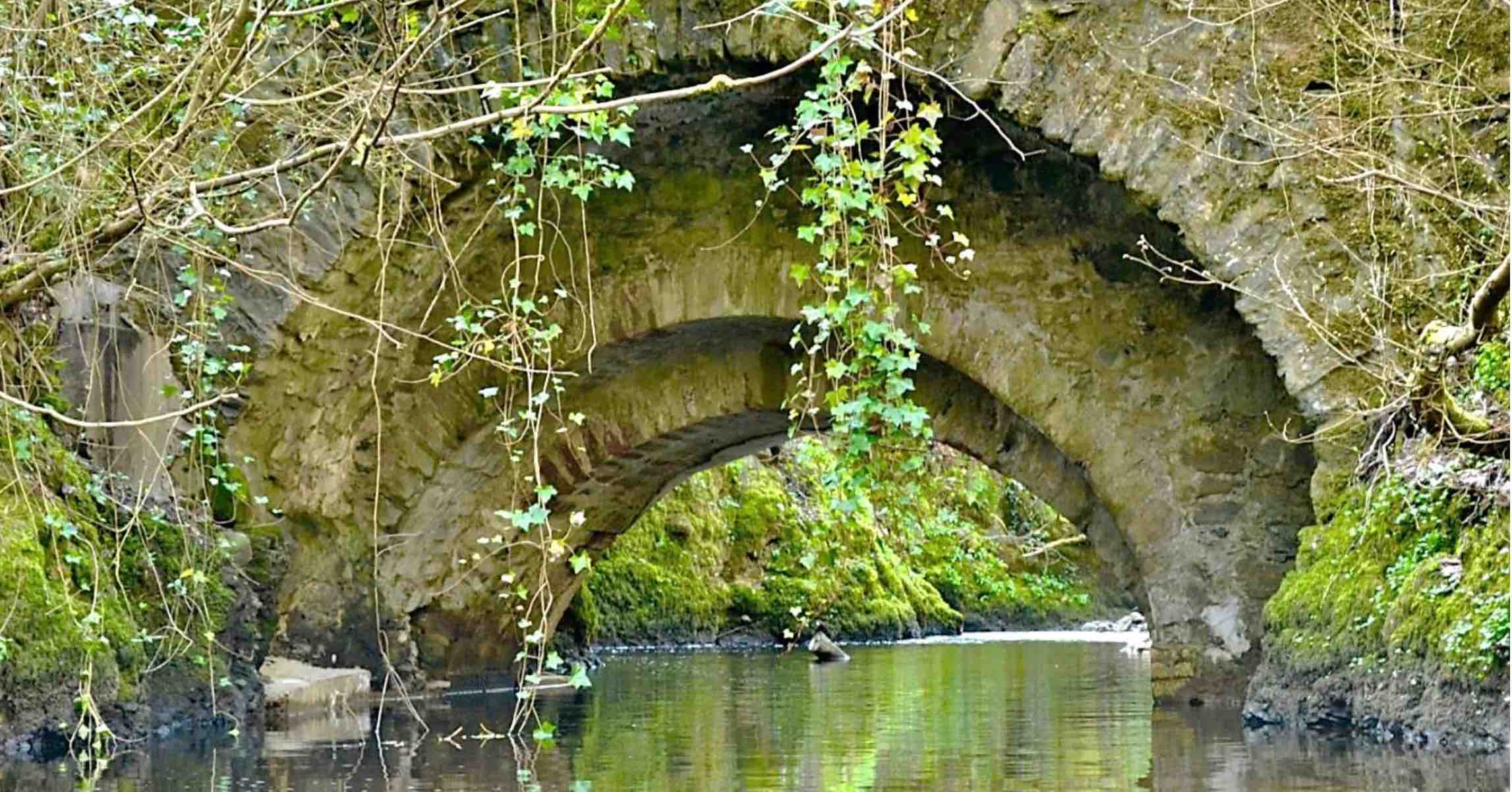
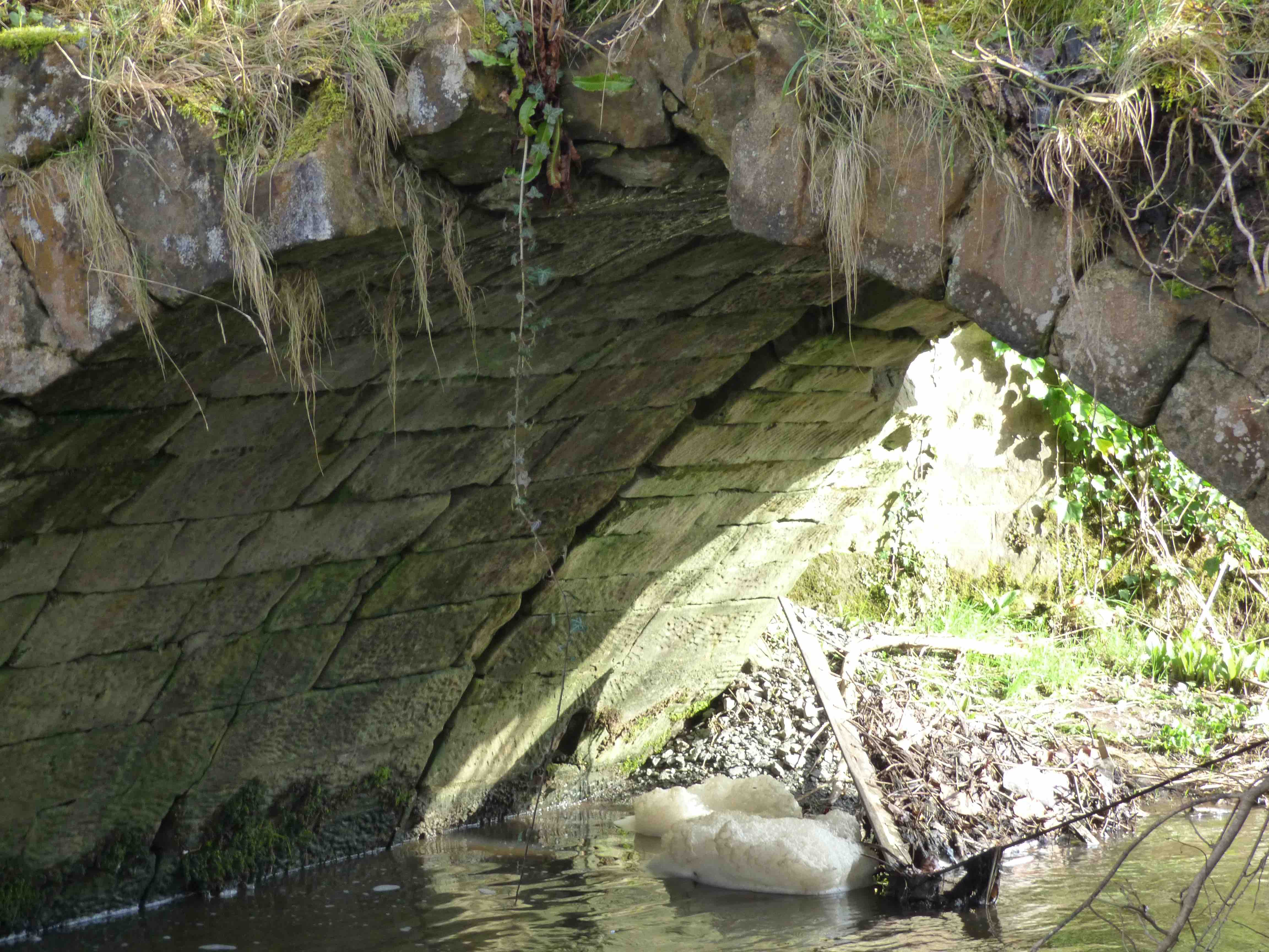
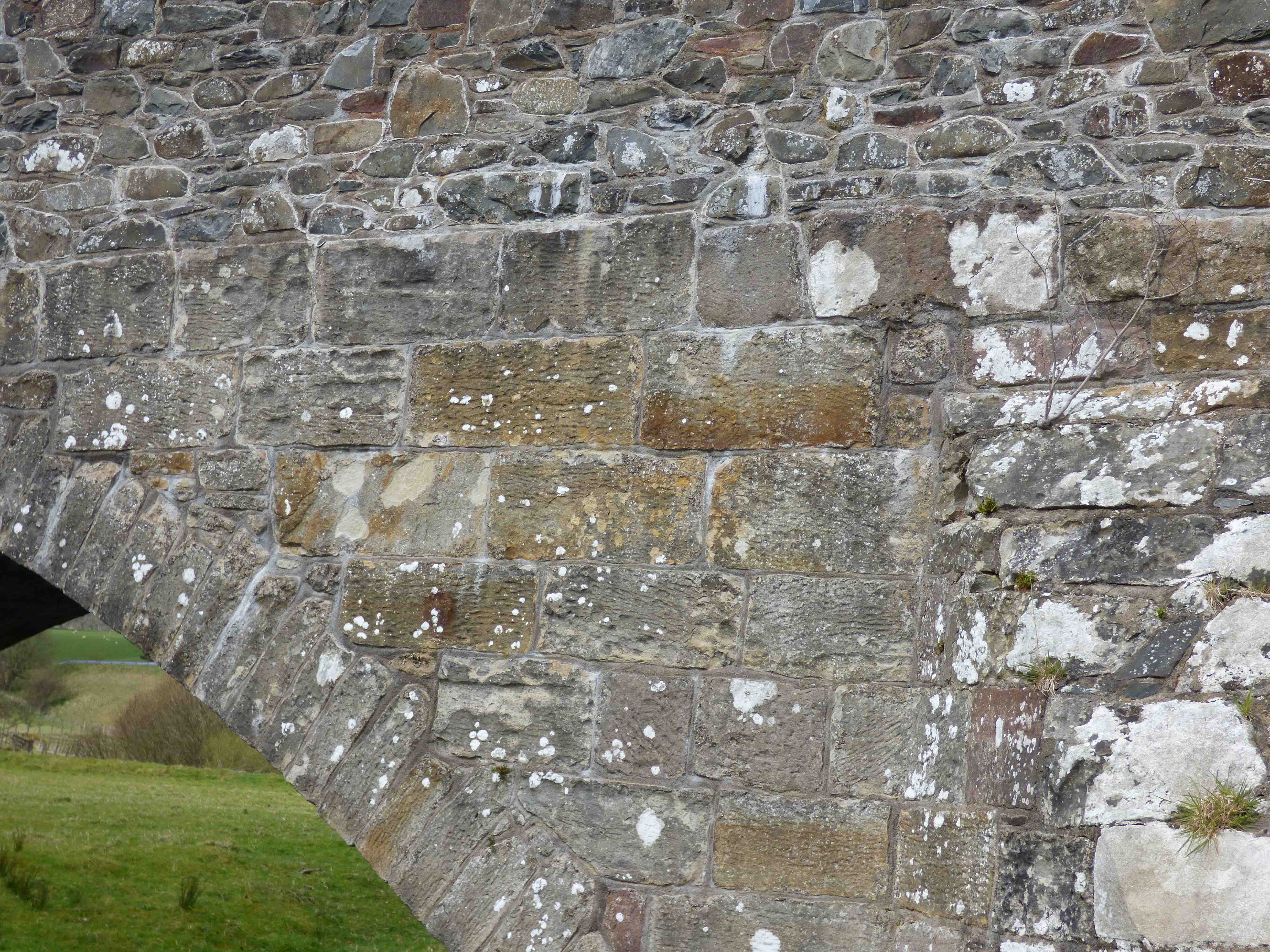
KENLY BRIDGE Boarhills
C.Fife R.Kenly 356962,713532
History: Nothing known.
Maps:1750
Currently:Dated 1793. This was probably restructuring.
Two small semicircular arches. Widened on the downstream side suggesting an original narrow 9ft bridge. Present structure has much from the 18th century suggesting that it was restored and widened in late 18th century rather than rebuilt. Also note(photo) a different angle on the older upstream side. Interestingly, only the older upstream side has a rather pretty bullnosed cutwater. There are also gate-piers and a solid string course on the upstream side, only.
photo photo photo photo
_______________________________________________
KERELAW CASTLE BRIDGE Stevenston
C.Ayrshire. Stevenston Burn 226874, 642883
History: The castle dates from 1171. It was destroyed in 1488, further sacked in 1528, abandoned to ruin in 1797, remodelled to a garden-folly in the 19th century. The bridge was the western access to the castle and later provided the link to Kerelaw Manor which was on the other side of the burn. Kerelaw Manor no longer exists but the ruins of the old castle are still standing, 30m from the bridge. The bridge has been widened, but probably at an early stage, perhaps when the new Kerelaw Grange manor was built in the late 18th-century.
Maps:Roy(1750).
Currently: A small 15th or 16th century semicircular arched bridge with stillted abutments. Stonework in squared coursed dressed masonry. Ashlar voussoirs largely lost from the facings but one voussoir is an example of richly verniculated stonework. Serious deterioration of the substance suggests that collapse may be quite soon unless repair work is started. Span of about 12 feet. Clearly widened: 6ft on the older upstream side. 12 ft extension downstream. Parapets are absent.
_______________________________________________
KILLIN BRIDGE see DOCHART
_______________________________________________
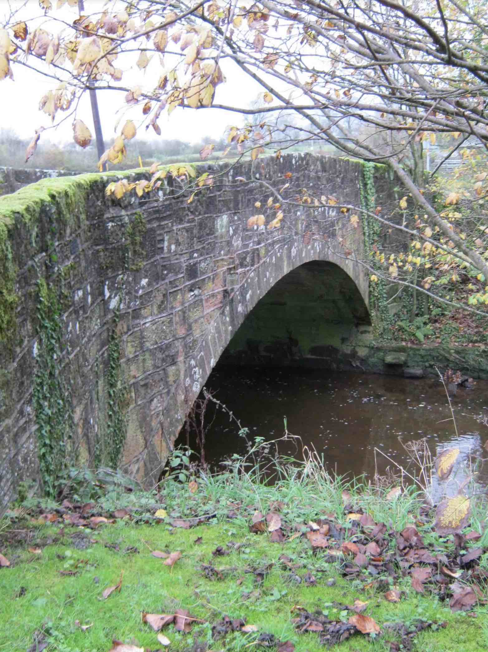
KILMARTIN BRIDGE
C.Argyll Kilmartin Burn 183267,698035
Maps:Pont 15 1600
This bridge is only on Pont. Location uncertain. Currently on the approximate spot is a small later 18th C segmental single-arched un-coursed random rubble bridge with splayed parapets, into a T junction. Clearly a replacement of what appeared to be there in 1600.
photo photo.
_______________________________________________
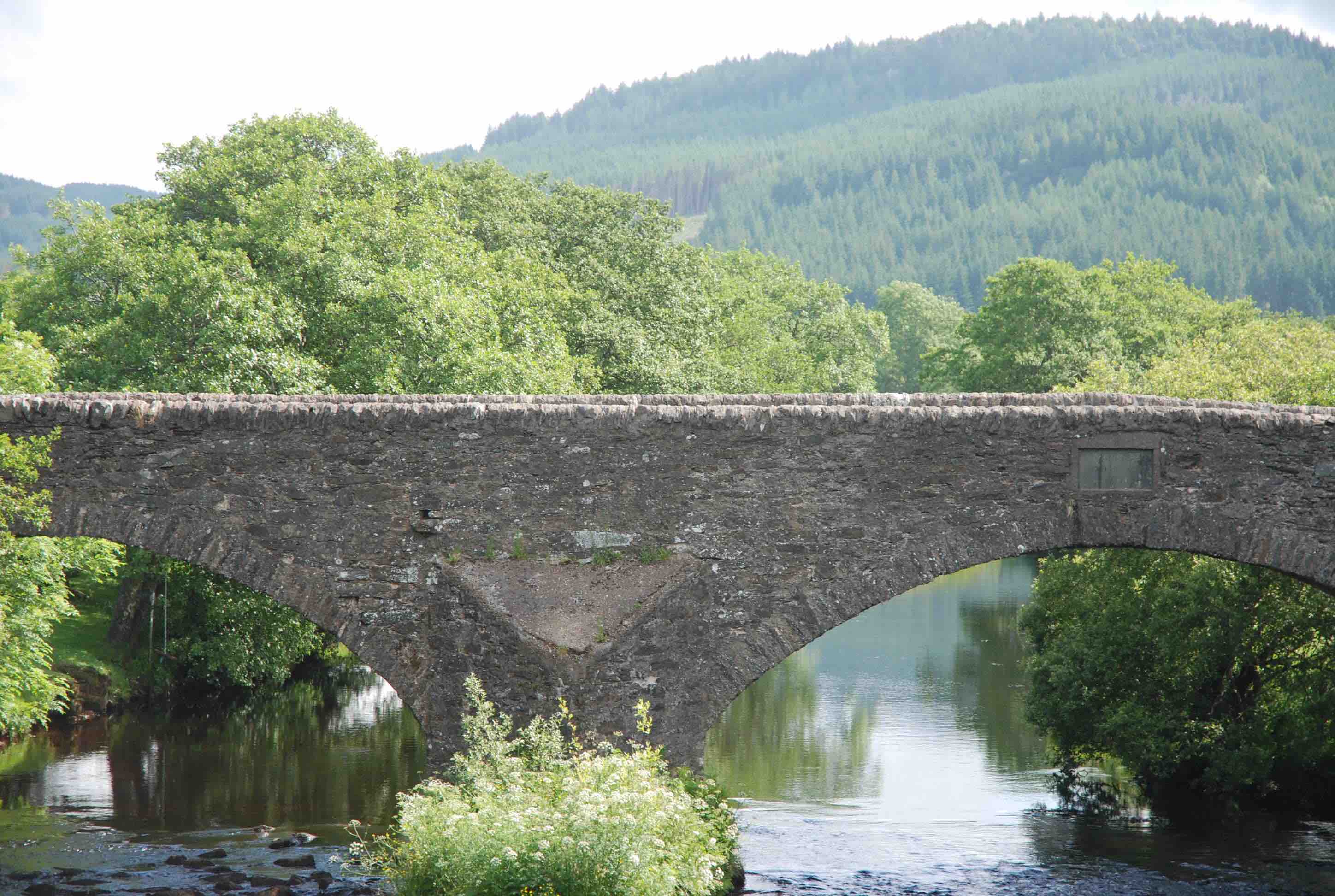
KILMICHAEL BRIDGE
C. Argyll R.Add 185289,692620
History:1737(not military). Described in the NSA as ' 4 arches-very narrow steep inconvenient and almost dangerous.' One has to wonder if this was the same bridge. It was an important crossing point for black cattle from Islay, Jura, Colonsay and Kintyre. There was a Tryst here and a drover's stance(Haldane). The main drove road continued to Inverary.
Maps:1750
Currently:1737. Two segmental arches plus two flood arches. Slightly stilted. Partially squared rubble with rough coursing. Plain with no string course. Cutwaters. Remarkably intact and original. It appears neither steep nor dangerous.
photo photo.
_______________________________________________
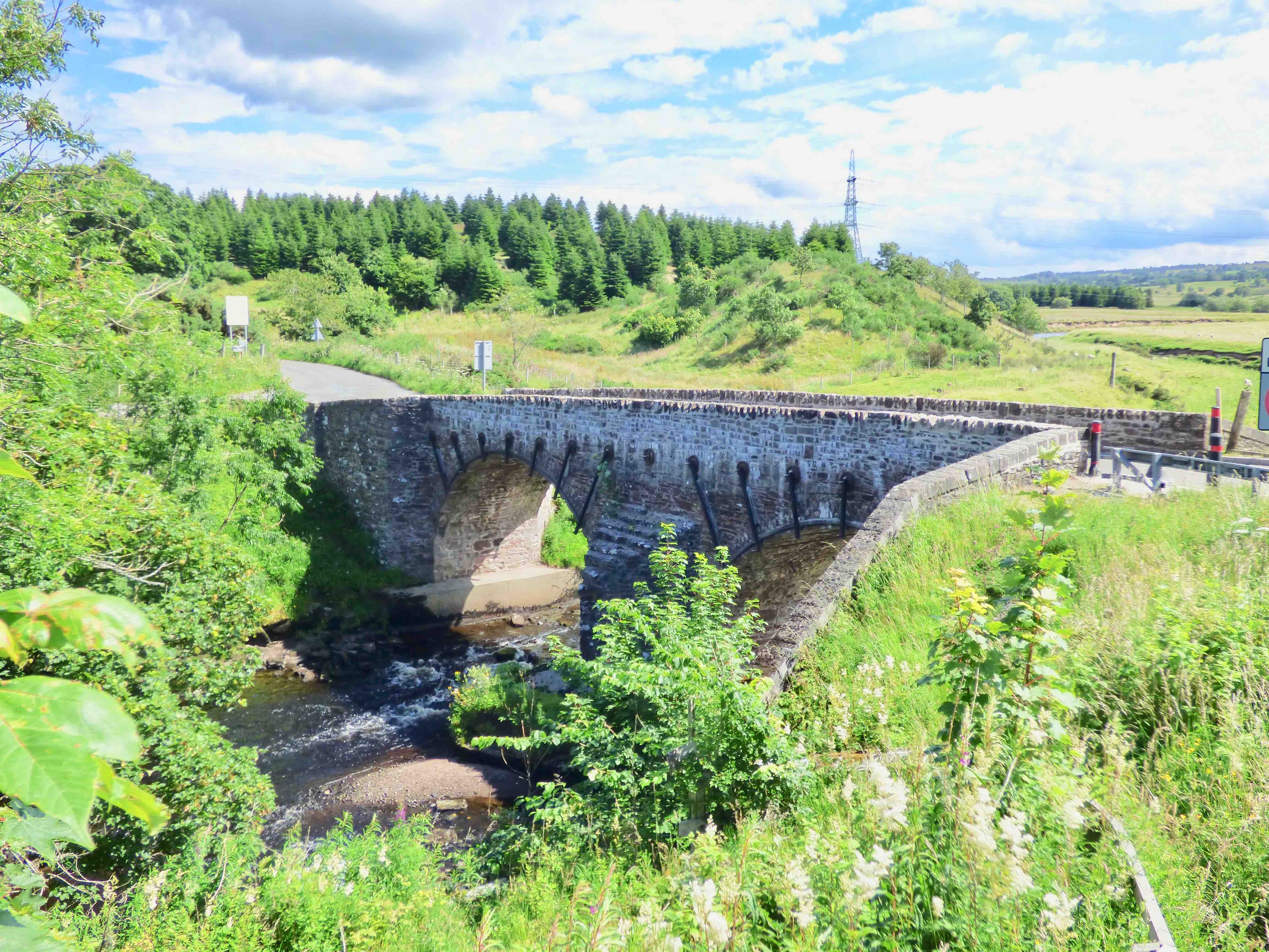
KINBUCK Kinbuck Bridge
C.Stirling R.Forth 279124,705388
History: plaque inside parapet indicates a 1752 date, but this refers to a rebuild.Macfarlane (1720s) describes '5 land stalls of stone covered with tymber and flags Hethir and gravel'. Clearly, not an arched bridge. He also locates it 'on the highway from Dunblane to Crief and the North Highlands 1/2 mile S. of the old Castle of Cromlix'. We know the bridge was crossed by 6000 highlanders in advance of the Battle of Sherrifmuir (1715), and that the Jacobites retreated to Kinbuck after the confrontation.
Maps: The bridge is on Roy's map, but it is exactly on a seam which means it is easily missed. Roy's survey may have been slightly earlier than 1752, so the map may well predate the dating plaque.
Currently: This is an 18th century bridge, but possibly earlier than 1752, at least in some parts. It is 10/11 ft wide and still taking traffic. Two segmental arches with irregular length voussoirs in well dressed rubble. These are not chamfered. Parapets are from a more recent date. Spandrels in very roughly dressed red sandstone random rubble with extensive metal tie-rods. Buttressing on the abutments is splayed on both banks from both facades with modern brickwork on the south bank. There is a single pier which is now embedded in concrete and large triangular cutwaters on both sides, which have an interesting stepped upper profile (photo3).
photo photo photo.
_______________________________________________
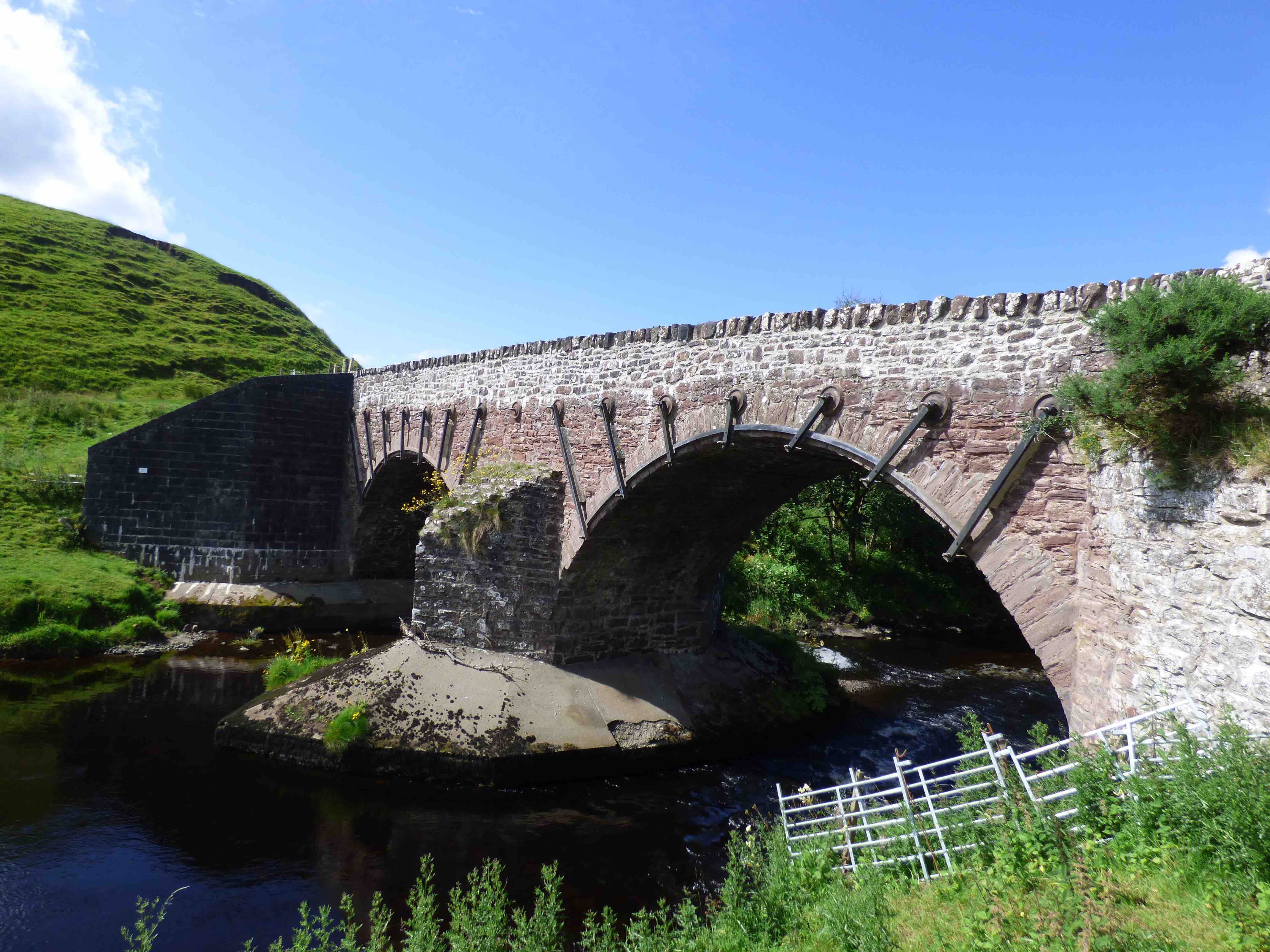
KINNEL BRIDGE nr Lockerbie
C.Dum & Gall Kinnel Water 308972,585015,
History: This remarkable bridge was built in 1723. The downstream side is entirely intact and standing. Built by John Frew who was contracted in 1717; date- stone.
Widened in 1821; date stone.
Maps:Roy(1750)
Currently:1723. Red sandstone squared, largely random rubble, but well faced and sometimes coursed. Voussoirs are in ashlar which is unusual for the date.
Two segmental arches and one flood arch. Originally 12 ft.wide. Extended on the upstream side in 1821, by a further 7 ft. Huge cutwaters downstream. Smaller on upstream. Slightly battered abutments. Coping and parapets appear original which is also rare. Band course.
______________________________________________
KIRKINTILLOCH LUGGIE BRIDGE
Dunbartonshire Luggie Water 265472,674160,
History: NSA: ‘In 1672, following an Act of Parliament, the Earl of Wigton built a bridge of three arches, the old one being ruinous.’ A toll was imposed. This bridge was swept away by floods in 1715. The present bridge may be from this period, but widened in cast-iron from around 1900.
Maps: Roy(1750)Pont 34(1600) Blaeu(1640)
Currently: An 18th century humped bridge, although it appears to be later 18th century. It is hiding below early 20th century iron superstructure which is 6ft wide on each side. Three segmental arches with small cutwaters. Appears to have coursed rubble spandrels, ashlar voussoirs and a strong string course.
_______________________________________________
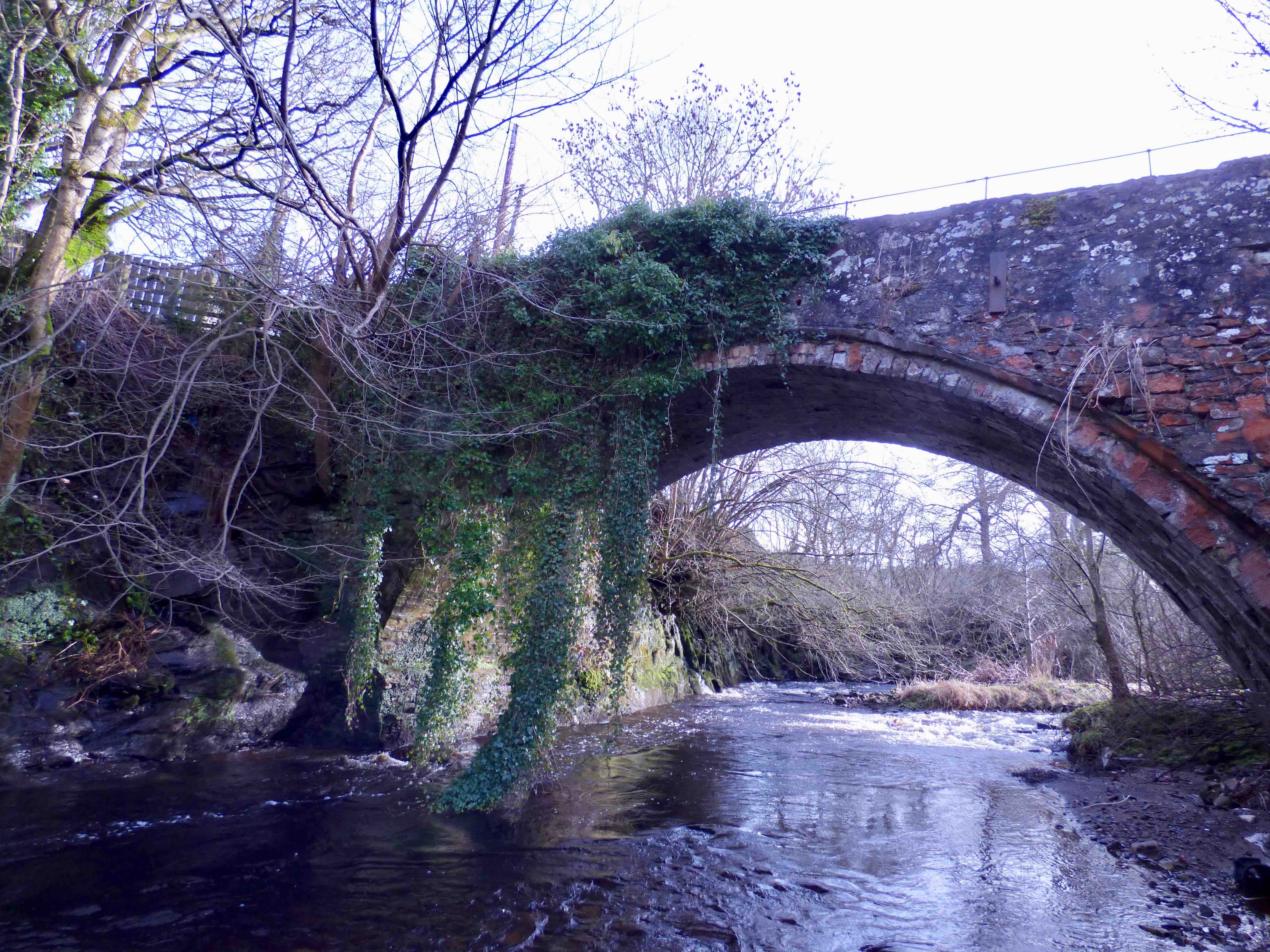
KIRTLEBRIDGE. Nr GRETNA
Dum & Gall. Kirtle Water
History: Roy's map clearly shows this bridge on his road north from Carlisle to Glasgow. A bridge was built was around 1752 by Forrest and Kennedy (Robertson 1993). They also built Kirtleside (A75) at the same time, the two bridges costing £140. Kirtlebridge does look a bit younger than that date which may suggest a rebuild in the 1780s, because of floods. This certainly occurred at Kirtleside. However, Kirtleside is a long way downstream. In 1825, Telford's new highway bypassed the bridge 100m upstream( photo3) and the new bridge was named Kirtle New Bridge. The old bridge then became the approach to the road to Annan.
Maps:Roy(1750)
Currently: This looks like a mid to late 18th century structure. It may be the one on Roy but the style does seem of a rather later date. The voussoirs are in very well dressed ashlar and the general stonework is random rubble, although well dressed and squared. The arch is segmental. The bridge gently humped. It is certainly of an older style than the bridge at Kirtleside. (photos and information from V.Weighill).
_______________________________________________
LANARK BRIDGE see CLYDESHOLM BRIDGE
_______________________________________________
LASSWADE BRIDGE nr. Dalkeith
C.Midlothian R.South Esk 330387,666107
History: recorded early 18th century, but also on Blaeu ( 1640). Part of the road south to Melrose and Jedburgh in the later 18th century. Evidence of major repairs in 1776 and plans to widen in 1795.
Maps:1750(Roy) 1680s(Adair) Blaeu(1640)
Currently: mostly late 18th, early 19th century. Upstream facade may be older, though a metal foot gangway has been added , supported by an extended 19th century pier. Clear evidence of parallel widening. Coursed squared sandstone rubble with ashlar voussoirs with a flat second order (almost a hood but not recessed) . Two segmental arches, with cutwaters superimposed by elongated buttressing. The cutwaters appear older. Parapets in modern ashlar with solid coping. Interesting approaches in un-dressed un-coursed random rubble, which also may be older. Tollhouse adjacent.
Link photo photo photo photo photo. .
_______________________________________________
LAW BRIDGE Darvel
E.Ayrshire Glen Burn. 257027,638268
History: Also called Roman Bridge- but certainly not Roman despite its proximity to the line of a Roman road, running from Edinburgh down to Ayrshire. The bridge appears to be on Roy and on Blaeu but on careful scrutiny of both old maps, the early bridge appears to be a little upstream of this one. Records have suggested that this bridge could be considered medieval but I cnnot confirm this. In fact, it has the hallmarks of a mid-18th century Commission of Supply bridge.
Maps:1750(Roy) Blaeu (1640) appears further upstream.
Currently: A mid-18th century bridge in uncoursed random rubble with well cut voussoirs and a flat recessed stilted segmental arch with a small hood mould. There is no string course. The abutments may be older. Overall, this may not be the bridge we see on the old maps, which appears to be further upstream at Skellyhill(Sally's Hill) .
photo
_______________________________________________
LESMAHAGOW MONKS BRIDGE. Lesmahagow
C. Lanarkshire. R.Nethan 281487,640440
History: Near to the Lesmahagow Priory remains. The earliest crossing point for the Carlisle Glasgow Road. A Telford Bridge(500m upstream) bypassed it in the early 19th century. The Priory was abandoned in the 1560s at the Reformation. The Duke of Hamilton took over this estate in 1663 and this bridge may well have been rebuilt then.
Maps: Roy 1750. Pont 34 1600. Blaeu 1640.
Currently: A very old bridge with significant original features. Appears to be 17th century in style. Many stages of repair. Rubble built. Some coursing. Beautifully fashioned arch-hood on a nearly semicircular recessed arch. Ten ft. wide between parapets. In a very sad state of neglect with many repairs of poor quality.
An abandoned crumbling Telford bridge is also located just 500m downstream.
_______________________________________________
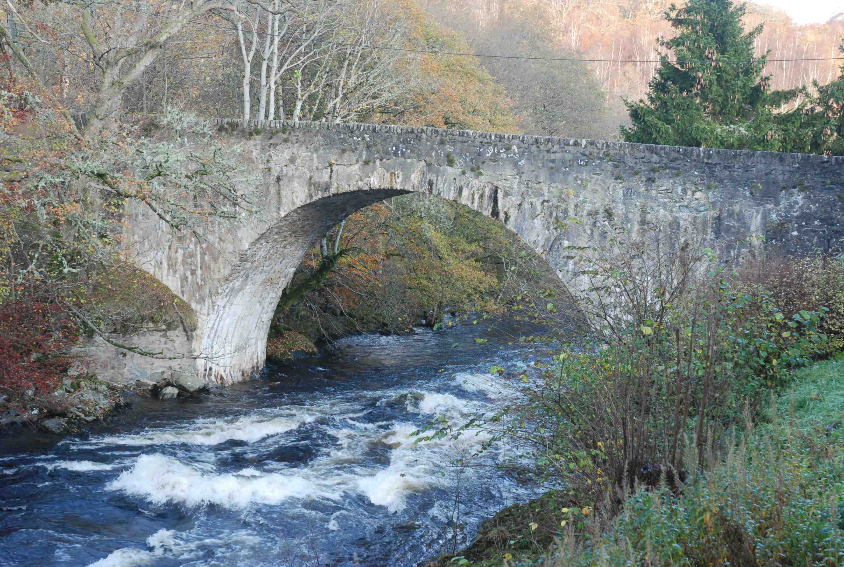
LOCHAY Bridge of Lochay
C.Perth R. Lochay 256973,734222
History: Known to be wooden in 1684 when first built; in masonry by 1720, perhaps with a wooden superstructure (iron bolts were ordered). Rebuilt in masonry in 1720, perhaps with a wooden superstructure (iron bolts were ordered). Rebuilt again in 1741.Contracts for building still exist.
Maps:1750( Roy).
Currently: probably from 1741. Single semicircular arch. Un-coursed, random rubble spandrels. Very worn harling. Large voussoirs in well dressed rubble. 50ft arch. 12ft p to p.
Link photo.
_______________________________________________
LORNTY BRIDGE Blairgowrie
C.Perth Lornty Burn 317124,746483
History: This little bridge lies on the Caulfeild military road going north, built in 1757 between Coupar Angus and Fort George. However, it appears on Pont's map which gives it a 16th century provenance, at the latest. It is reputed to be Roman, but that is extremely unlikely; the known Roman road is some 10km away-which is far enough to exclude any association, and yet too near to be a duplicate. It seems probable that this was a 15th or 16th century packhorse type bridge. We have no knowledge of its story.
Maps:1750 1600 (Pont 27)
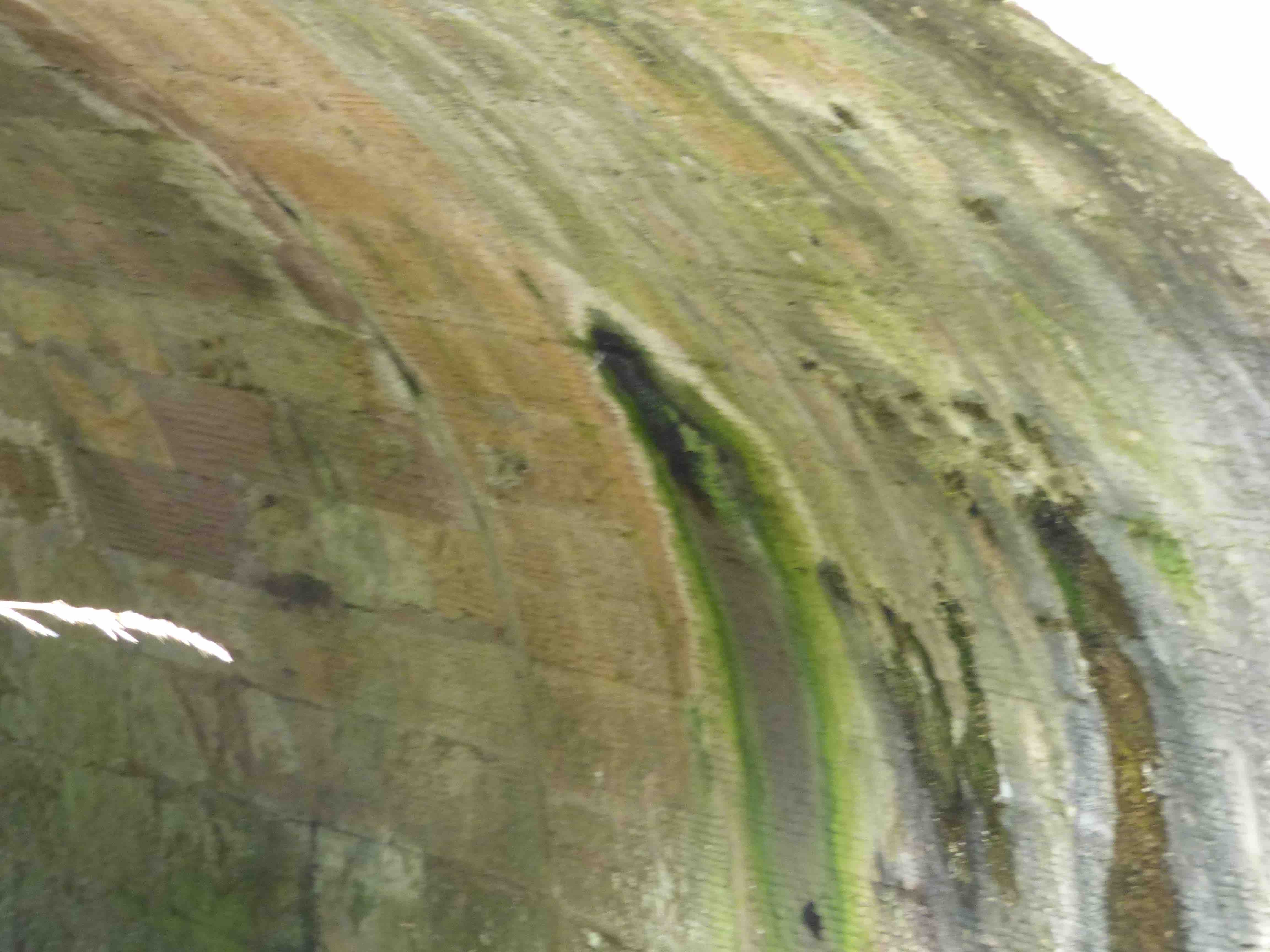
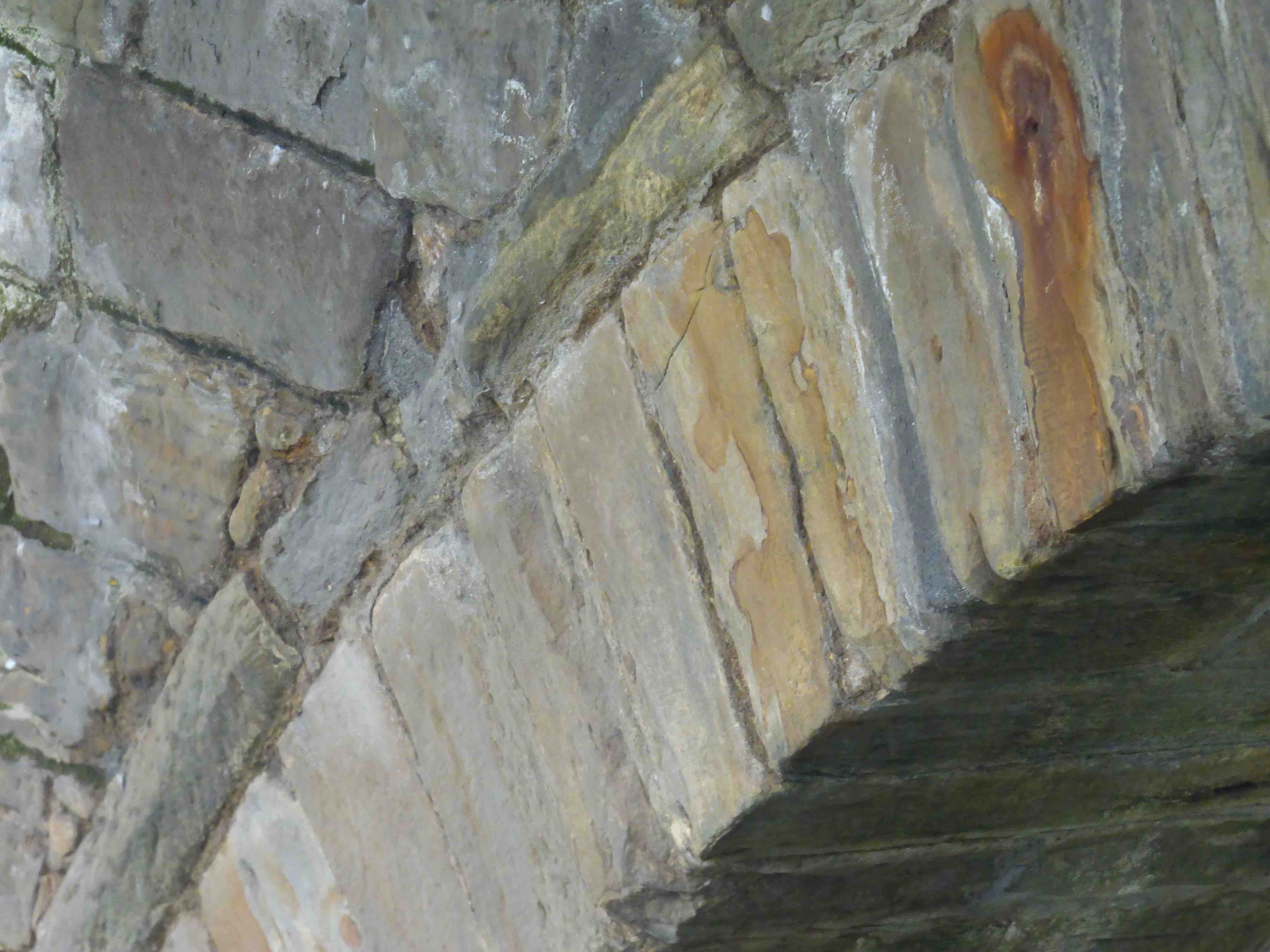
Currently: The western face is entirely encased in concrete, all the way down to a small segmental culvert. This work was done in the 1990's. The eastern face is almost inaccessible because of overgrown embankments, but the profile has been recently revealed by a remarkable photograph (included) by Clare Cooper of the Cateran Ecomuseum. The picture shows a complex array of arches on the soffit. There is at least one additional smaller arched bridge incorporated into the structure. Altogether, we have the appearance of an 18th century military span of about 14ft (including parapets) overlying a 10 ft span bridge which must be considerably older. This latter appears to have a saddle support of a more segmental shape. I think we can say with confidence that the older bridge dates from the 16th century.
_______________________________________________
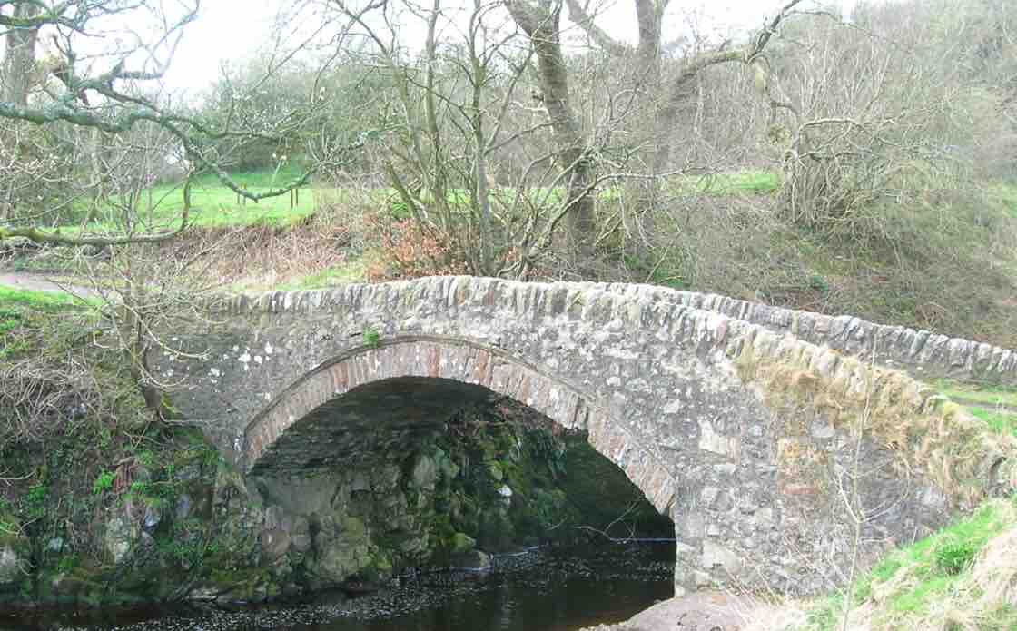
LOW BRIDGE Fintray
C. Stirlingshire R. Endrick 263353,686311
History: Also known as Gonachan Bridge although it does not span the Gonachan burn. It has also been attributed to General Wade but clearly that is not the case. Existed in 1600. Rebuilds in 1696 and in 1751. Mentioned in Macfarlane in 1724. This bridge must have been in the process of being rebuilt around the time of Roy's map. It was also resuscitated in 1966.
Maps:Roy(1750) Blaeu 1640
Currently: 18th century. One very wide segmental arch plus one flood arch. Rough random un-coursed rubble spandrels. Thirteen ft. wide and un-widened. Deck on an incline. Date-stone 1696 (photo) but even this must refer to a rebuild since the bridge is on Blaeu. Very well dressed voussoirs with recessed barrels. Small hood-mould.
Link photo photo.
_______________________________________________
LUGGIE BRIDGE Kirkintilloch
C. Dunbartonshire Luggie Water 265472,674160
History: NSA: In 1672, the Earl of Wigton built a bridge of three arches, the old one being ruinous. A toll was imposed. This bridge was swept away by floods in 1715. The present bridge may be from this period, but widened in cast-iron from around 1900.
Maps:Roy(1750) Pont 34(1600) Blaeu(1640)
Currently: An 18th century humped bridge, although it appears to be later 18th century. It is hiding below early 20th century iron superstructure which is 6ft wide on each side. Three segmental arches with small cutwaters. Appears to have coursed rubble spandrels, ashlar voussoirs and a strong string course.
photo
_______________________________________________
LUGGIE BRIDGE
Kirkwood, Glasgow City. Luggie Burn. 270750,663357
History: On Roy's map there is a road running from Old Monkland Kirk to a small bridge at the mouth of the Luggie Burn where it enters the North Calder. This was a medieval parish and had both a religious and a civil function from the 16th century. The old bridge was very much still in use in the 1860s.
Maps: Firmly on Pont 34 (1600) Blaeu (1640s) and Roy(1750). Also on later maps including the early OS.
Currently: This little bridge lies exactly where it should be according to Roy, Blaeu, Pont and the early OS. Today, it lies in largely abandoned waste ground adjacent to urban motorway fly-overs and slip roads, near Bargeddie village on the fringes of Glasgow. There is a modern iron walkway bridge, superimposed. The old bridge is approximately 12ft wide with clear evidence of parallel widening(Photo4). Voussoirs are in coarse dressed squared rubble. Some are missing. Spandrels are also roughly squared and dressed with clear coursing. The bridge is completely overgrown and dilapidated. Parapets are absent. The mortar has gone. There is a turf surface. There are remnants of iron ties which are falling away from the masonry. There is a dated keystone of '1787' on the narrower part of the widening. It would seem very probable that this is the bridge on the oldest of the maps (1600). This is because the division of the widening is to 9ft and 3 ft sections with the datestone on the narrow part. The 9ft section must be older than 1797, and the presence on Blaeu and Pont is significant. The coursed masonry also suggests an older build. This little bridge is therefore rather a treasure. It is certainly the oldest bridge in the city. Sadly, it is very dilapidated and at serious risk of further deterioration.
_______________________________________________
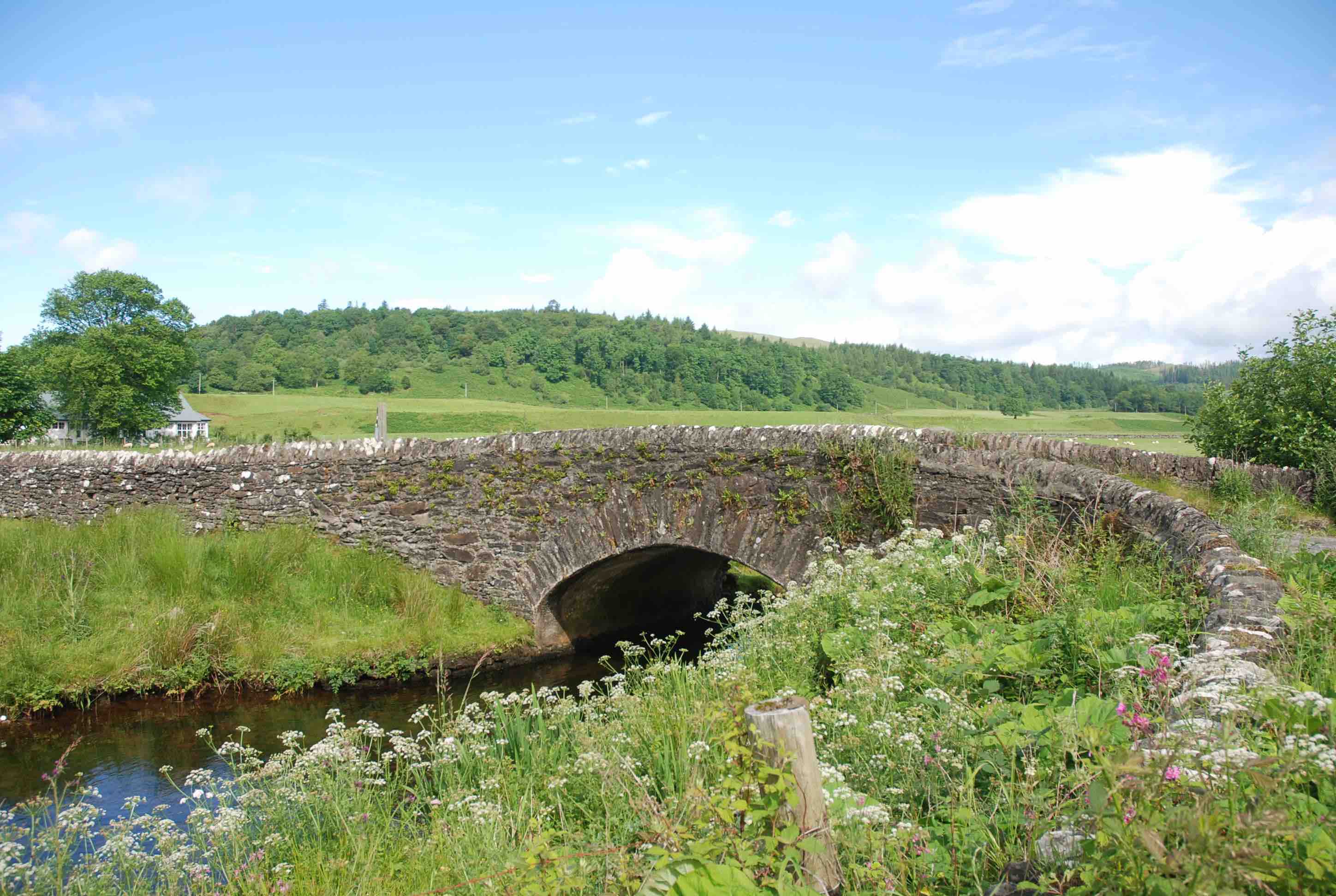
LYNESMILL BRIDGE
C.Peeblesshire Lyne Burn 320925,640106
History: An 18th century bridge. Firmly on Roy but on Roy's map the road crossed a little upstream from his bridge, which is clearly shown, a little away from the road. A date of 1717 has been attributed but much of the bridge appears later in style than that.
Maps:1750(Roy) Blaeu(1640)
Currently: Two span un-coursed random rubble with one segmental and one semicirular arch. Coursed, squared rubble on lower parts. Random un-faced rubble above. Dressed, stugged squared rubble voussoirs. Many repairs. Widened by about 5 ft on the upstream side, clearly in the 19th century, because there the voussoirs are in red sandstone ashlar. Curiously, the flood arch has three soffits (parallel widening) whilst the main arch has only two. Smaller cutwaters on the original downstream side.