Scotland’s Oldest Bridges.
A map-based catalogue of the oldest masonry bridges in Scotland.
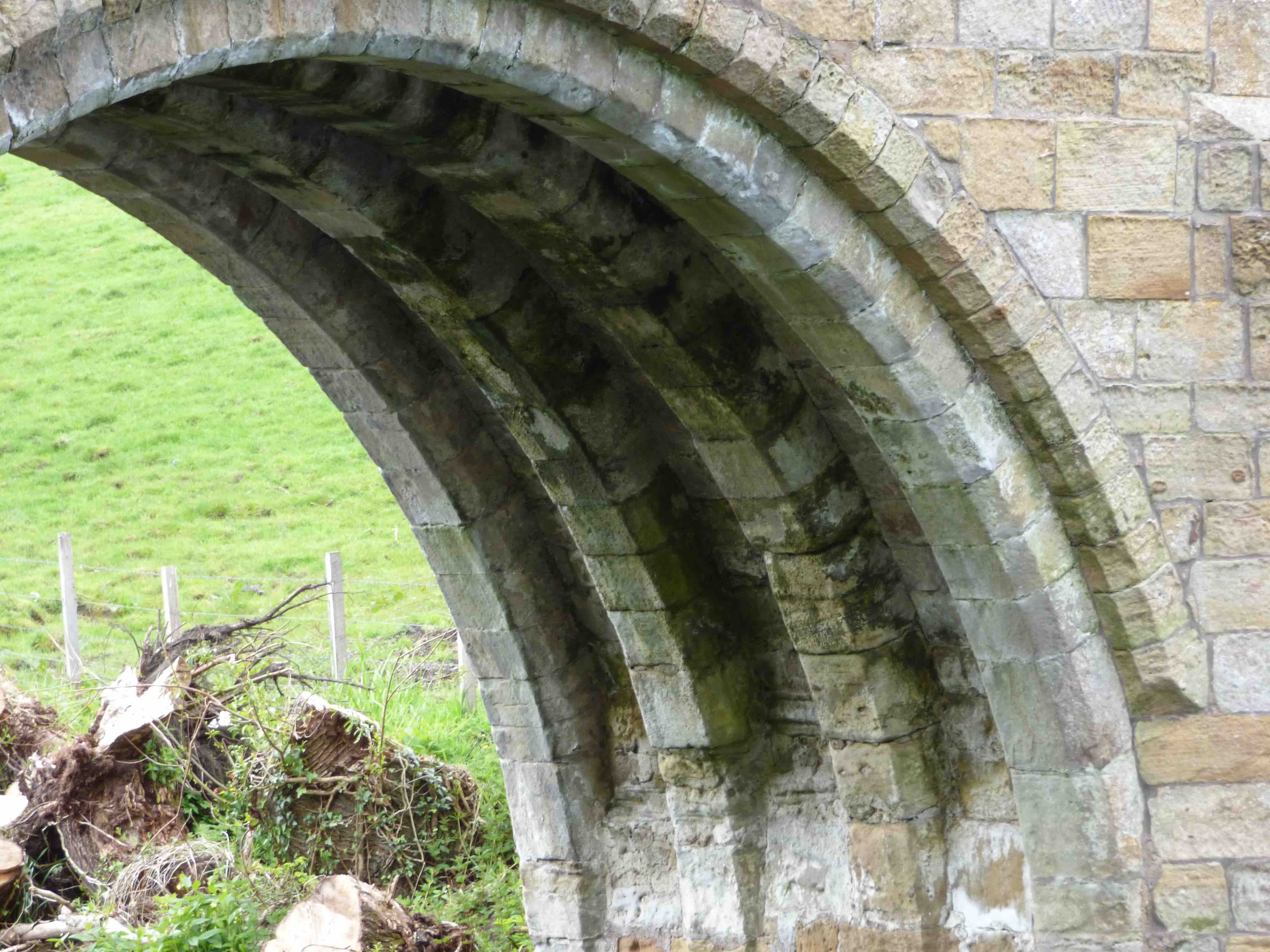
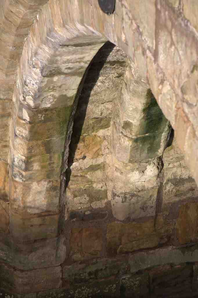
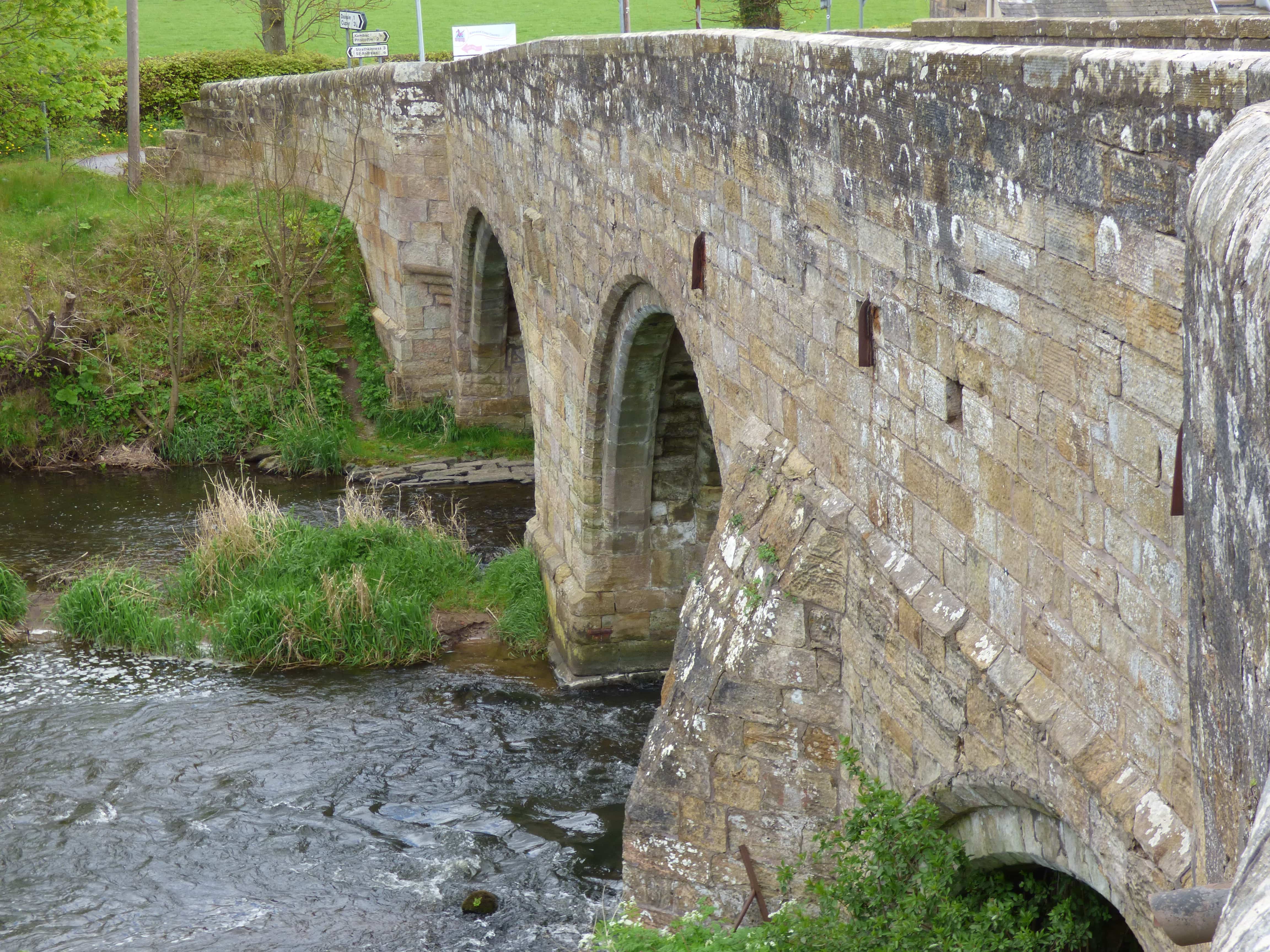
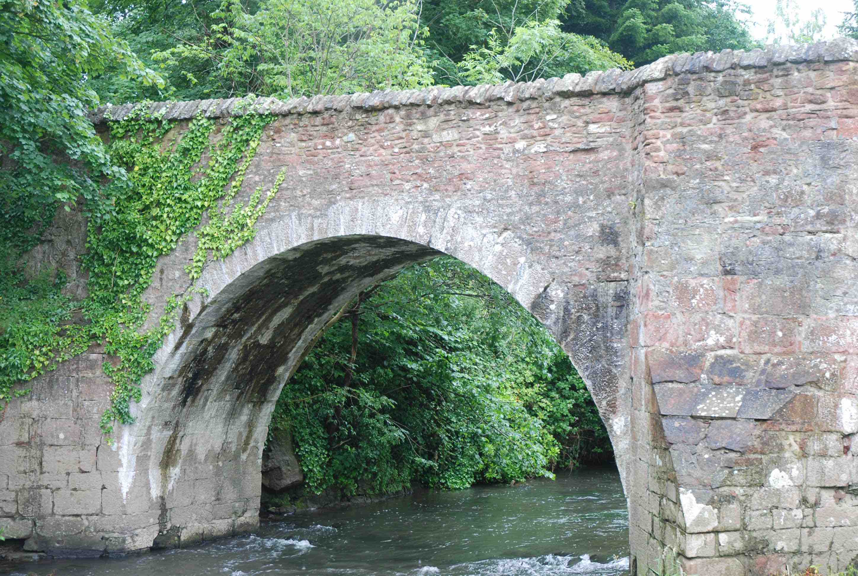
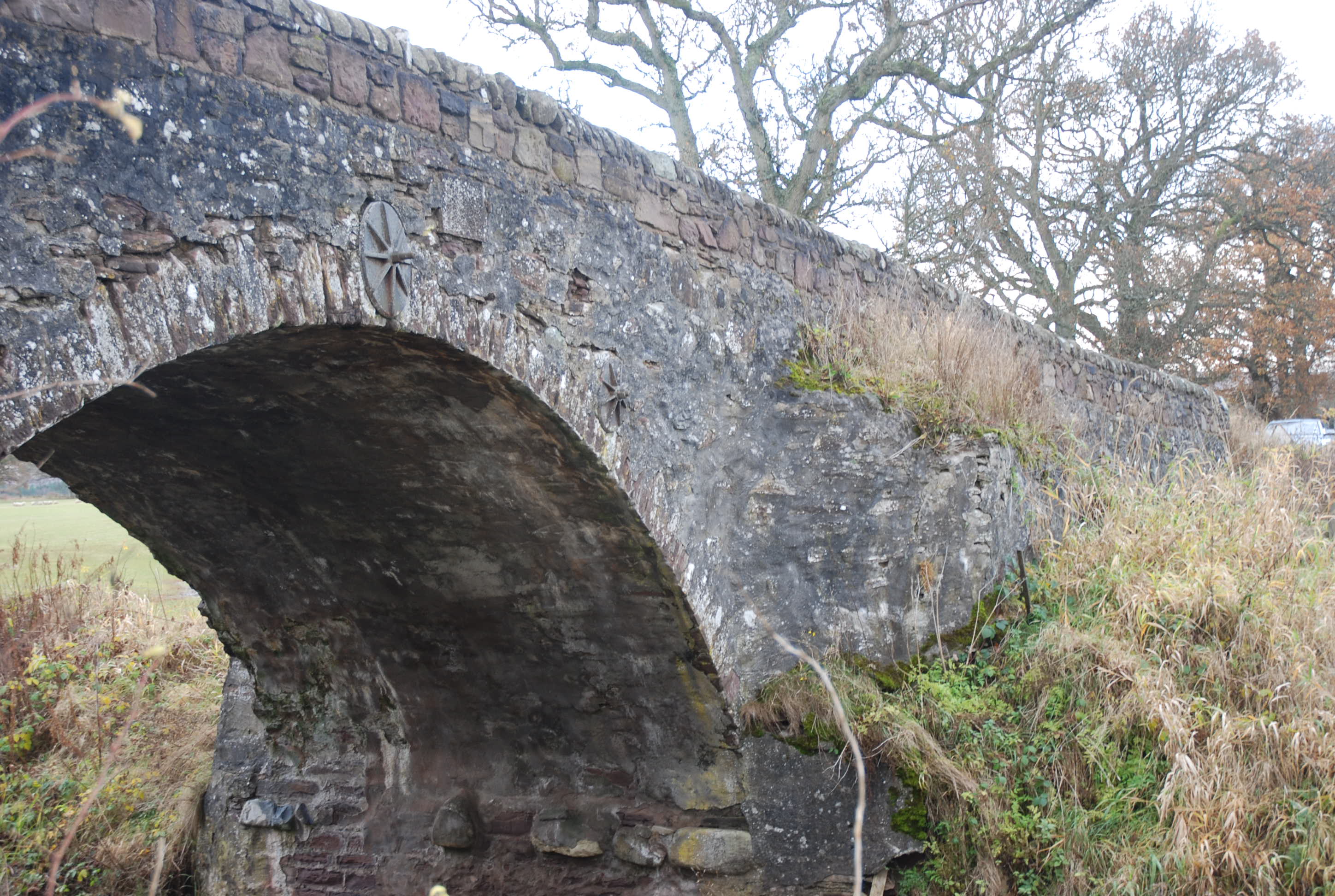
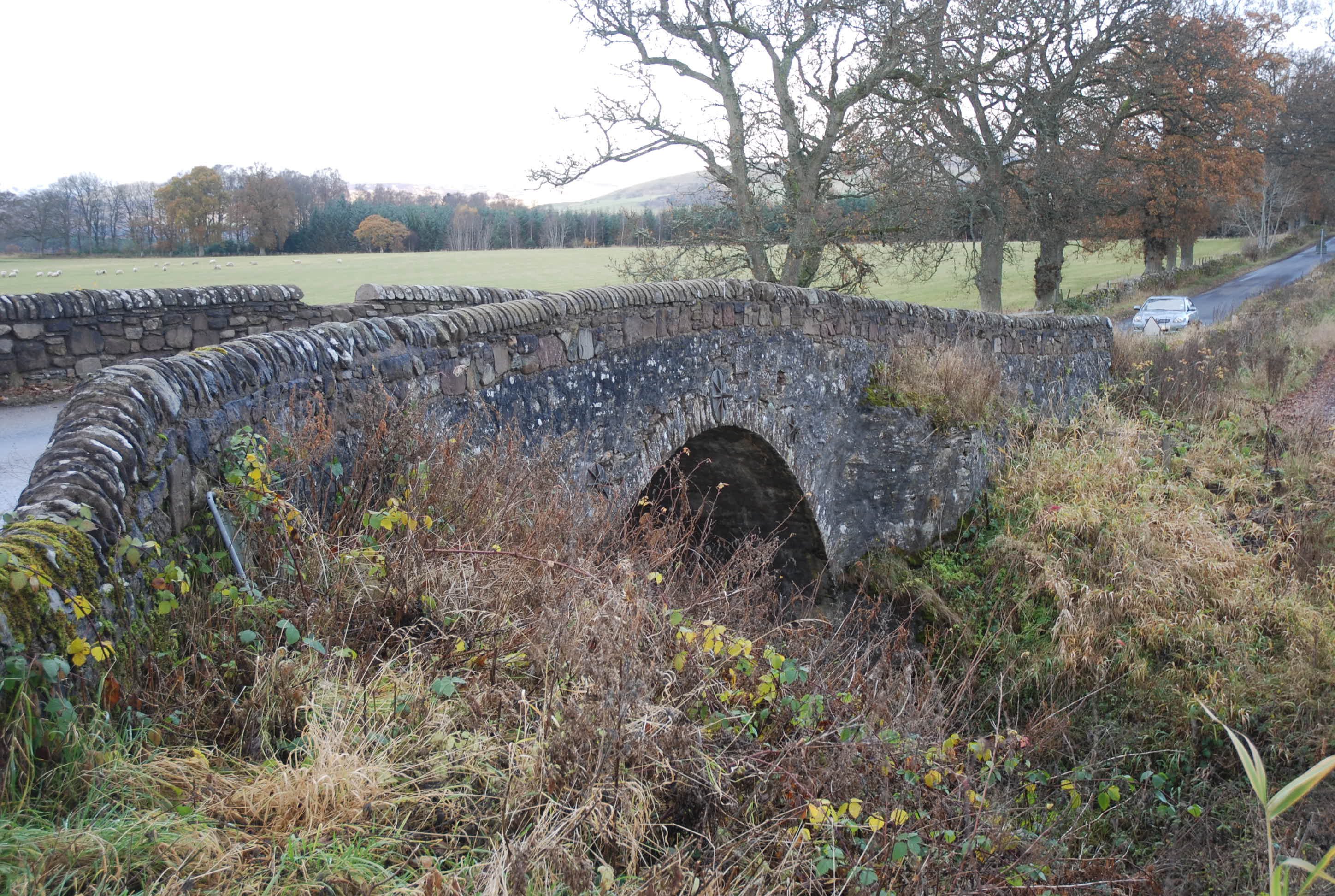
DAIRSIE BRIDGE nr. Cupar
C.Fife R.Eden 341581,716096
History: This bridge carries the heraldry of the Bishop of St.Andrews, James Beaton; this would date it to around 1530. However, the pointed arch might suggest an earlier date. In fact, a Lord High Treasurer document confirms that a bridge was there in 1496 and that a sum of money was given to 'ane pur wif at the brig of Dersie as the king raid by'. As is often the case, the heraldry may refer to major restructuring rather than a new build. A Balmarino charter from the 13th century refers to a 'King's Highway' from Cupar to St.Andrews crossing the Eden at Dairsie. The Church of St.Mary, overlooking the bridge, is mentioned in 12th century charters. Clearly this was a very ancient and important corner of Fife: a key component of a well trodden trade and pilgrim route.
Maps:1750(Roy) 1680s(Adair) 1600(Gordon 54) 1640 (Blaeu)
Currently: Partly 15th century; mainly 16th century. Three arches of different size and style: one small ribbed pointed drop-arch operates currently as a flood arch but may be a remnant of an earlier construction. The largest arch of around 30ft is semicircular; its slightly smaller neighbour is segmental. The width is just over 12 feet. The substance of the bridge is in weathered, well-dressed, coursed, squared rubble. Chamfered voussoirs are in the same material. Each arch has four heavy ribs, also chamfered, and indentation for corbelling supports can be seen on the lower soffits. A small squinch appears to facilitate some N. bank widening which may be of later construction. Parapets are also clearly part of a later repair. Oddly, there is only one refuge, located upstream on the southern cutwater. On the downstream face there is only one cutwater, which is also odd because it is adjacent to the small pointed arch; this gives strength to the suggestion that the latter was part of an earlier bridge. This is a very old, very beautiful bridge, but very mixed in style and structure, reflecting a long history of rebuild and repair.
Link photo photo photo photo photo photo photo
_______________________________________________
DALCHULLY BRIDGE nr Newtonmore
C. Inverness R.Mashie 260030,793558
History: 1730 military. Wade. Dalwhinnie to Fort Augustus road.
Maps:1750
Currently: original, single semicircular humpbacked bridge with rubble arch; long voussoirs of even length. Random uncoursed rubble spandrels. Now harled, and this harling has deteriorated. 22 ft span. 12ft rise. 9ft. parapet to parapet. Still in use on a very minor private road.
photo photo photo.
_______________________________________________
DALHOUSIE CASTLE BRIDGE nr Gorebridge
C.Midlothian R. South Esk 332379,663530
History: The road on Roy's map from Galashiels to Edinburgh crossed here, and through the castle grounds before progressing to Bonnyrigg. It was later bypassed twice, a little to the north. The bridge has been described as late 18th century in date, but this may need to be reviewed. The adjacent castle has a 13th century history, although the present build is largely 17th century; the bridge style appears compatible with the latter date. Its narrow width and style of voussoirs give weight to its firm presence on the old maps. The Roy map outlines the approaching roads.
Maps:1750(Roy) 1680s(Adair)
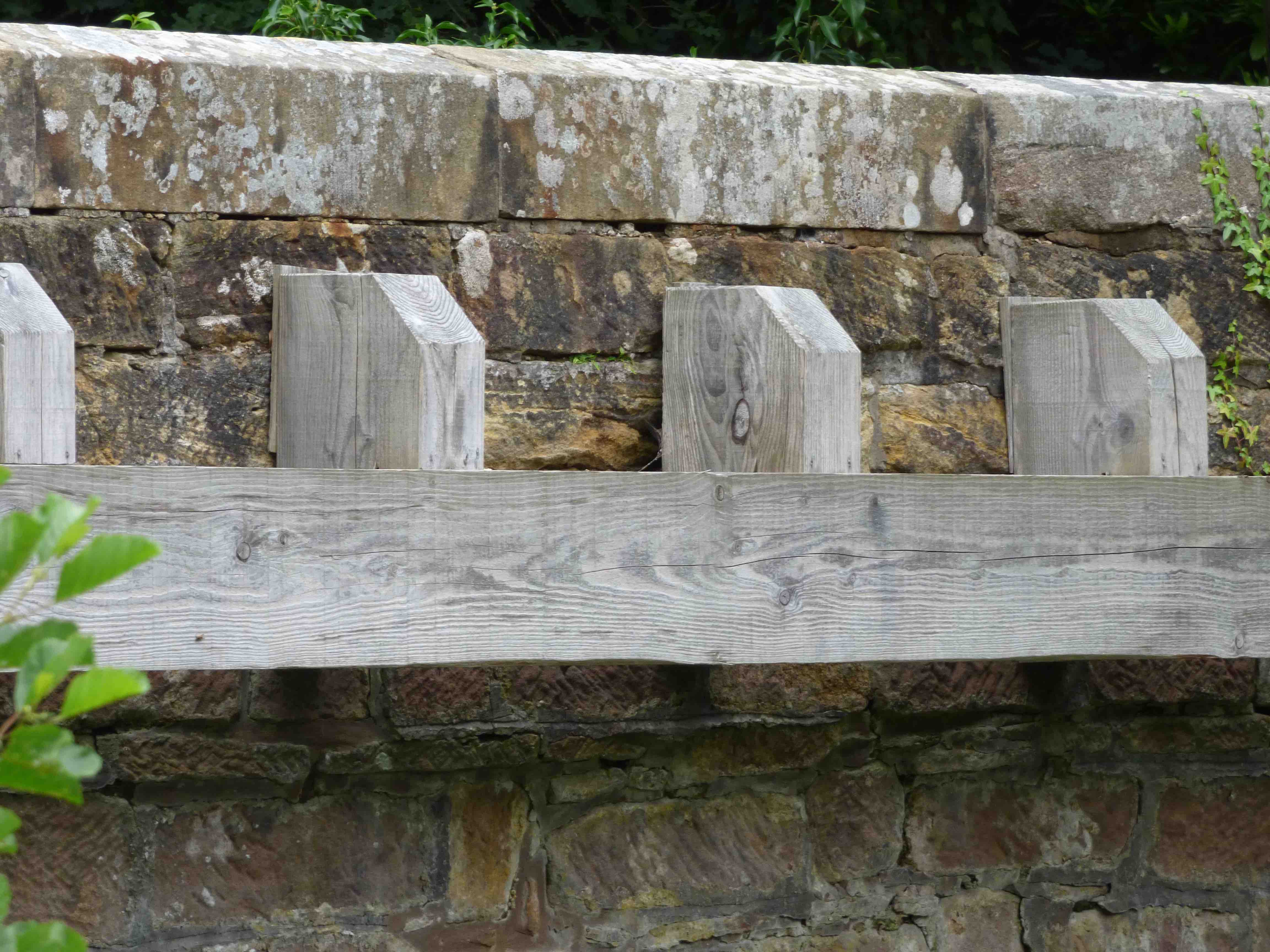
Currently: Single wide segmental arch with chamfered voussoirs. Splayed wings. Coursed squared well dressed rubble spandrels and abutments in pink sandstone. Seven and a half feet between the parapets. Very well dressed coping which may be of later date. Unusual wooden structure attached, which is not corbelling and seems to have little utility. The bridge is rather dilapidated and in need of repair, particularly on the east side downstream buttress and adjacent voussoirs. This little bridge is rather an underestimated treasure.
photo photo photo photo photo.
_______________________________________________
DALNACARDOCH BRIDGE see GARRY
_______________________________________________
DALWHINNIE BRIDGE
C. Inverness R.Truim 263882,782788
History: This is a 1730 military bridge. Wade. Dunkeld to Inverness road.
Maps:1750
Currently: Early 18th century military. Much more crudely built than later Caulfeild bridges. One rubble segmental arch with radially non-aligned voussoirs plus one flood arch. Springing from rock. Spandrels and abutments in un-coursed, random, completely undressed rubble. Horizontal decking. No parapets remain.
Link photo photo photo.
_______________________________________________
DANNA BRIDGE. Danna Island
C.Argyll Loch Sween
Maps:1750
Currently:Causeway in random uncoursed rubble with minimal pointing. Appears quite ancient and reputed to be so.
_______________________________________________
DARVEL BRIDGE see LAW BRIDGE
_______________________________________________
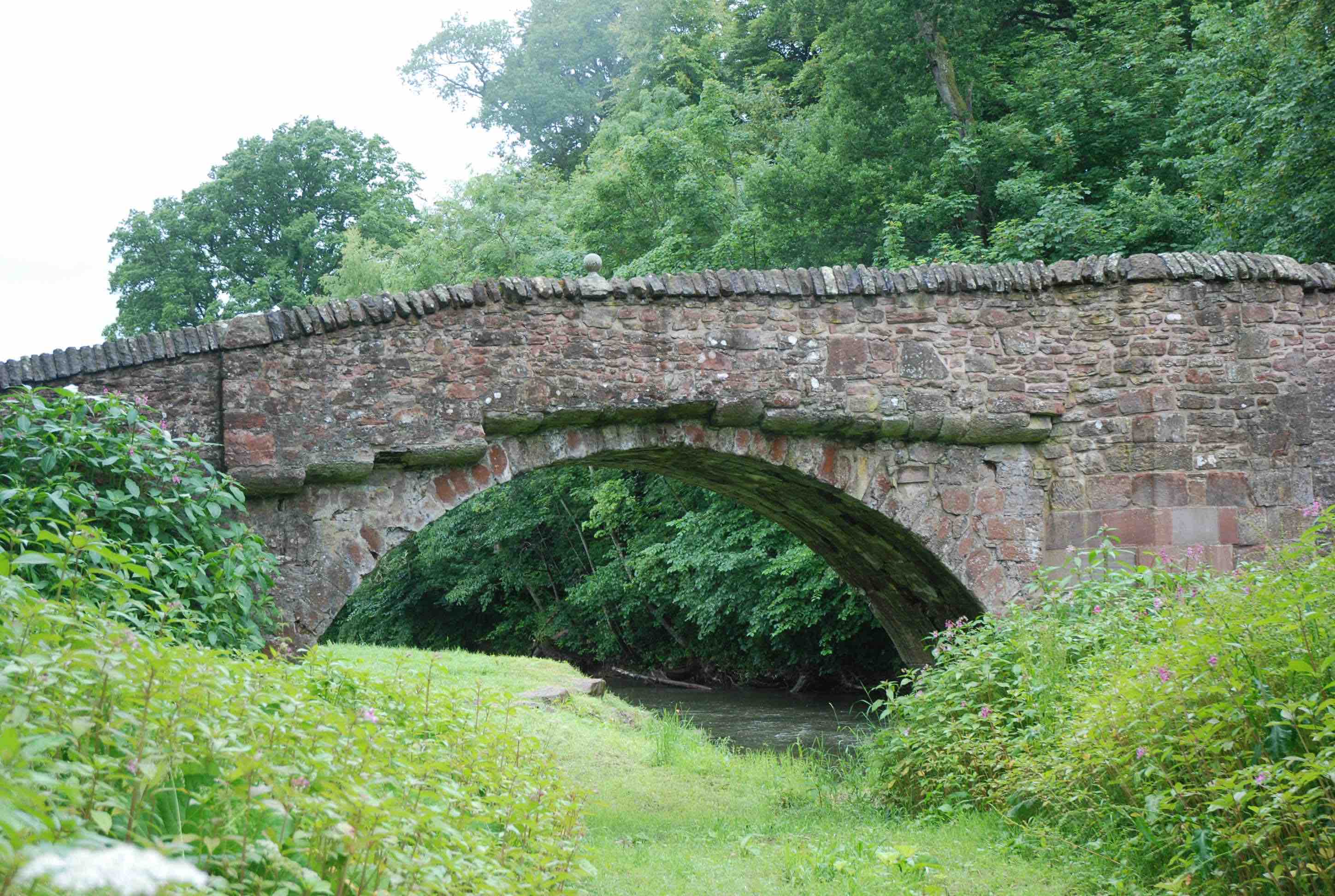
DEAN BRIDGE Cardean
C.Forfar Dean Water 328656,745836
History: 17th century. Lies precisely on the Roman Road crossing of the Dean Water. Adjacent Roman fort. OSA for Meigle Parish (1790) reports "Across the Dean is a narrow and badly constructed bridge in the road from Cupar to Kirriemuir" Airlie OSA (1791) : "a very old bridge near the Roman camp that some think Roman."
Maps: Roy (1750) and firmly on Adair map (1680s). Not clear on Pont.
Currently: wonderfully preserved 16th or 17th century bridge.
Two semicircular arches . Wide, well dressed voussoirs. Un-coursed red sandstone random rubble spandrels with multiple repairs. Nine ft. wide. Refuges overlying the cutwaters which suggests 16th century. Cobbled decking. Well preserved (or repaired) whinstone coping to parapets. Upstream has very ancient corbelling below the parapets. The bridge had a major restructuring in 1878 in which the north arch was carefully rebuilt. The bridge is now bypassed 100m downstream.
photo photo photo photo photo.
_______________________________________________
BRIDGE OF DEE Aberdeen
C.Aberdeen R.Dee 392891,803555
LINK TO FULL SUMMARY
History: 1527. Bishop Elphinstone.
Maps: (Pont 11)
Currently:16th-century
_______________________________________________
OLD BRIDGE OF DEE Castle Douglas
C. Dum & Gall R.Dee 273429,559969
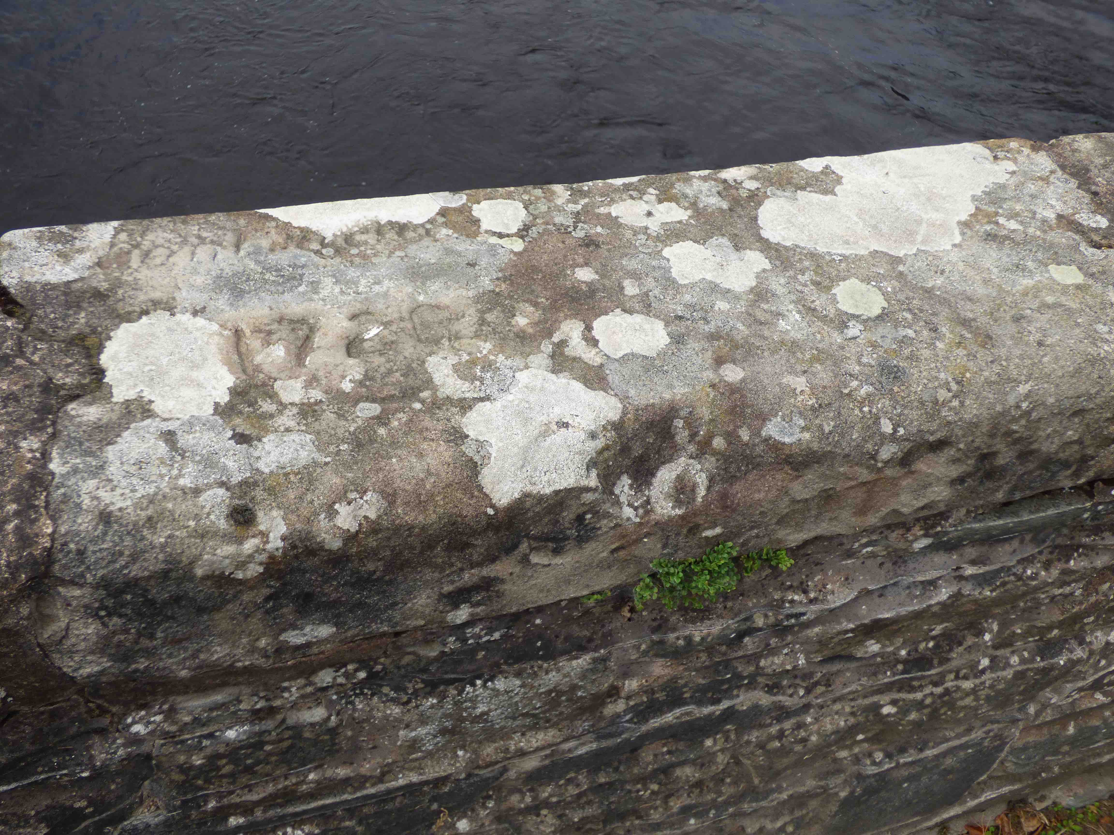
History: Previously known as the Granny Ford which was a little downstream. A 'Ford House' still exists. Reputedly built in 1737 but coping stone engraving (photo) reveals "constructed 1720”. The bridge was incorporated into the military road from Carlisle to Portpatrick in 1764, but then bypassed a few years later as the military road was rerouted via Tongland. Further bypassed in 1825 by the Turnpike over Threave Bridge (200m upstream) thus making the old bridge finally, completely redundant, which may account for its good condition and preserved narrow span.
Maps:Roy(1750) Appears as Granniford Bridge. Not on Blaeu.
Currently: Beautifully preserved early 18th century bridge with 4 semicircular arches equal in size, at 41ft. Twelve foot wide p to p. Substantially in random un-coursed rubble in granite and whinstone, but rather well pitch-dressed. Voussoirs are slim rather course rubble. Remarkable parapets on a decking slightly wider than the bridge. No string course as such.
photo photo photo photo.
_______________________________________________
DERVORGILLA BRIDGE see DUMFRIES
_______________________________________________
OLD DEUCHAR BRIDGE Selkirk
C.Selkirkshire R.Yarrow 336071,627947
History: possibly late 17th century. Built by the Duchess of Buccleuch. Macfarlane presents a 17th century report of a stone bridge next to a gentleman's home over the Water of Yaro at Deuchar. Damaged by flood in 1734 and major repairs or replacement in 1748.
Maps: 1680s(Adair) 1750(Roy)
However, on Roy it is marked by "bridge" only.
Presumably down at the time
Currently: Ruined single semicircular arch. Most likely the remains of the 18th century work.
Link
_______________________________________________
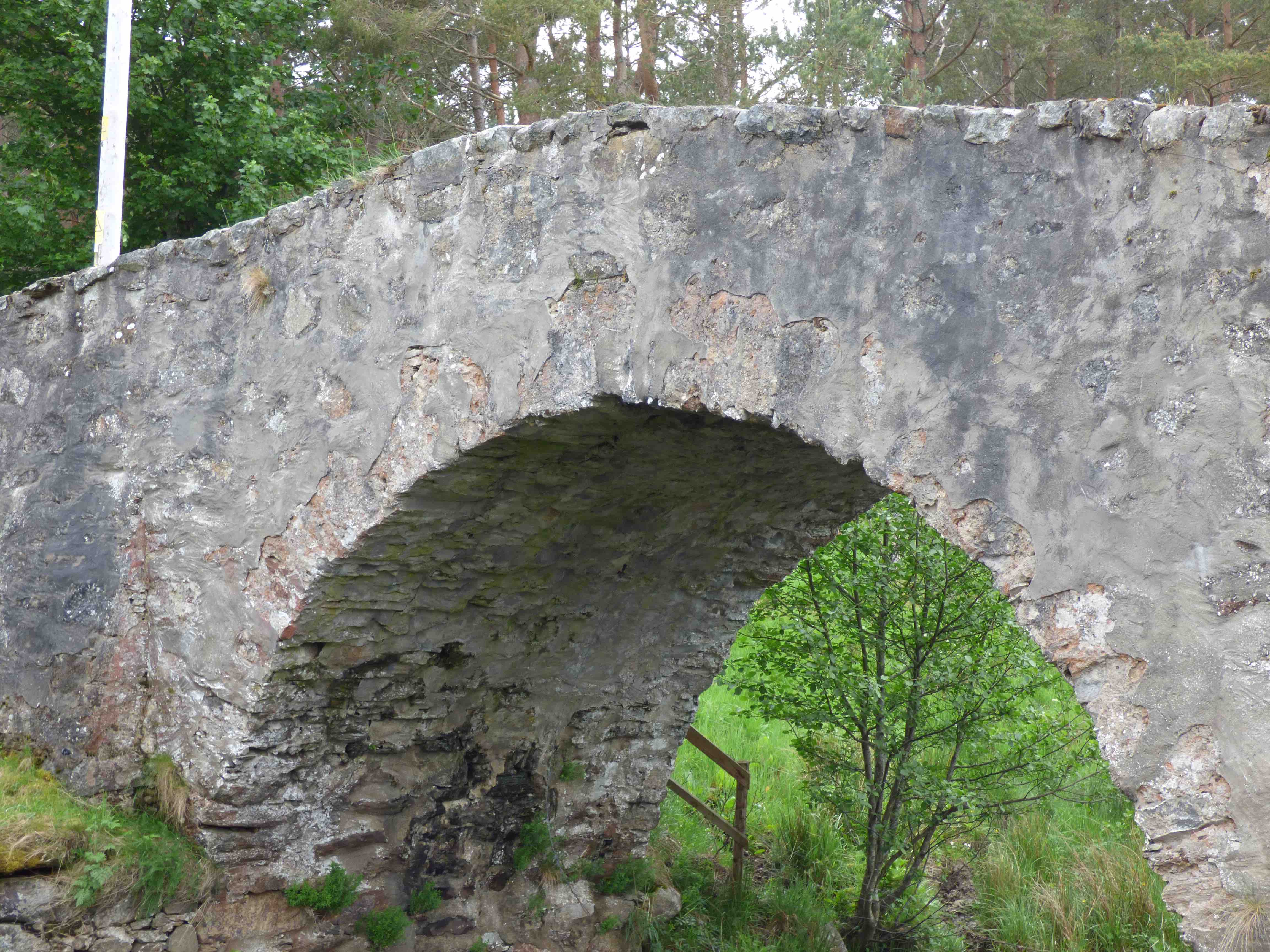
DEUGH BRIDGE Carsphairn
C. Dum & Gall Water of Deugh 255693.594498
History: Alkso known as Holm Bridge. This bridge is falling down: another sad case of neglect. It was firmly on Roy's map but nothing is known about its history or provenance. Previous photos and a postcard show an undressed random rubble bridge with a single arch.
Maps:Roy(1750)
Currently:100 m upstream of the present bridge which bypasses it. 18th century single segmental arch in squared rubble. Outer wall of the spandrels has fallen away revealing the inner wall and the infill behind. The infill is surprisingly substantial. Decking is overgrown with turf .
photo photo.photo
_______________________________________________
BRIDGE OF DOCHART Killin
C.Perth R. Dochart. 257143,732500
History: This bridge was built 1760 but there is clear evidence on Roy and Pont of an earlier existence. Also, repairs are noted by the Commissioners of Supply in 1720. It was restructured in 1831 and the central arch was rebuilt. The bridge hops between small islands. Inchbuie Isle, the largest, was the ancient burial ground of the Clan Mcnab. The Falls of Dochart, a famed and picturesque tourist spot, can be viewed from the bridge.
Maps:1750(Roy). 1600 (Pont 18).
Currently: 18th century style. Twisting profile through the rocks. Four segmental arches. Three flood arches. Large rubble and whinstone voussoirs of irregular length. Random rubble spandrels and abutments. Flat decking. Natural piers on rock bases.
photo photo.
_______________________________________________
DOLLERIE BRIDGE near Crieff
C.Perth Pow Water 290713,720917
History: The Inchaffrey Pow medieval canal was repaired by a 1690 Act of Parliament. There are two bridges here, close to each other: Dollerie bridge and Witches' Bridge. The marker appears to be Dollerie (Witches' Bridge is a little downstream at 290378 720949 and has a date-stone of 1778 which would indicate that it is not the one on Roy or on Pont. However, date-stones are notoriously misleading and often refer to repair dates. The style (especially with the witches' twist) is not that of an estate bridge, nor of a folly. It looks older than late 18th century.)
Dollerie Bridge looks more probably the one on the the Roy map. Macfarlane (1725) confirms the bridge at Dollerie, but could be referring to either. Stobie (1793) shows three bridges over the Pow at Dollerie.
Maps: 1750(Roy) 1680s(Adair) 1600(Pont 21). Precise locations unclear.
Currently: Dollerie (photo1) is a 17th century single semicircular arch with rubble voussoirs of unequal length. Slightly humped random un-coursed rubble spandrels with brought-to-course squared rubble parapets of later date. Pattress plates. There is clear 18th century widening (photo).
Witches' Bridge on photo2 appears to be a small random un-coursed rubble packhorse bridge, just a a few feet wide, with a twist to exclude witches and evil spirits. This last is not expected in the late 18th century. Worth noting that both Adair and Pont predate the Inchaffrey Act of Parliament.
photo photo photo photo.
_______________________________________________
DOON BRIDGE see BRIG O DOON
_______________________________________________
DOUNE BRIDGE see TEITH
_______________________________________________
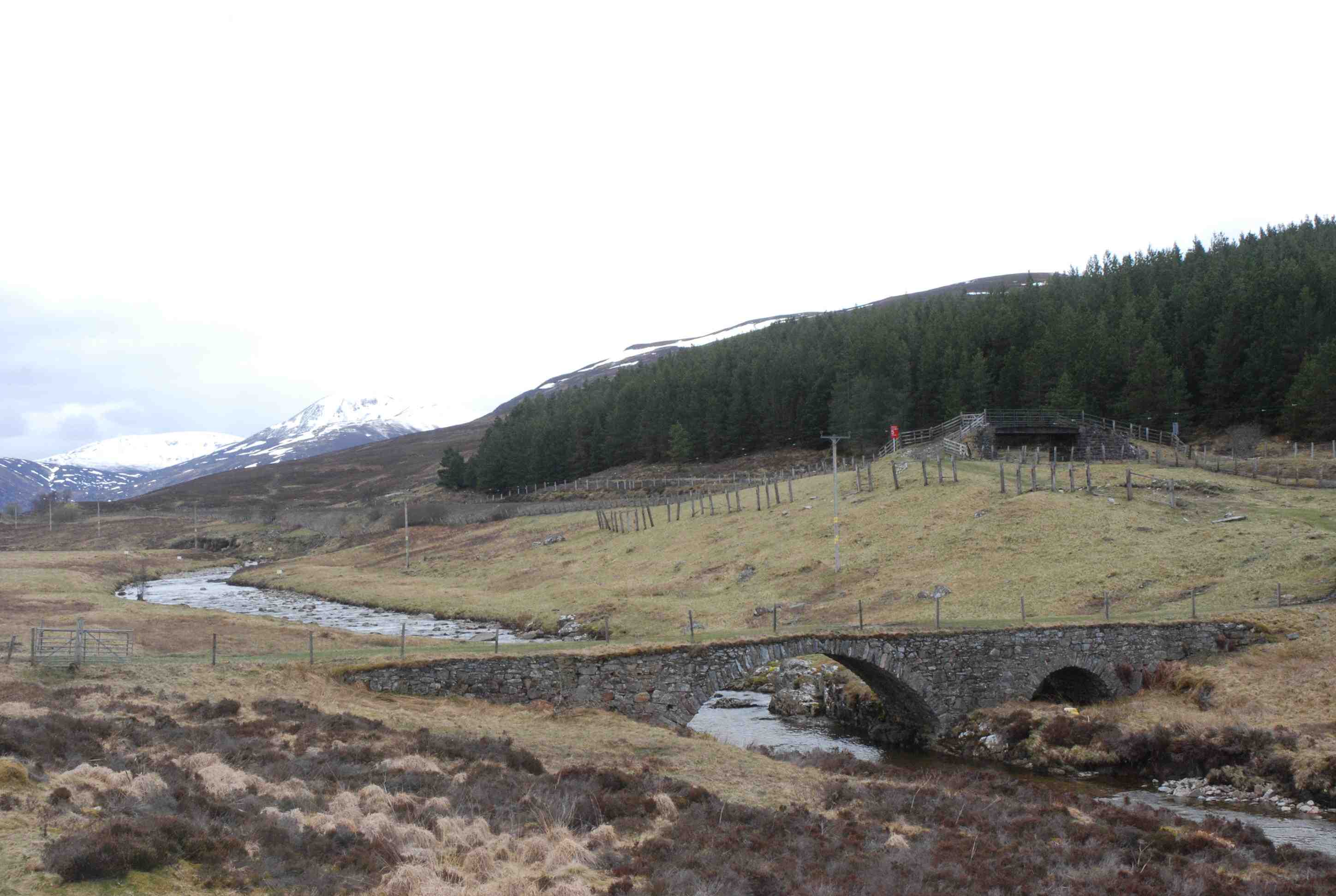
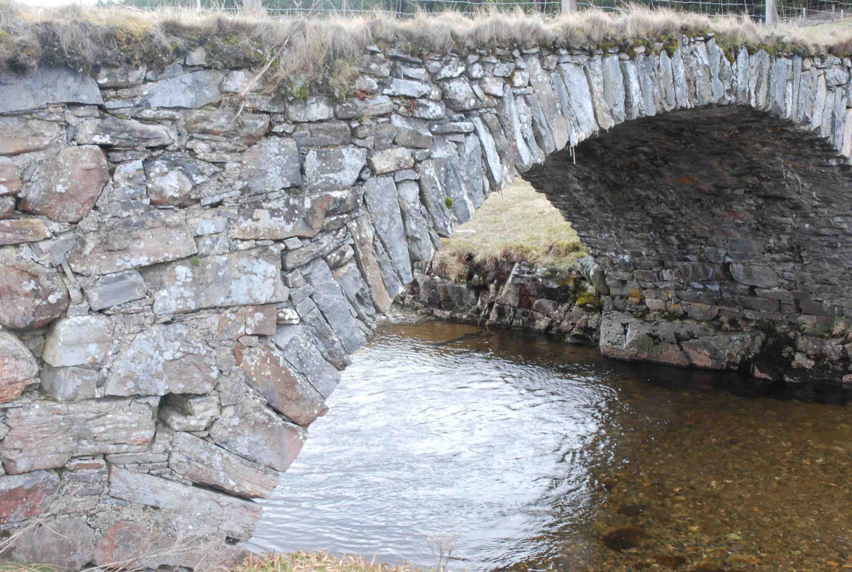
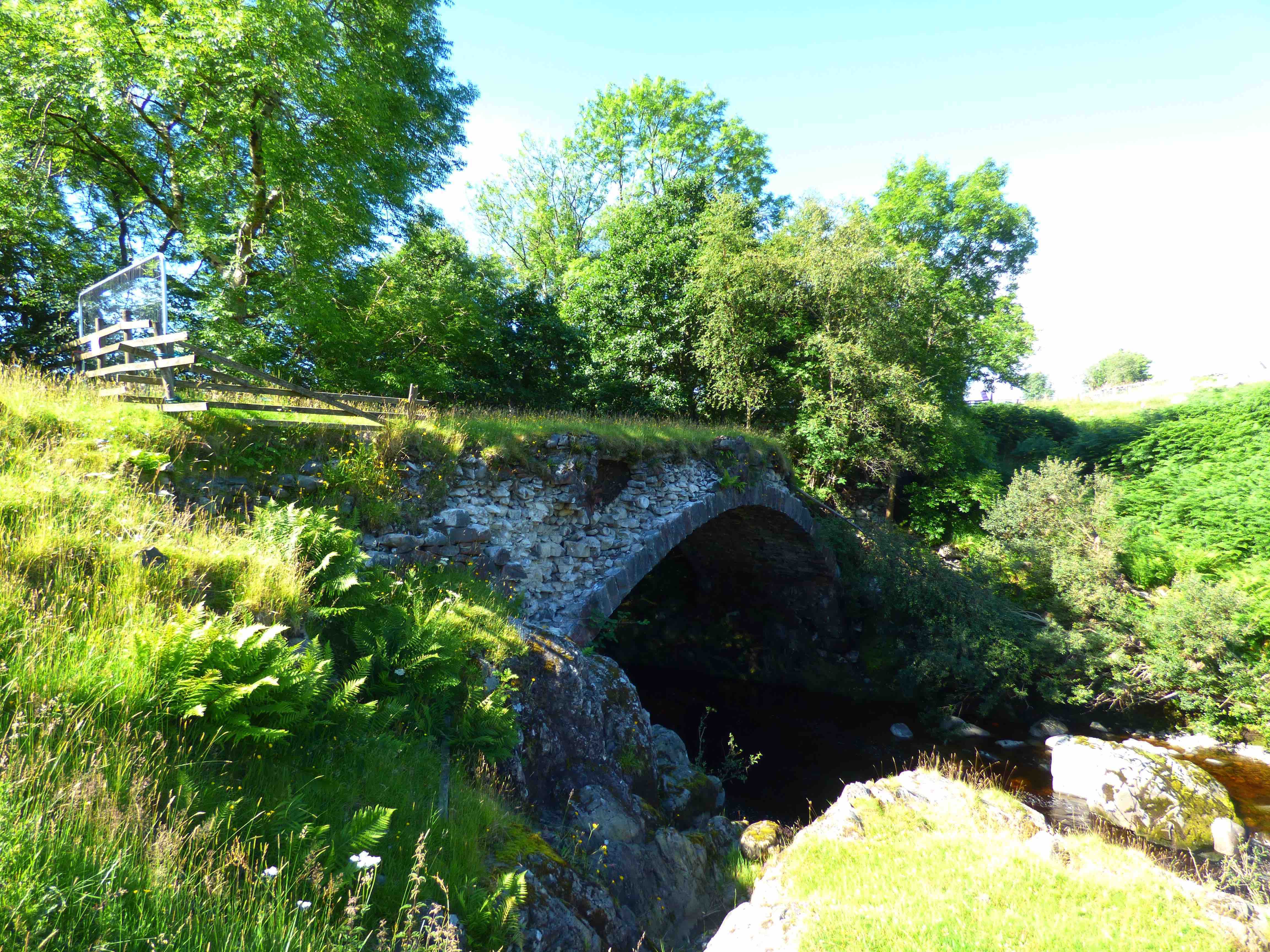
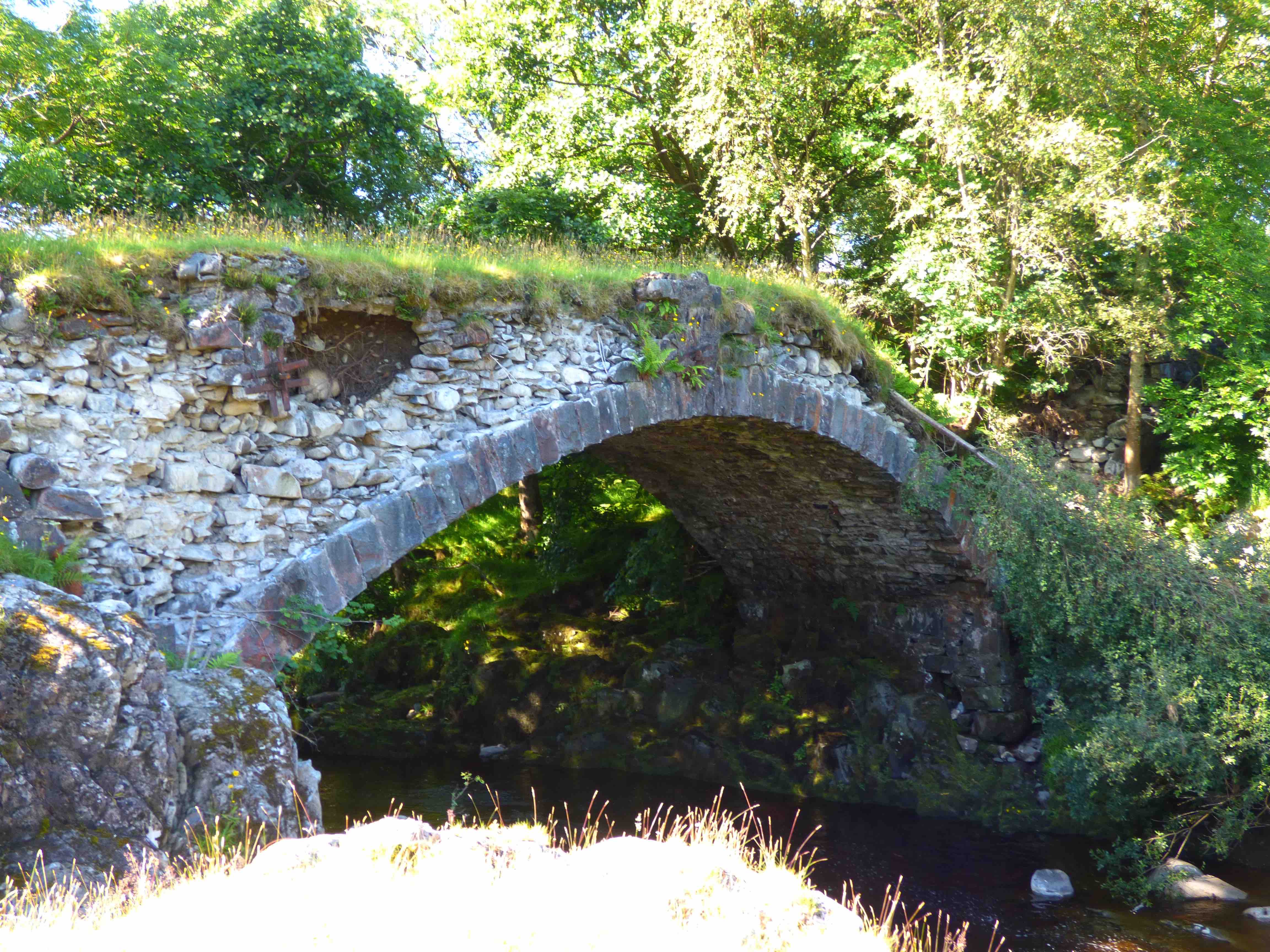
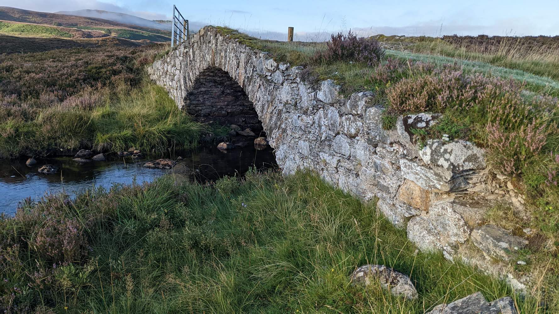
DROCHAID BALBH BHORDAIN near Newtonmore
C.Highland. Milton Burn 272567,796175
History: This remote little treasure lies on the Stirling to Inverness military road which dates it to the early 1730s. It has most of the characteristics of an original Wade bridge. It appears to be absent from Roy's map which is surprising, but it has been included in the catalogue because it is tempting to think that Roy made an error, here, and confused the location with a spot 2km to the north(See Drochaid Tigh na Mile).
Currently: A small random rubble bridge with a segmental arch of large whinstone voussoirs of approximately equal length(60cm) which appear to be in radial alignment. Slightly humped, the spandrels are in crudely dressed stone with no coursing. Mortar appears in good condition. Width is 3.6m (11.4 ft) between the parapets. Much of the parapet substance is now missing. The decking is of turf. Some rather crude concrete rendering has been recently applied to part of soffit which is a pity. Its remoteness may well have protected it over the centuries, but it certainly deserves some attention and perhaps some repair and careful maintenance.
Photos courtesy of R. MacPherson.
Photo. Photo. Photo Photo. Photo
_______________________________________________
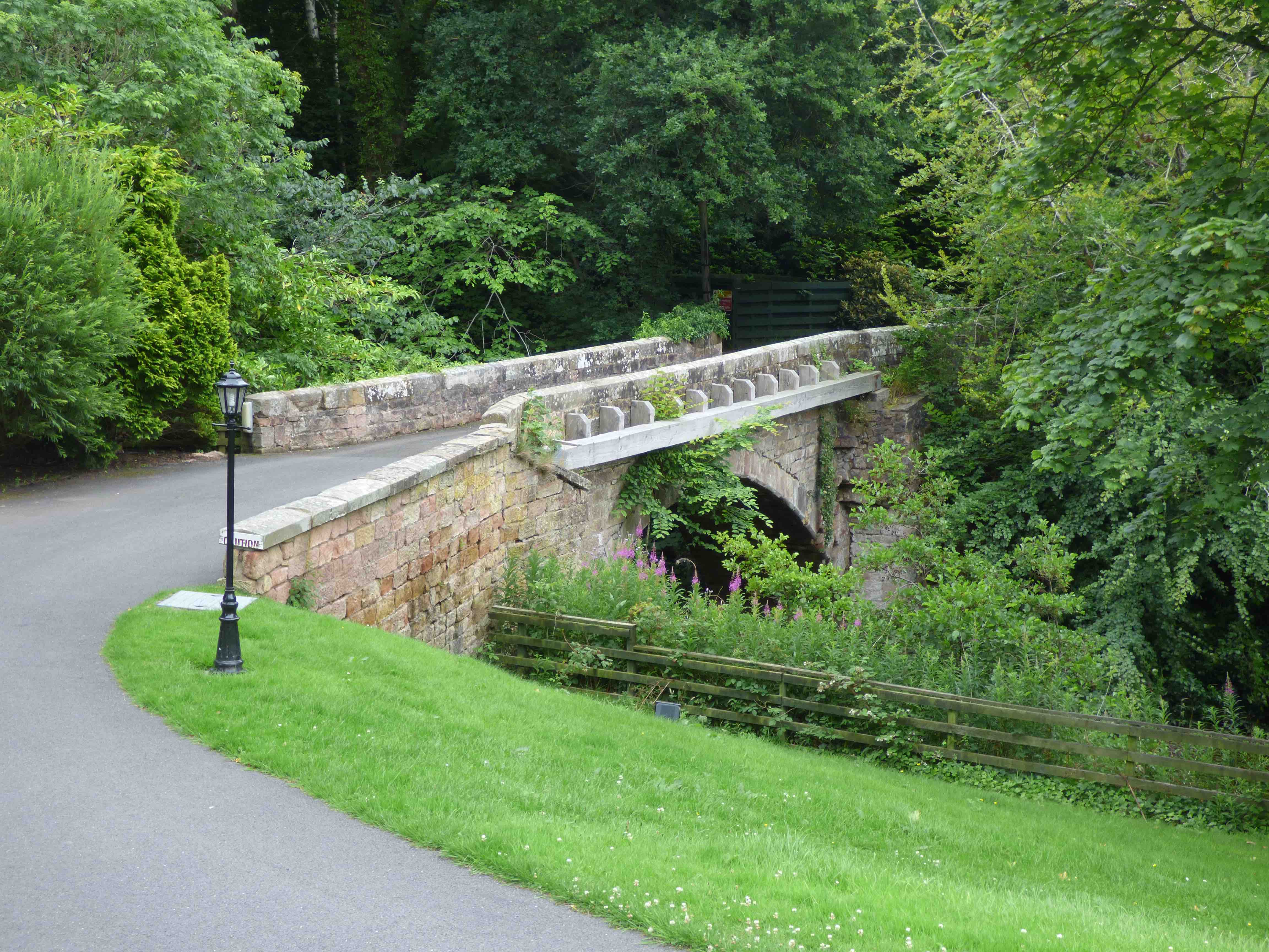
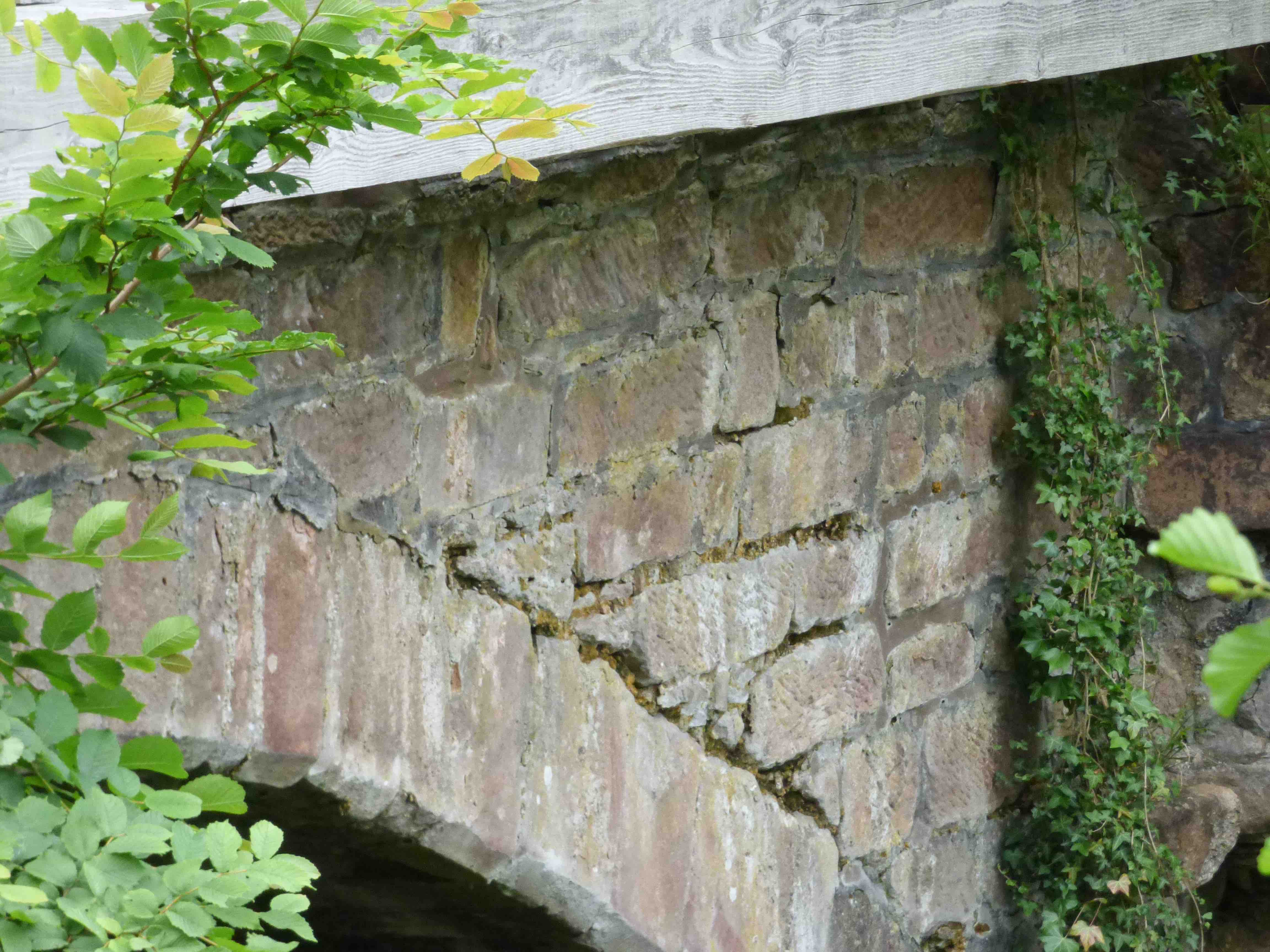
DRUMLANRIG CASTLE BRIDGE nr Thornhill
C. Dum&Gall R.Nith 285956, 599862
History: This bridge is on the main approach from the east to Drumlanrig Castle and is the castle home-bridge. Drumlanrig Castle is largely 17th century with foundation walls from the 15th century and a history from the 14th. The bridge probably has a medieval origin and is on the maps of Pont and Blaeu. It seems it was rebuilt in 1708 and had repairs in 1747. A further extensive repair and widening was carried out in 1860. Maps: Roy(1750) Pont 35 (1600) Blaeu(1640)
Currently: Two impressive pink stilted ashlar arches, almost semi-circular and flush with the spandrels. Huge cutwaters on each side. Coursed very well dressed squared stonework. Horizontal decking. Elaborate string banding, four feet wide, and parapets that are more recent. This is largely a 19th century reconstruction. it is difficult to make out any 18th century remnants but estate bridges were always more elaborate and better built.
_______________________________________________
DRUMMIN BRIDGE Corrieyairack Pass
C.Inverness Coachan Riabach 246342,796107
History: The military road through the pass was built in 1730 by General Wade. Repaired in the 1760s, probably by Caulfield, who spent £350 on repairing and replacing bridges in this area (see Allt Coire Uchdrachan). This appears more like a Caulfeild bridge. It was fully restored in 1986.
Currently: 18th century. Single segmental rubble arch. Rubble voussoirs. Largely squared and partially coursed rubble spandrels of varying length. Splayed approach. Turf decking. Gentle sloping humped bridge. 12 ft. wide p to p.
_______________________________________________
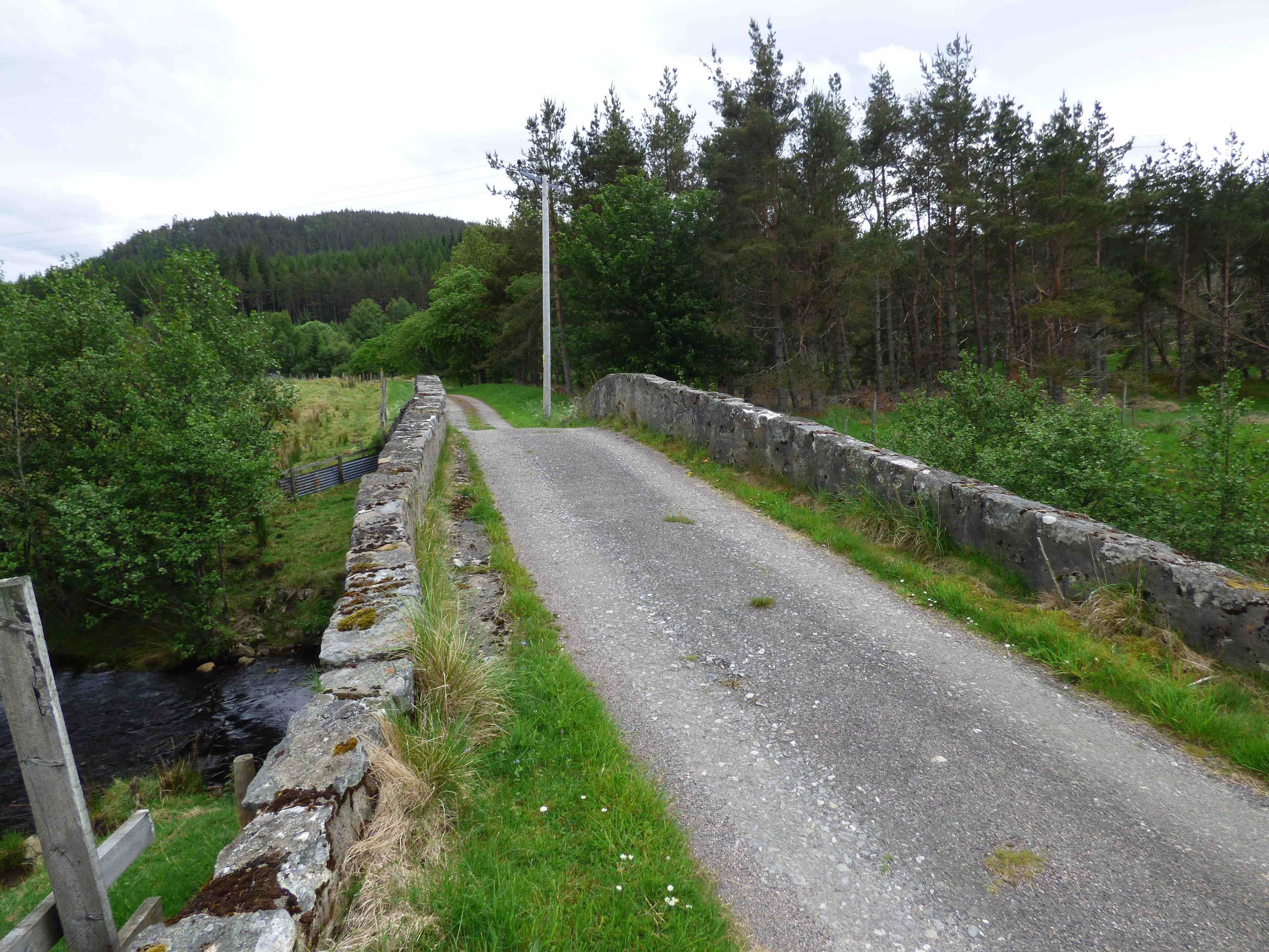
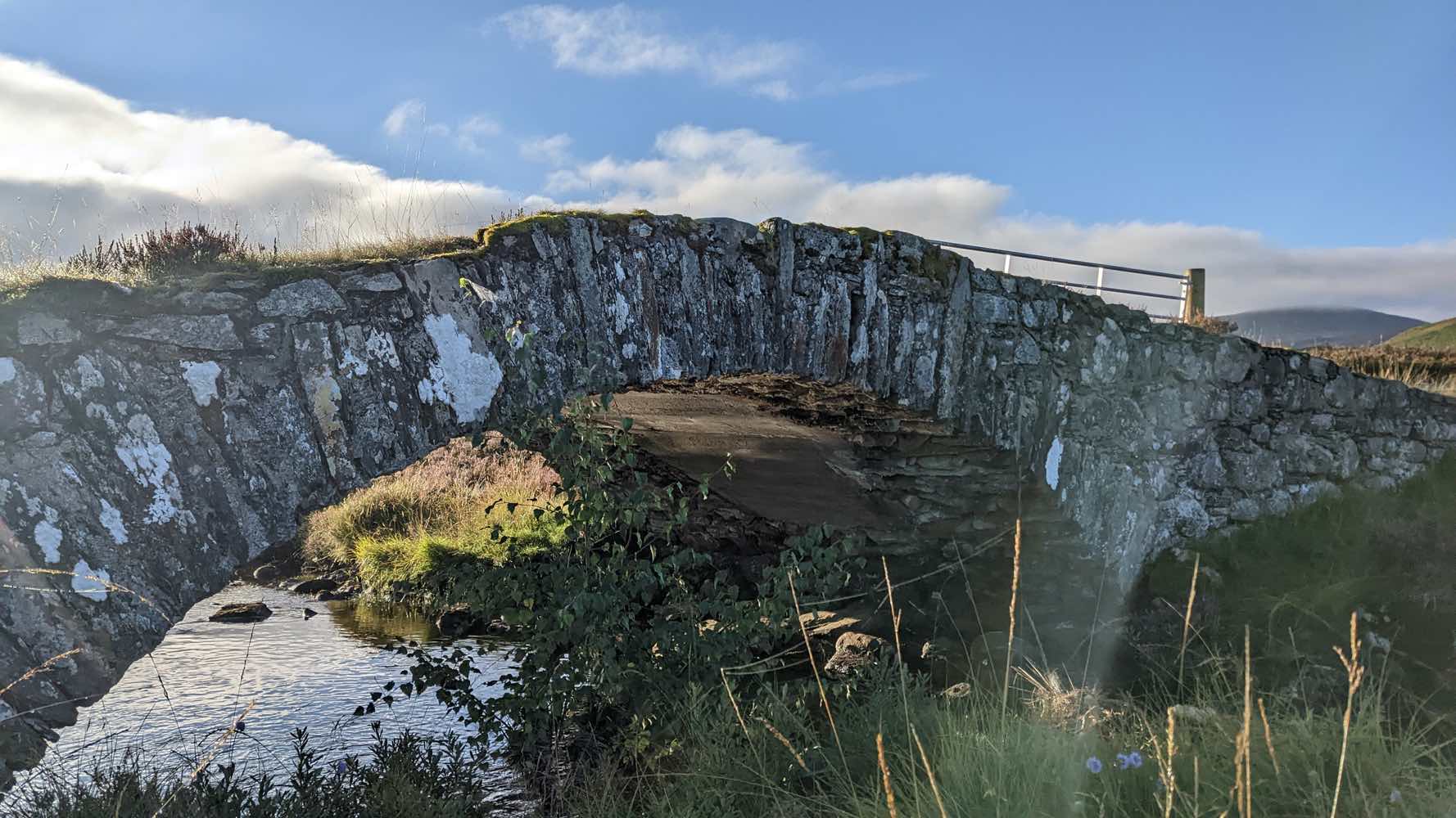
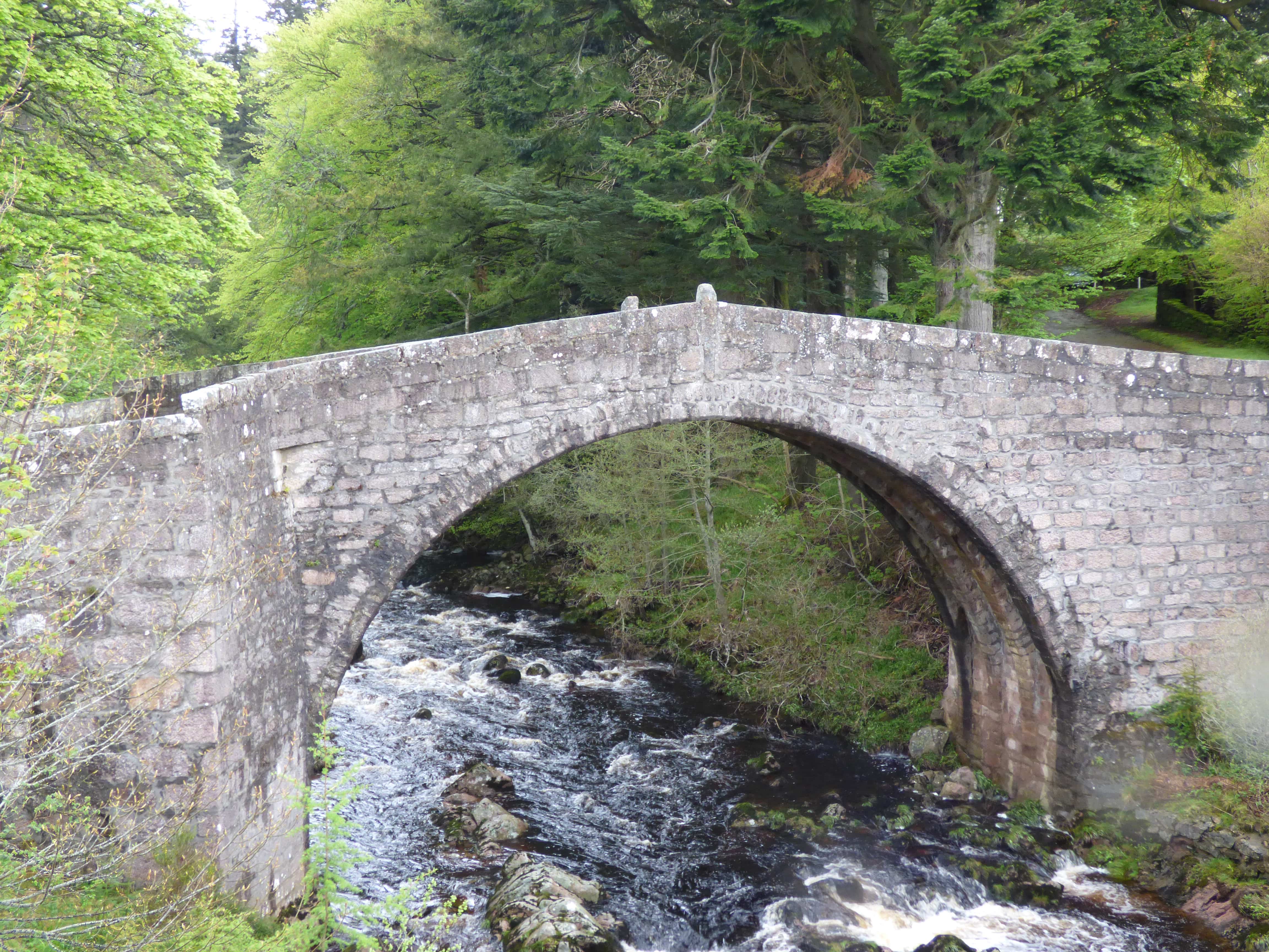
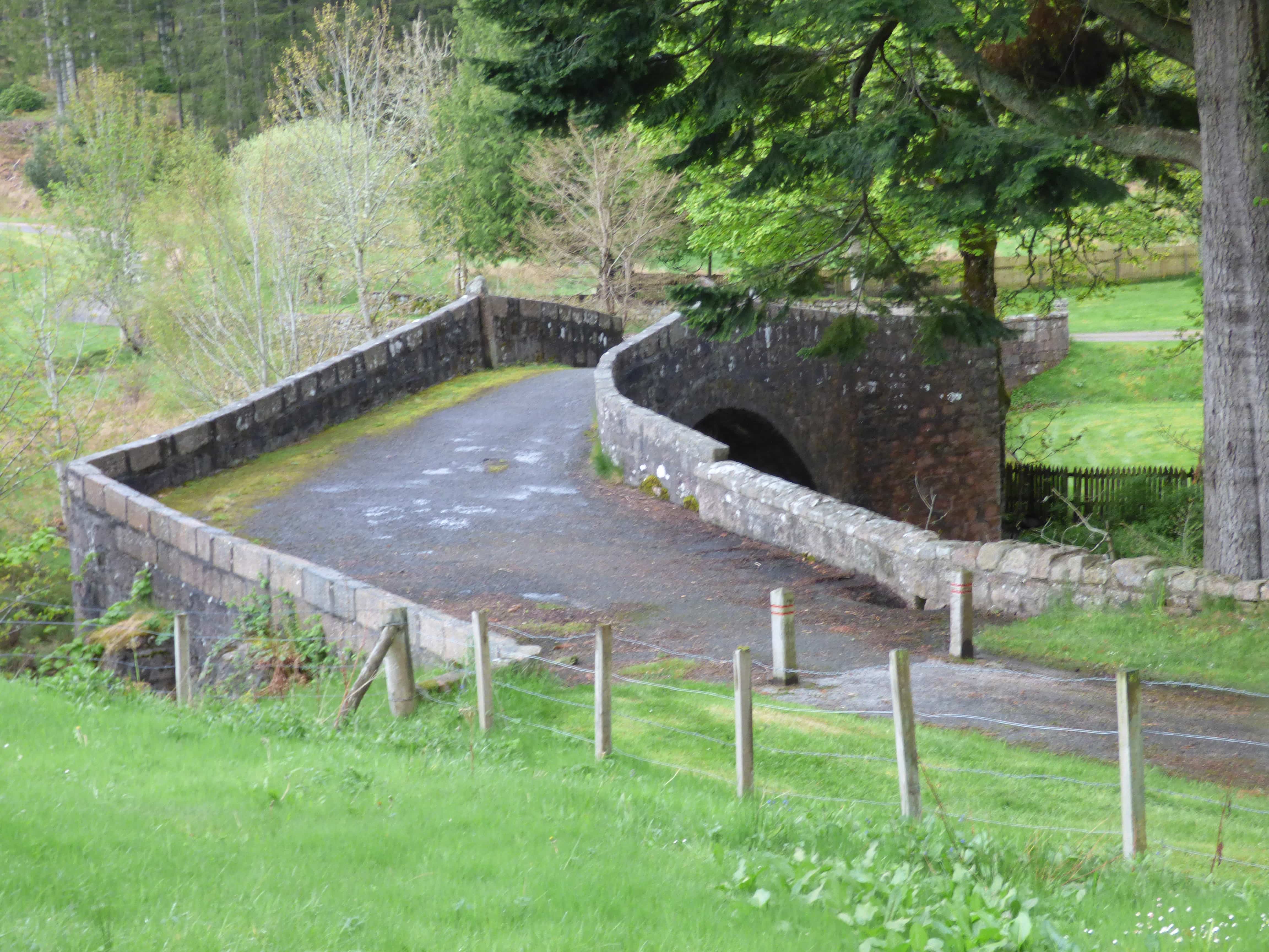
DULSIE BRIDGE
C. Inverness R.Findhorn 293194,841445
History: 1755 military bridge. Caulfeild. At the time of Roy's survey the military road (Coupar to Fort George) appears to have been just completed down to this point. It would be a very new bridge. However, in 1726 Macfarlane records a predecessor: 'Dallassy Bridge' with a single arch 60ft above the water. The bridge was seriously shaken in 1829 floods but survived with some damage to a pier. The water level reached within 3 ft. of the keystone.
Maps:1750
Currently:Classic granite random rubble Caulfield bridge. Enormous 46ft. semicircular arch over a gorge with fast running water below. Two to three ft wide rubble voussoirs. These are very large stones. One wonders how they raised them up there. Roughly faced granite random rubble spandrels. No string course. Solid heavy coping. A second small segmental flood arch is elevated. Buttressing on the downstream side. Splayed parapets. Cramping to main arch. 12ft p to p.
photo photo.
_______________________________________________
DUMFRIES BRIDGE
C. Dum & Gall R. Nith 296885,576046
LINK TO FULL SUMMARY
History: 1270
Maps:Roy(1750) Pont 35 (1600) Blaeu(1640)
Currently:Mainly 15th C. style.
_______________________________________________
DUNBLANE BRIDGE Bridge
C.Perth R.Allan 278186,701042
History: Written date 1409. Handbook of the Church of Scotland suggests Bishop Dernoch. 1419. This was also the crossing of the military road built in the 1740s by William Caulfeild. This was Caulfeild's first road. The bridge was widened and restructured in 1849. Further widened with brick and iron girders in 1927 and extensive repairs in 2020.
Maps: Roy(1750) Adair(1680s)
Currently: Appears to be a 19th century bridge with balustraded parapets and 20th century iron superimposed at the sides. However, underneath there are two joined semicircular arches. The downstream side is the 19th century widening. The older upstream side (with the pipe) is probably the 18th century military bridge; however, there is room to speculate because it is rather narrow (10-11ft). Caulfield’s bridges were 12ft wide, exactly.
One has to wonder if this is a remnant soffit from the 15th century. There seems to be no mention of a Dunblane Bridge military rebuild in the 1740s, nor of its cost which would have been considerable. This contrasts with the upgrade (possible rebuild) of the bridge nearby at Bridge of Allan which was recorded and costed in 1742. Could it be that Caulfield merely incorporated a very ancient bridge at Dunblane, as part of his road? It is impossible to tell because both bridge facings are entirely 19th century in style. Taylor notes that on the building of this military road most of the work was 'reconstruction and realignment'.
photo photo
_______________________________________________
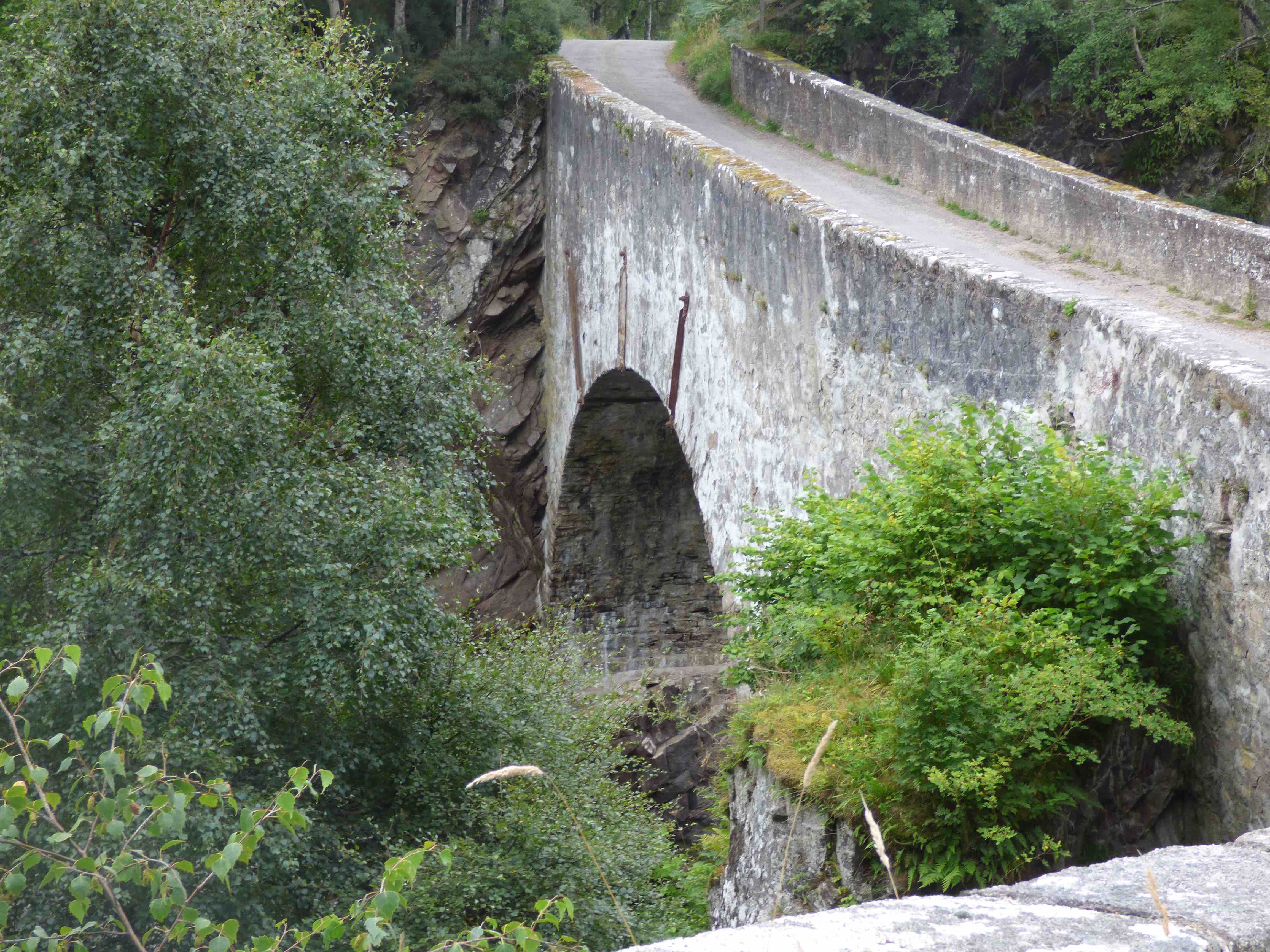
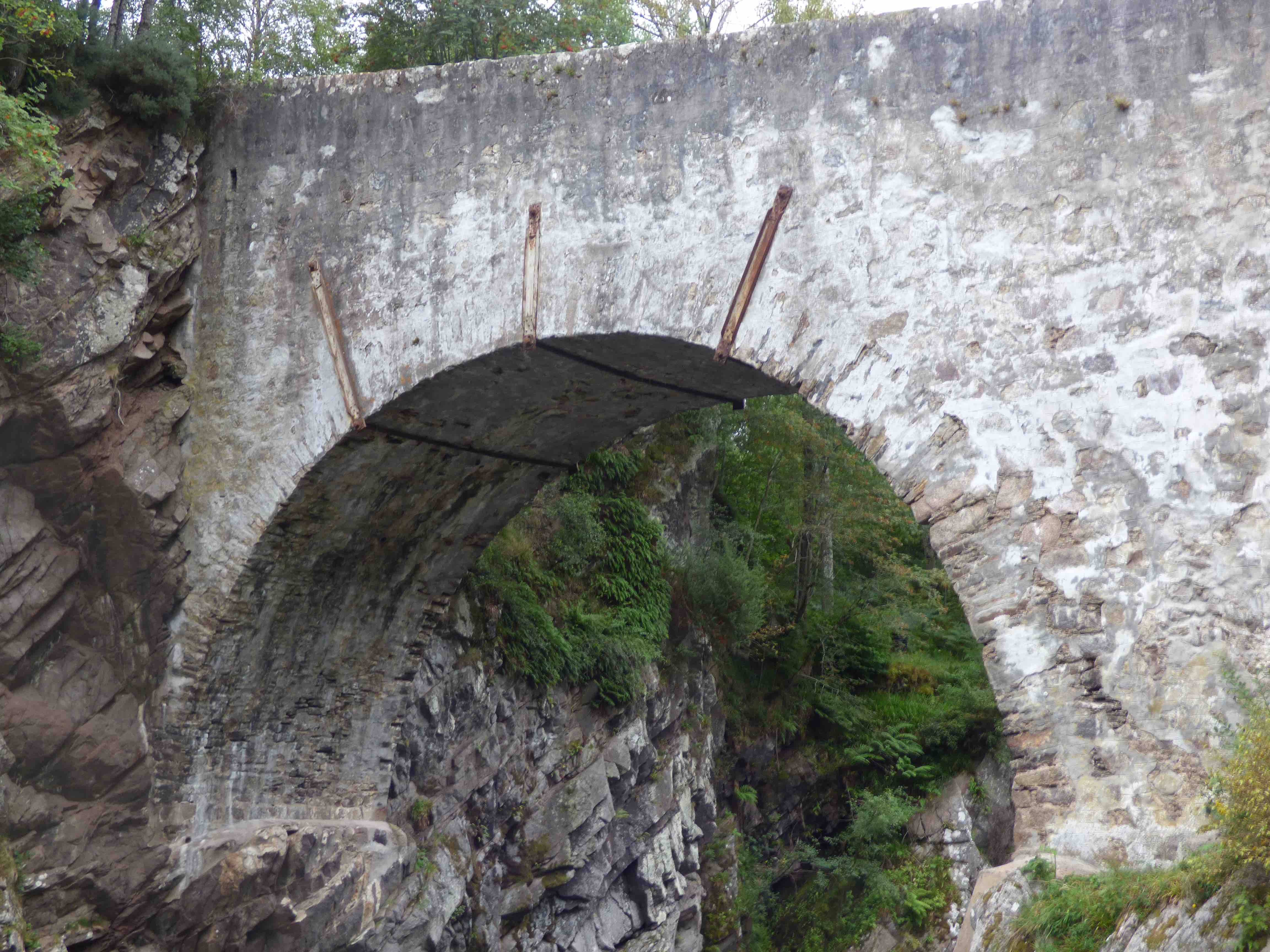
DUNGLASS OLD BRIDGE Cockburnspath
C. Berwick Dunglass Water 377208,672321
History: Coburnspath (Colbrandispeth) recorded as part of the Great Post Road north in 1128 (Holyrood charters). This was the southern limit of Lothian. A mill-bridge is first recorded 1617. The earliest crossing was on the shore. A later pathway seems to have wound its way from there up to the location of the present bridge. At this stage the Old Post Road7#44; going north, approached the old bridge by a route much closer to the shore. Some of the sandstone rubble walls date from before 1617 and may well have a 16th century origin. Buttressing was added around 1648. The 17th century bridge was lower in the chasm than at present with a considerable dip. In 1794 the bridge was raised up to provide a flat decking across the divide. The bridge is on the Adair map (1680s) along with the old road. In 1798 it was bypassed upstream as part of a considerable restructuring of the Post Road. There are five later bridges at around this site.
Maps: 1750(Roy) 1680s(Adair)1640(Blaeu)
Currently: Very difficult to get access. 17th-century. Perhaps some 16th century remains at the base. Very large single stilted semicircular barrel arch about 30ft wide within a chasm. It is over 200ft long and the arch spans about 35ft. Chamfered voussoirs. Width is 15 ft. at its narrowest; 37ft on very splayed approaches. The parapet is 50ft above the river bed. Random uncoursed rubble approaches and coursing on the spandrels. Some parts have large squared well dressed blocks. Iron ties and anchor rails. Decking is completely camouflaged (photo2). On the northern side there is a small earthed up additional arch with a 6ft span which may have been for the mill-lade. Access for any useful inspection is so difficult, due to vegetation, that a winter visit is recommended.
photo photo photo.
_______________________________________________
DUNNING BRIDGE
C.Perth R. Dunning Burn 301948,714433
History: This small Perthshire village has a 16th century church with an early 13th century tower. It lay on the old Stirling to Perth Road between Auchterarder and Bridge of Earn. A large Roman marching camp is adjacent. The village was completely burned down by Jacobites in 1715, but there is no record of whether the old town bridge survived. It is clearly on Pont’s map which implies a 16th century date. In 1750 the settlement was entirely on the eastern side of the burn. The bridge appears to have been widened or rebuilt in the 18th century.
Maps:1750 1600(Pont 21)
Currently:18th century single flush segmental arched bridge with random well-dressed rubble spandrels and rubble voussoirs. Horizontal deck. Parapets renewed at some stage. A 1960s concrete lintel support for widening on the western face, along with additional widening on the same side of the ancient soffit. However, there is also evidence of widening ( about 5 ft.) on the east side of the soffit which may date from the 18th century( R side of the soffit photo) . It is very possible that the main soffit of about 12 ft may be compatible with the bridge on Pont’s map.
photo. photo photo photo
_______________________________________________
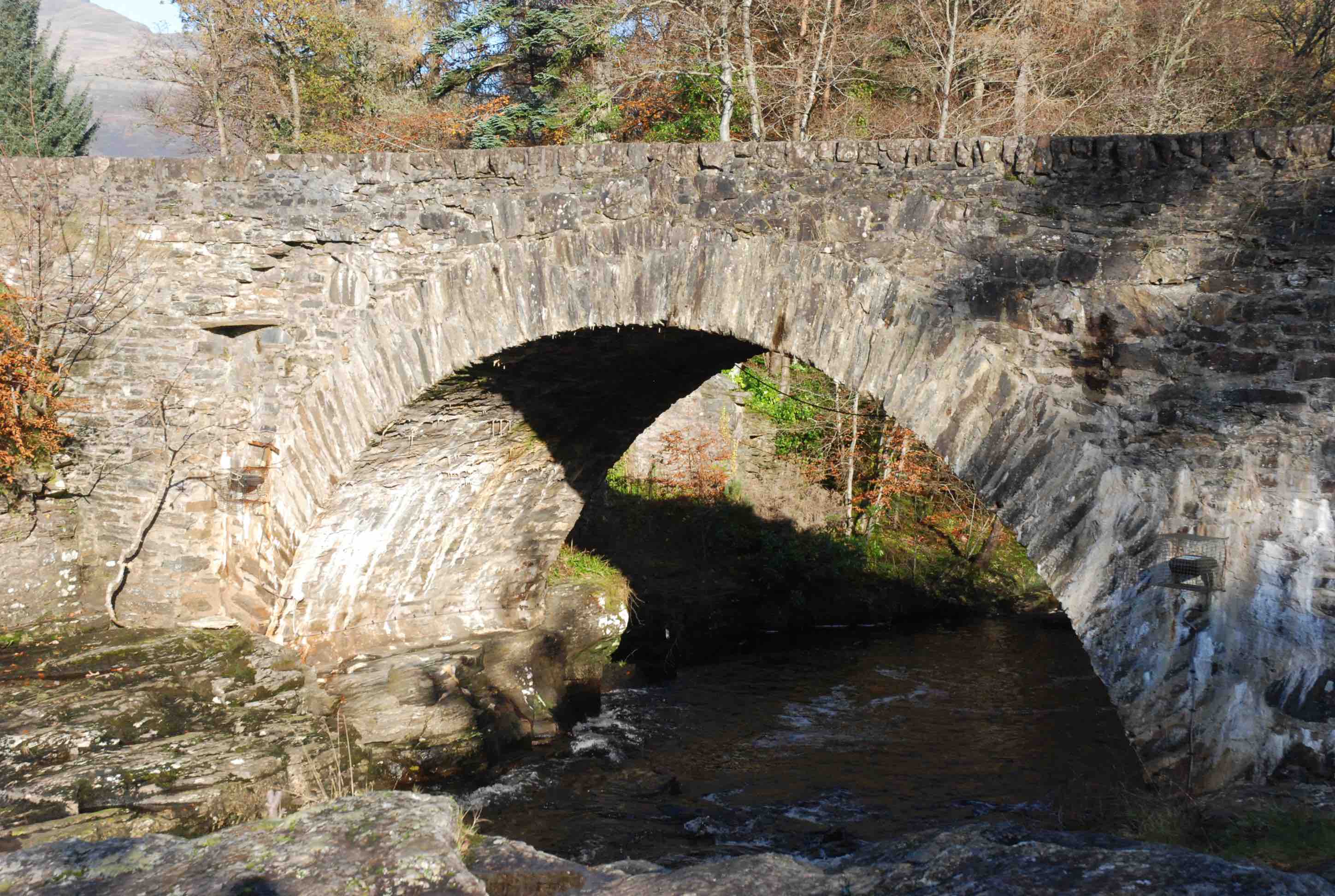
BRIDGE OF DYE
C.Kincardine R.Dye 365109,786076
History: Built in 1680 at same time as Whitestone Bridge, nearby. Both were mentioned in Macfarlane in 1724. The bridge is on the Cairnamounth- a very ancient trackway, used in the 13th century by Edward I, which runs through the Grampian mountains from the River Esk to the River Dee. An 1681 Act of Parliament permitted tolls to be imposed for its upkeep. The bridge was later incorporated into the military road from Fettercairn to Fochabers, built in 1760 by Caulfeild.
Maps:1750
Currently: Magnificent 17th century bridge with large perfect single semicircular arch. Four ribs (ribs are unusual for this period.) Humped. Triangular refuges at one end only. Renewed parapet but no string course. Very large coping stones with a pilot at the apex on each side. Almost castellated coping. Coursed very well dressed squared rubble spandrels. Voussoirs in the same masonry with an illusion of two courses. 11 ft wide p to p. 42 ft. span.
Photo. Photo Photo Photo