Scotland’s Oldest Bridges.
A map-based catalogue of the oldest masonry bridges in Scotland.
BALBIRNIE BRIDGE
Glenrothes. C.Fife. R.Leven 328615,701434
History: First built in 1685. Synod of Fife. Appears on Adair's map(1680s) when it must have been very new. OSA. Rev. Thomson (1791) refers to it having been 'lately rebuilt’.
Maps: 1750 1680
Currently: 18th century. Coursed squared drove-dressed rubble with long unequal rubble voussoirs. Flat coping. Approaches more recent. Two segmental arches.
Note: A Dunfermline charter of 1466 (458) identifies a ' very ancient bridge over the Water of Leven.' The described location appears to be about 1km upstream of Balbirnie, where there is nothing to be found, today. Nor does this latter appear on any of the old maps.
_______________________________________________
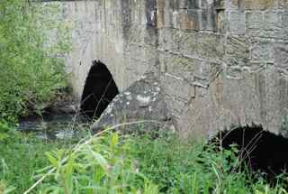
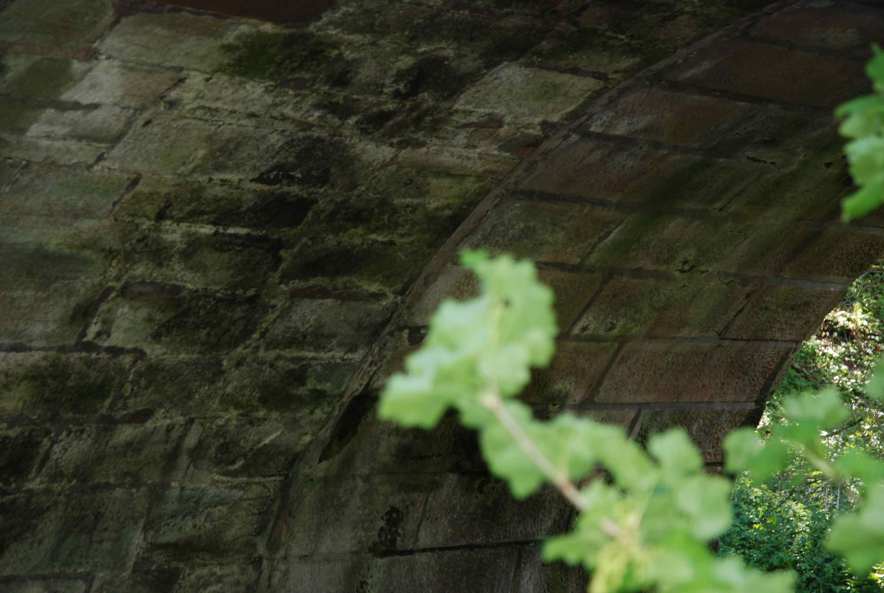
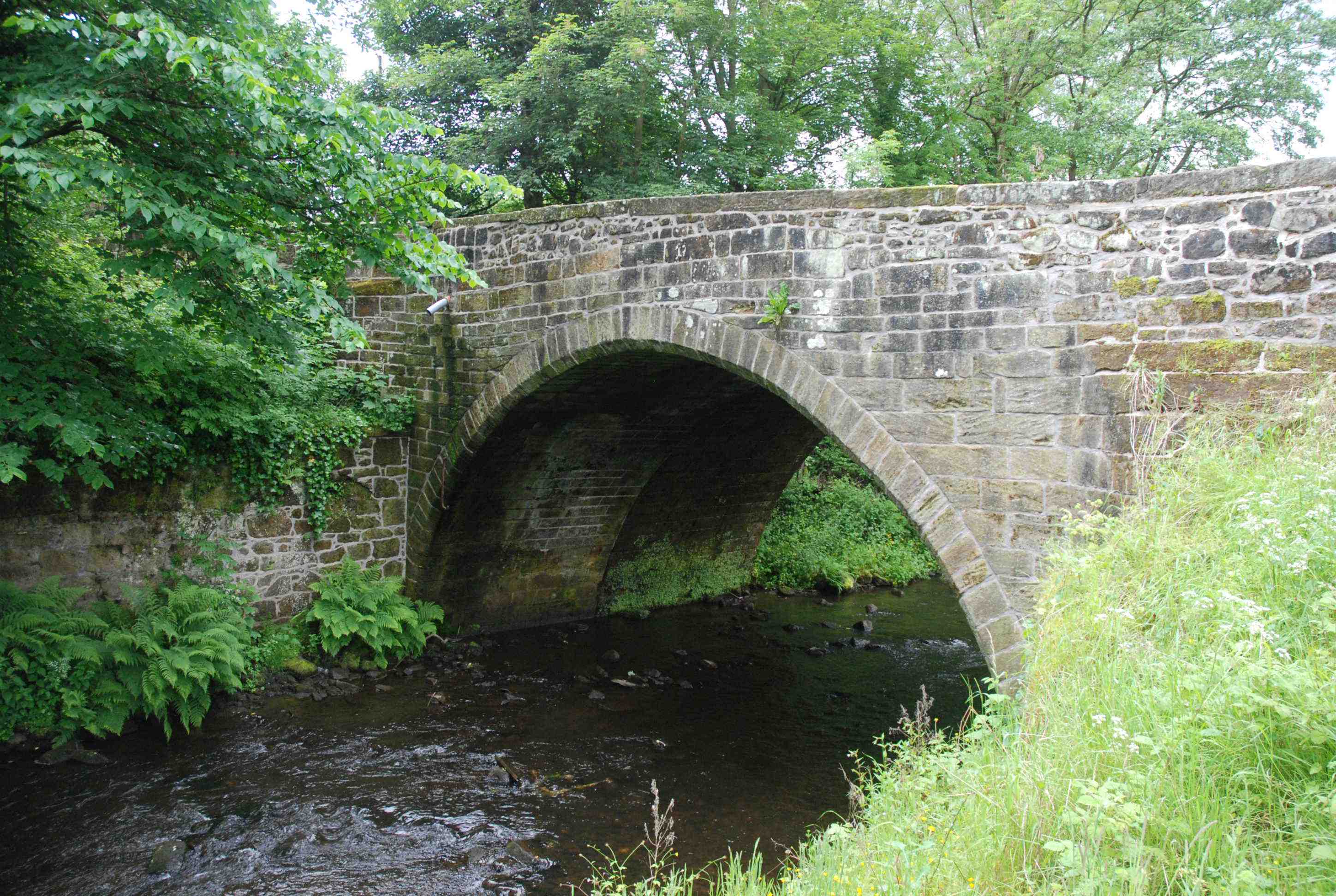
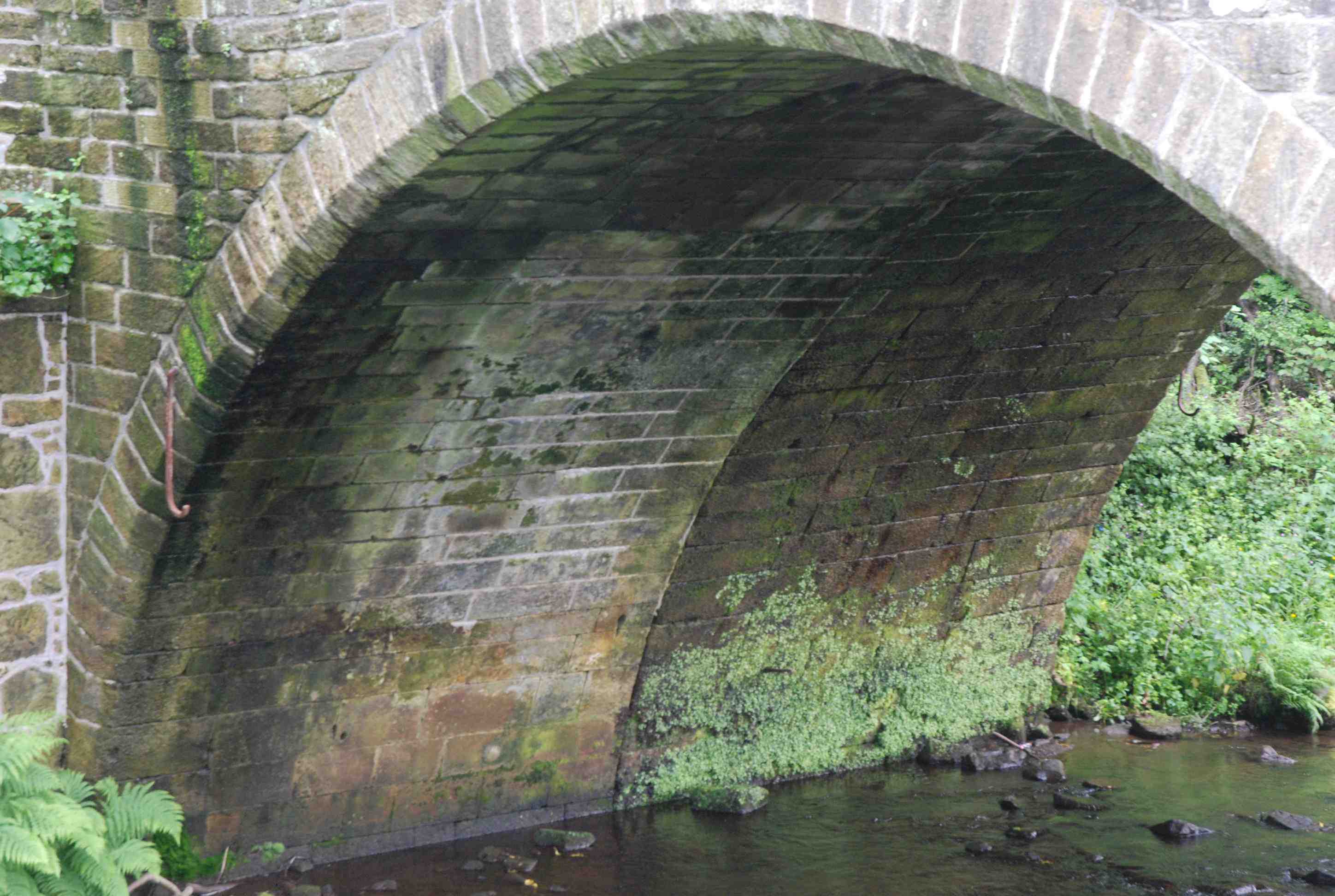
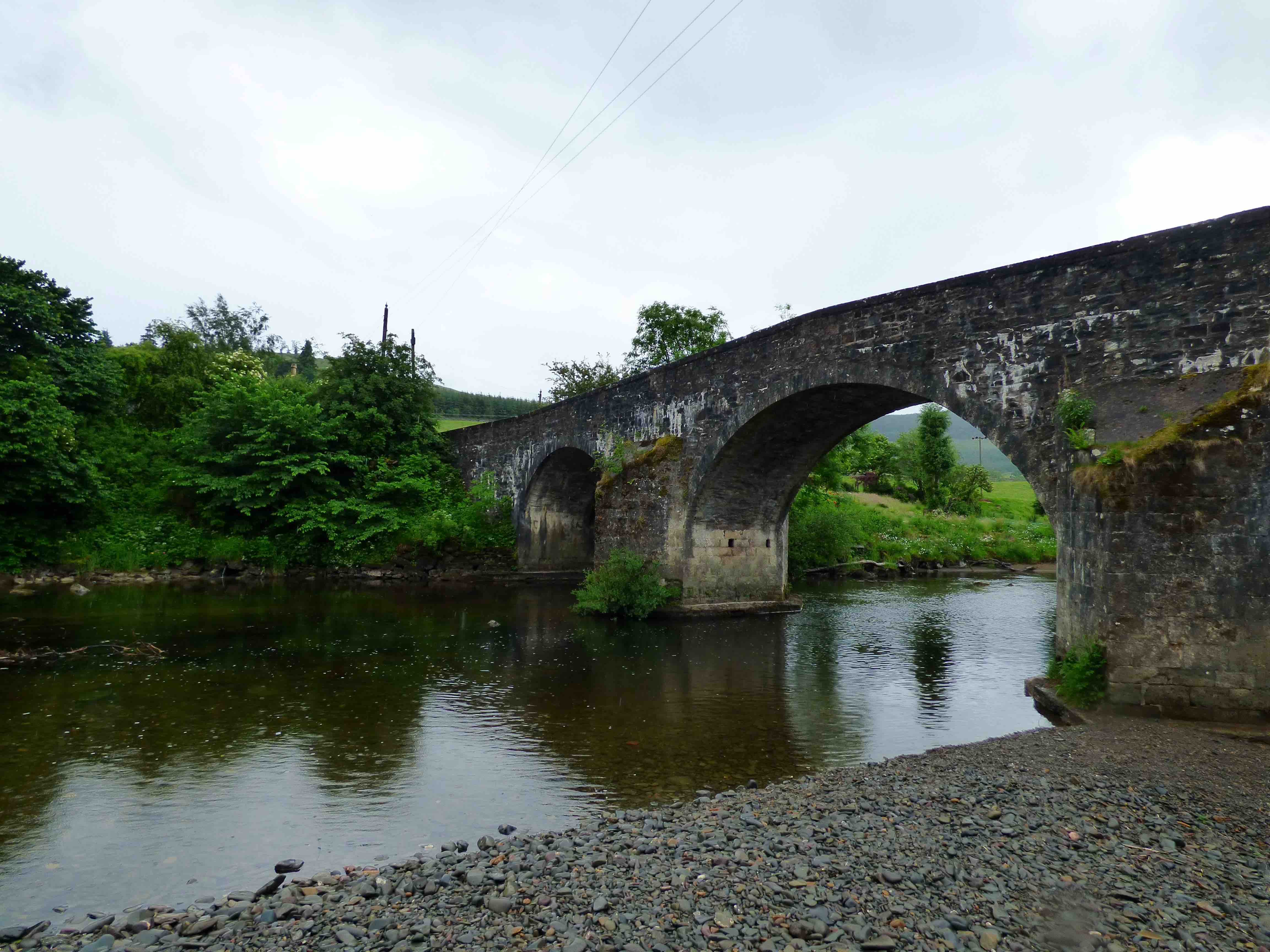
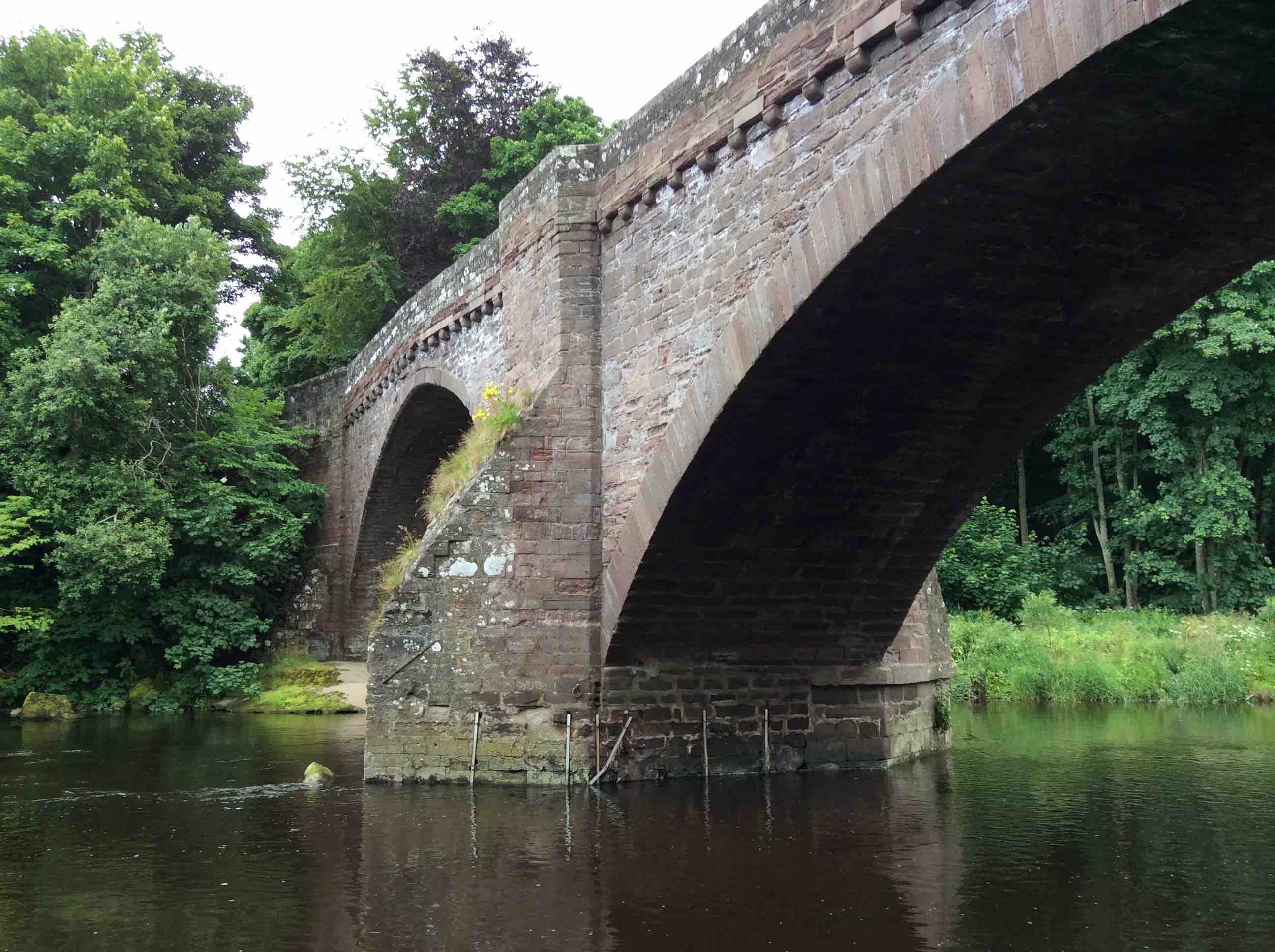
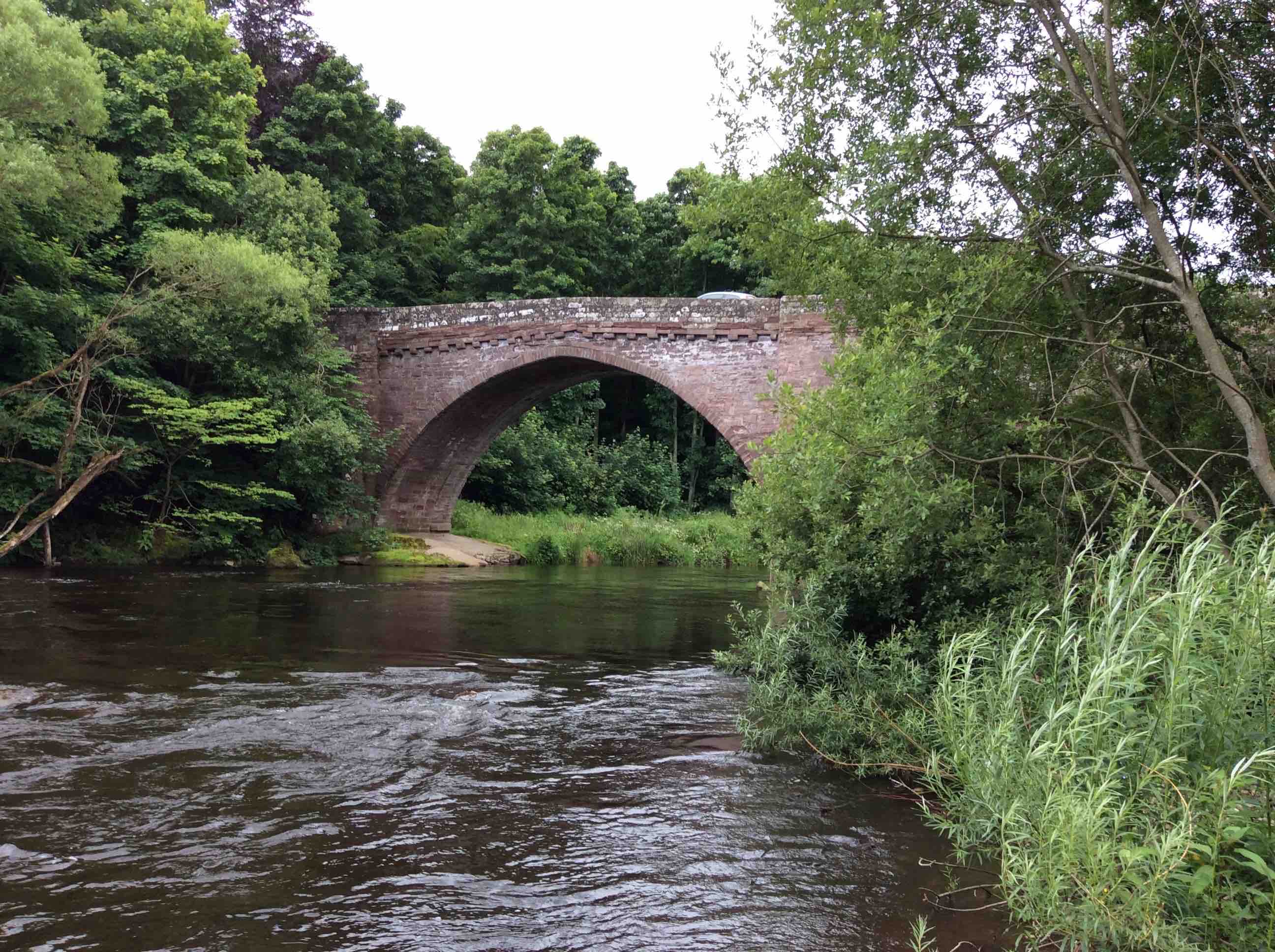
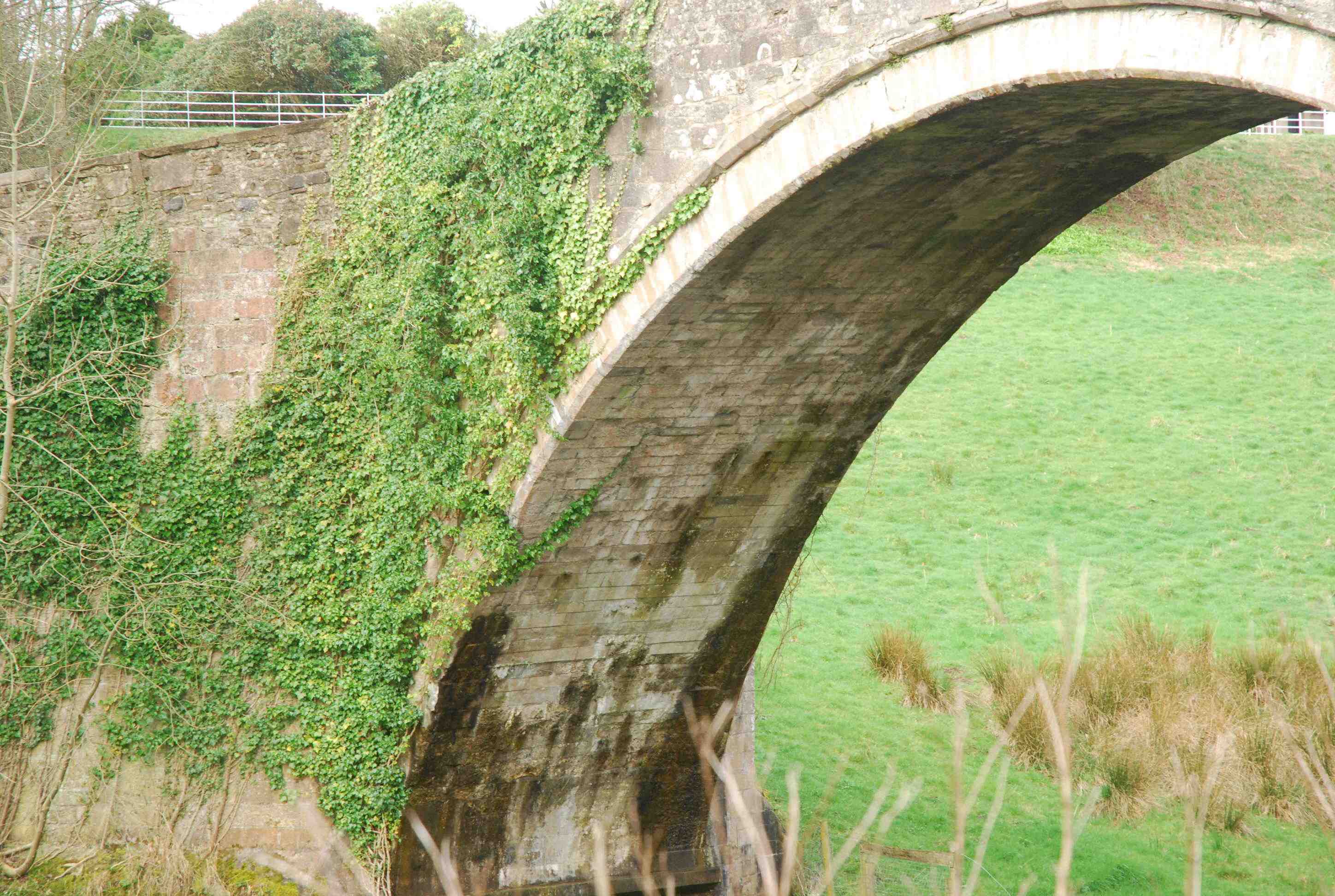
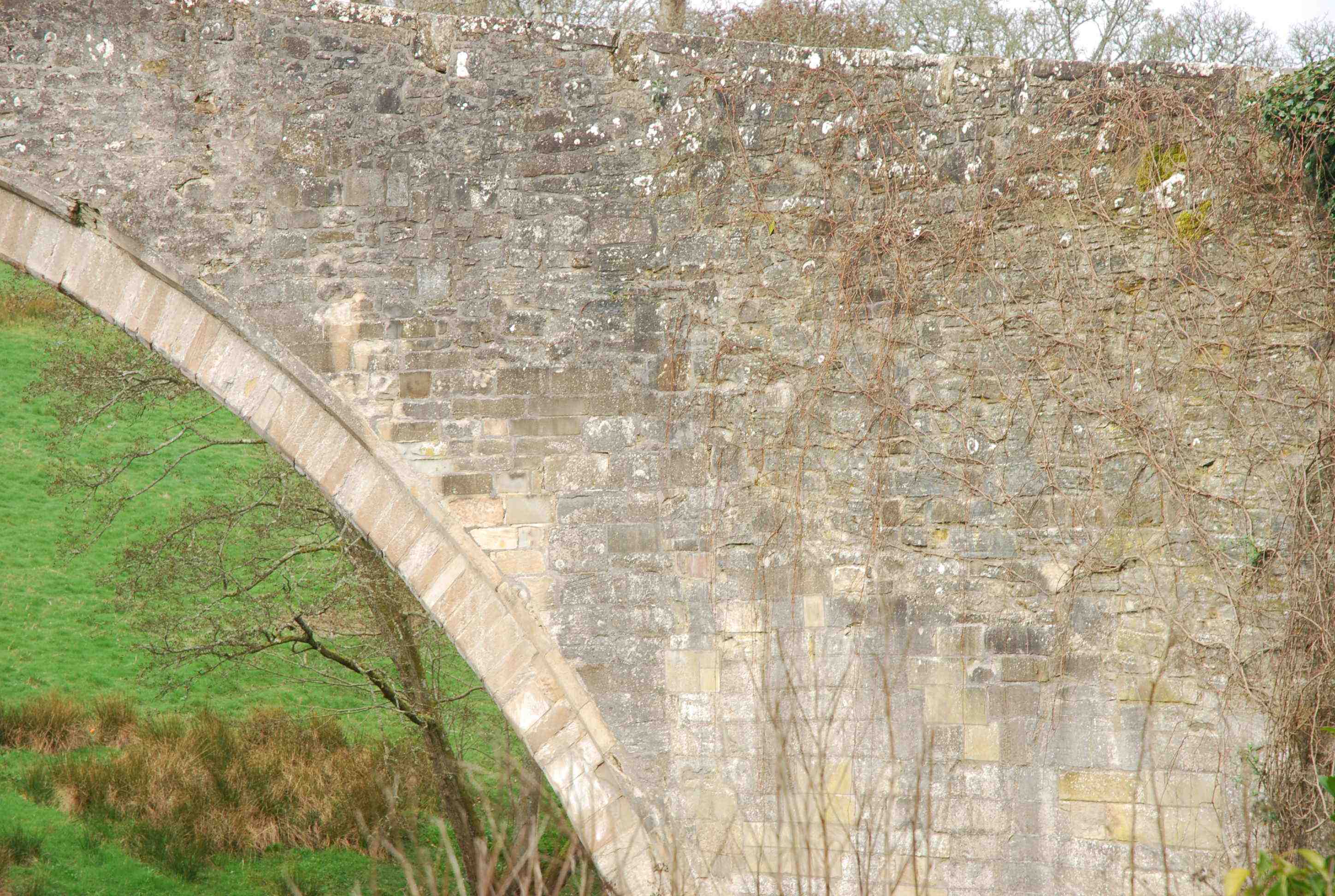
BALGONIE BRIDGE nr Glenrothes
C.Fife R.Leven 331728,700430
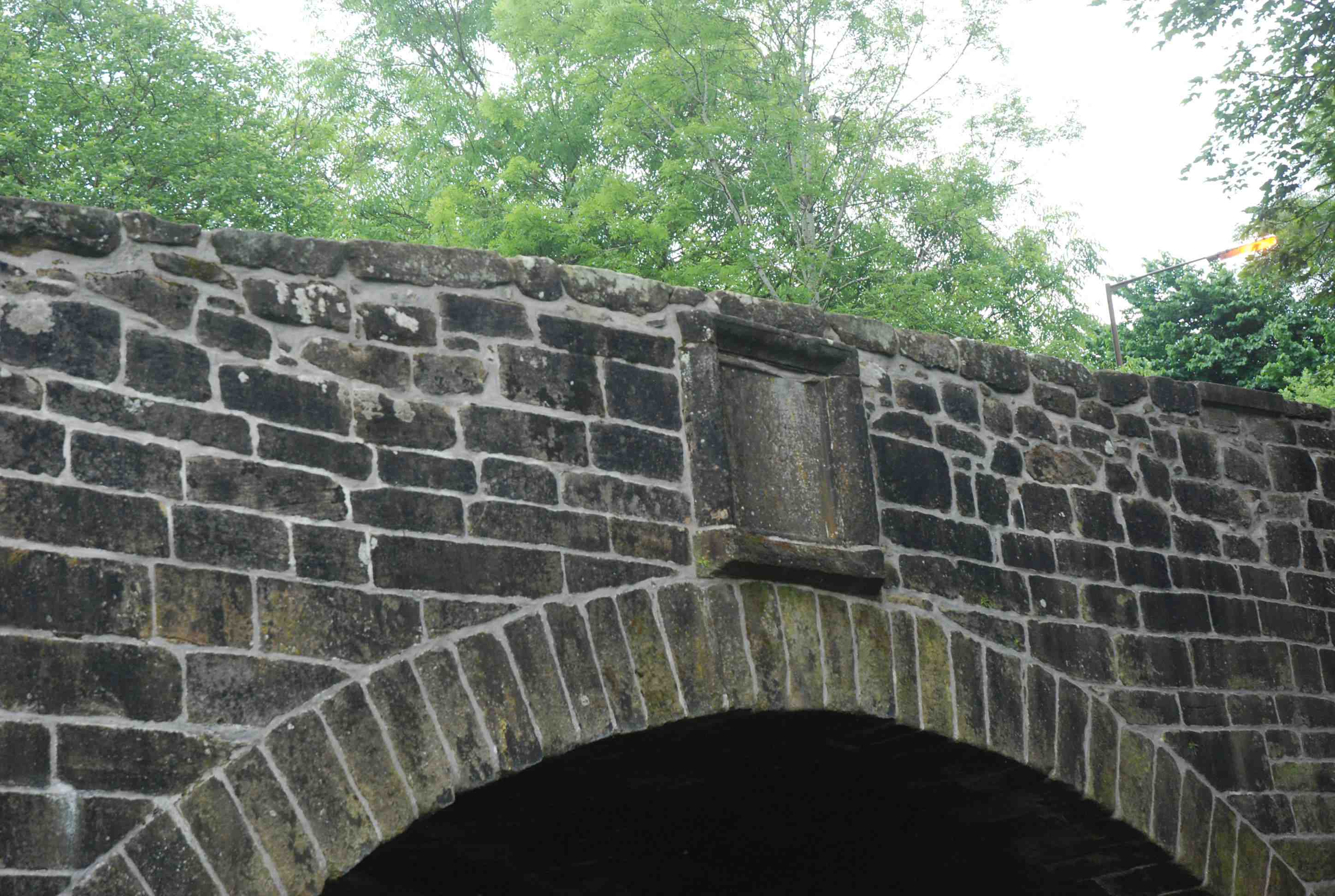
History: Also called Balfour Bridge. Very close to Balgonie Castle which was in the hands of David Melville, Earl of Leven, in 1710 when the bridge was built. The heraldic panel is indecipherable but could be Melville Arms. Sibbald (History of Fife) attributes the bridge to him. Macfarlane records the bridge in 1725.
Maps:1750. Not on Pont (1640) so this would fit.
Currently: Appears older than 18th century in style but probably younger than 1682. 1710 seems unlikely because of the style.
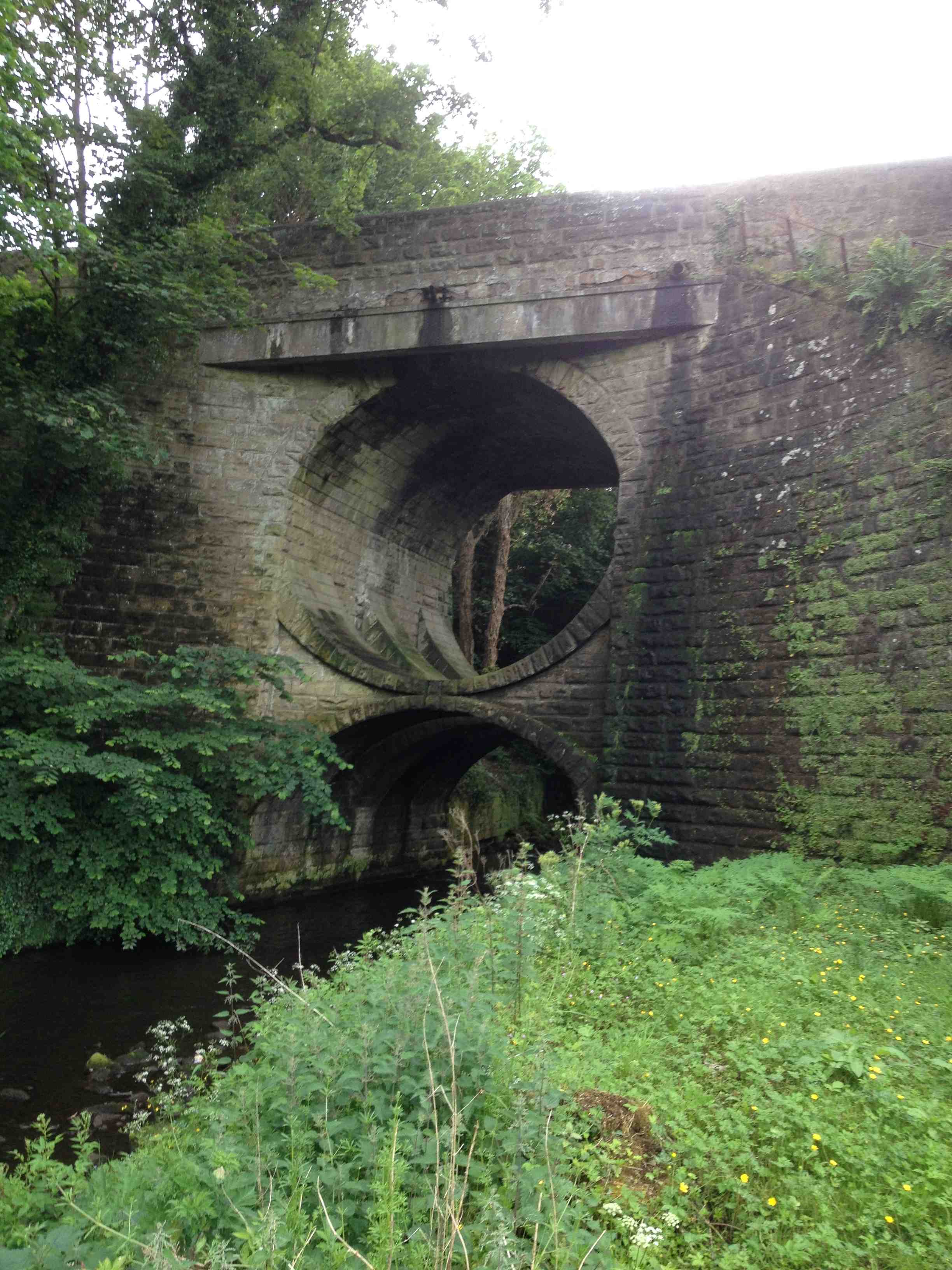
Widened on upstream side (photo).
Two segmental arches. Appears to be in very old weathered ashlar which has lost some of its coursing, due to repairs. Heraldic panel over central cutwater. Ashlar voussoirs, slightly chamfered.
Link photo photo.
_______________________________________________
BALGOWNIE BRIDGE Aberdeen
History: Possibly 14th century
Maps: Pont91600) Blaeu(1640) Roy(1750)
Currently: Probably 15th century
_______________________________________________
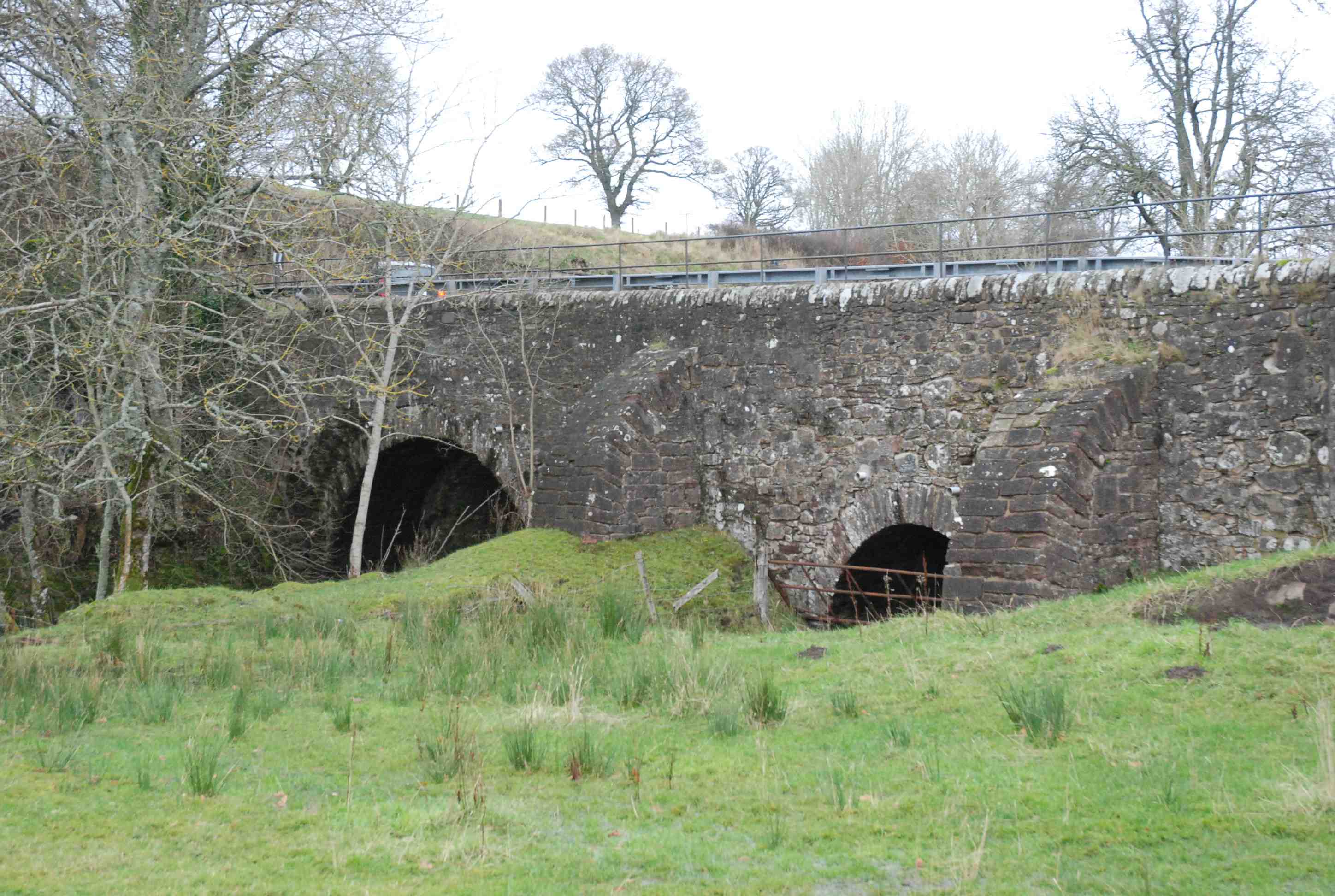
OLD BANNOCKBURN BRIDGE nr Stirling
C.Stirling Bannock Burn 280763,690444
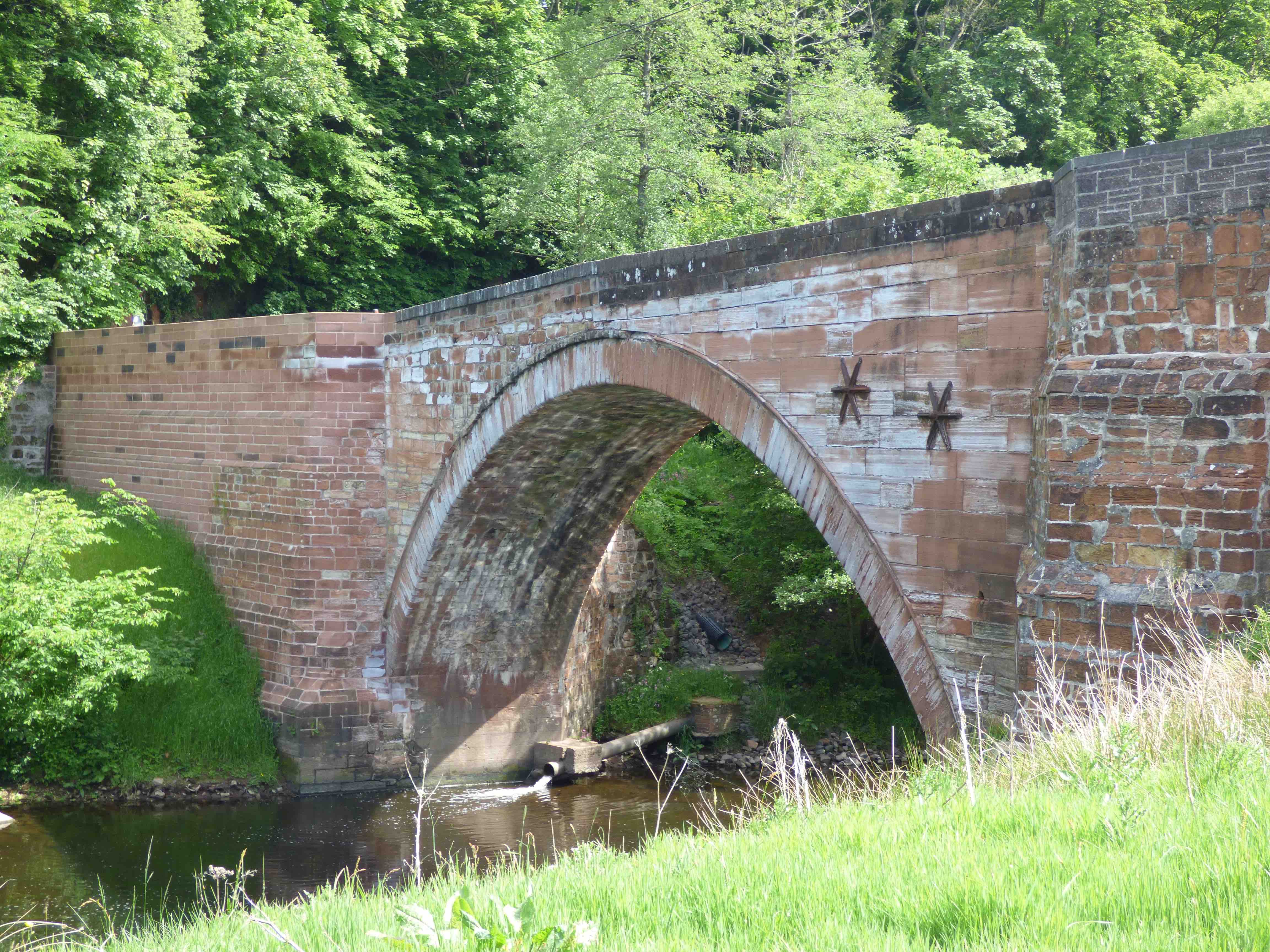
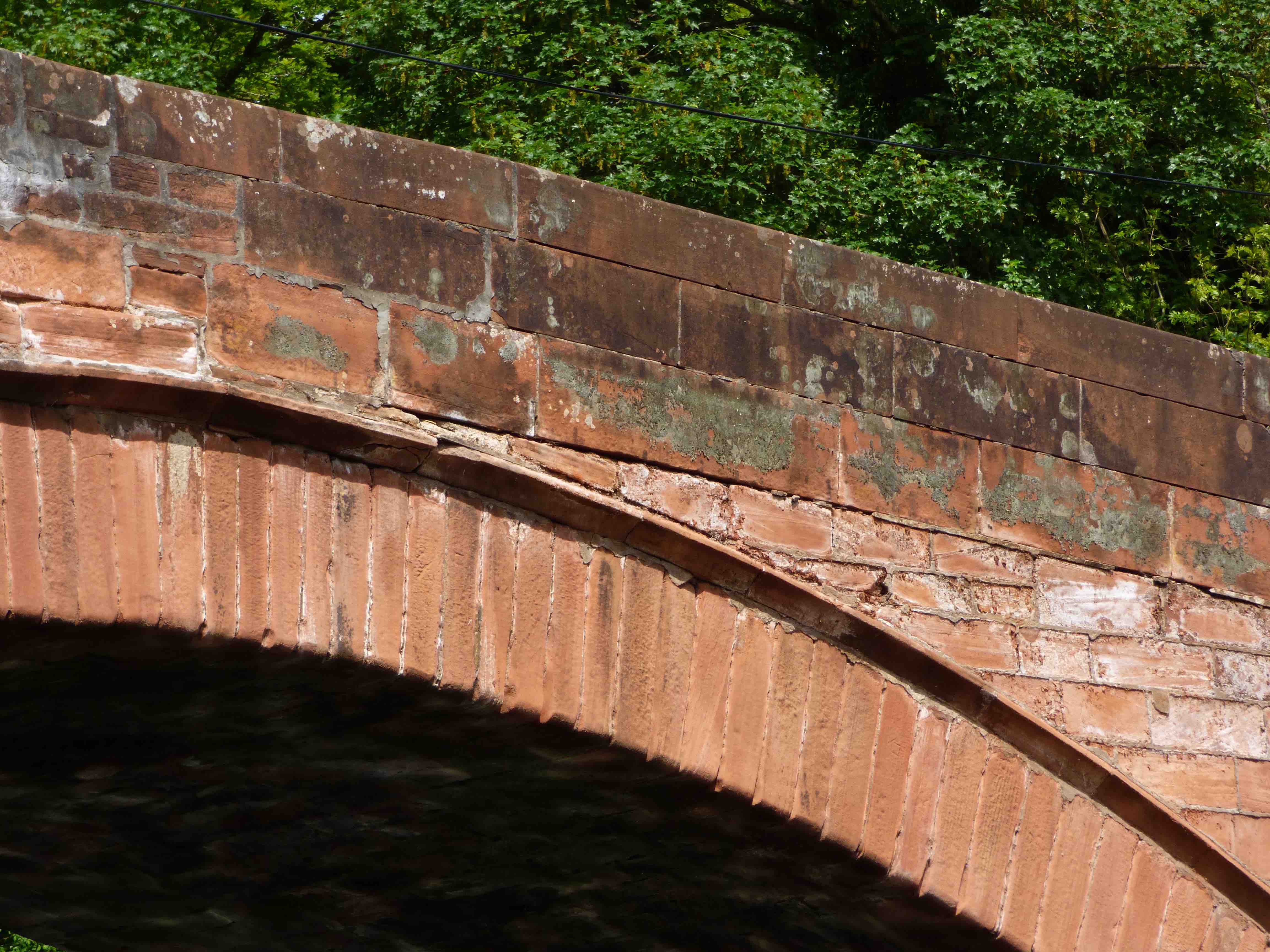
History: Built in 1516 according to plaque (1781). Repairs in 1631. Substantially rebuilt in 1710 and then widened in 1781(see photos). Included in the first turnpike to Edinburgh in 1750s. Bypassed to the east in 1813 by the magnificent Thomas Telford bridge which also bypassed the town main street (see last photo). Robert Spittal was reputed builder of the earliest bridge as well as Doune and Tullibody bridges. This is strange because it is very different from both Tullibody and Doune bridges which in turn are different from each other.
Maps: 1600(Pont) 1640(Blaeu) 1680s(Adair) 1750(Roy)
Currently: a 17th century bridge- possibly with an older original arch with chamfered voussoirs on the older eastern part. Un-chamfered on the widening. Single almost semicircular arch . Largely squared and coursed rubble spandrels and dressed voussoirs. Very splayed at the south approach. 25ft wide and the earlier part 12ft. This last is unusually large and suggests the 1710 build rather than 1516. Clearly on Pont's map which is significant.
_______________________________________________
OLD BARSKIMMING BRIDGE nr Mauchline
C. Ayrshire R. Ayr 249056,625414
History: Clearly on Blaeu (1640), so much older than was thought. Only two bridges on the Ayr River are on Blaeu's map. Original was probably 16th century. Possibly linked to the adjacent mill. Comm.of Supply repairs 1715 (‘profound ruining and falling down’) and in 1755. Plaque (photo 4) suggests an extensive rebuild. OSA attributes this to Sir Thomas Miller, who introduced wagons and carts to the parish. Macfarlane (1720) records'..one great arch- the highest and largest to be in the kingdome’. Comm.of Supply repairs 1715 (plaque), and in 1719 and 1755. Then in 1776 the Commissioners built 'a new arch seven foot lower and two foot wider than the former arch..and the public got a safe bridge as any in the country.. at a cost of £212/13s/2p' Clearly the entire structure was dismantled and rebuilt. Further considerable repairs in 19th century. Also very sensitive repairs in 2015 with road closure for some weeks.
Not to be confused with New Barskimming bridge (1770), which is strangely at Old Barskimming about 1km away.
Maps:Roy(1750) Adair(1680s) Blaeu(1640)
Currently: mainly 18th century. Large single recessed segmental arch in pink sandstone with ashlar voussoirs. Spandrels and abutments appear to be weathered ashlar in parts. Elsewhere, coursed squared rubble. Plumb and batter style on downstream side (rather Thomas Telford in style). Parapets more recent and the north approaches are very new.
_______________________________________________
BENTPATH BRIDGE nr Langholm
C. Dum & Gall R. Esk 331160,590251
History: Built in 1734. Provides access to the Westerkirk kirk which was 14th century; the kirk was rebuilt in 1788 and again in 1888. Church records from 1693.
Maps:Roy(1750)
Currently: Early 18th century. Two span random un-coursed but faced-rubble bridge with stilted segmental arches. One flood arch. Dressed rubble voussoirs. Piers appear to be in weathered ashlar. Large cutwaters. No string course.
Link photo.
_______________________________________________
BERWICK OLD BRIDGE
C.Berwick R. Tweed 399595,652721
LINK TO FULL SUMMARY.
History: completed in 1624.
Maps: 1750(Roy) 1640(Blaeu)
Currently: 1624.
_______________________________________________
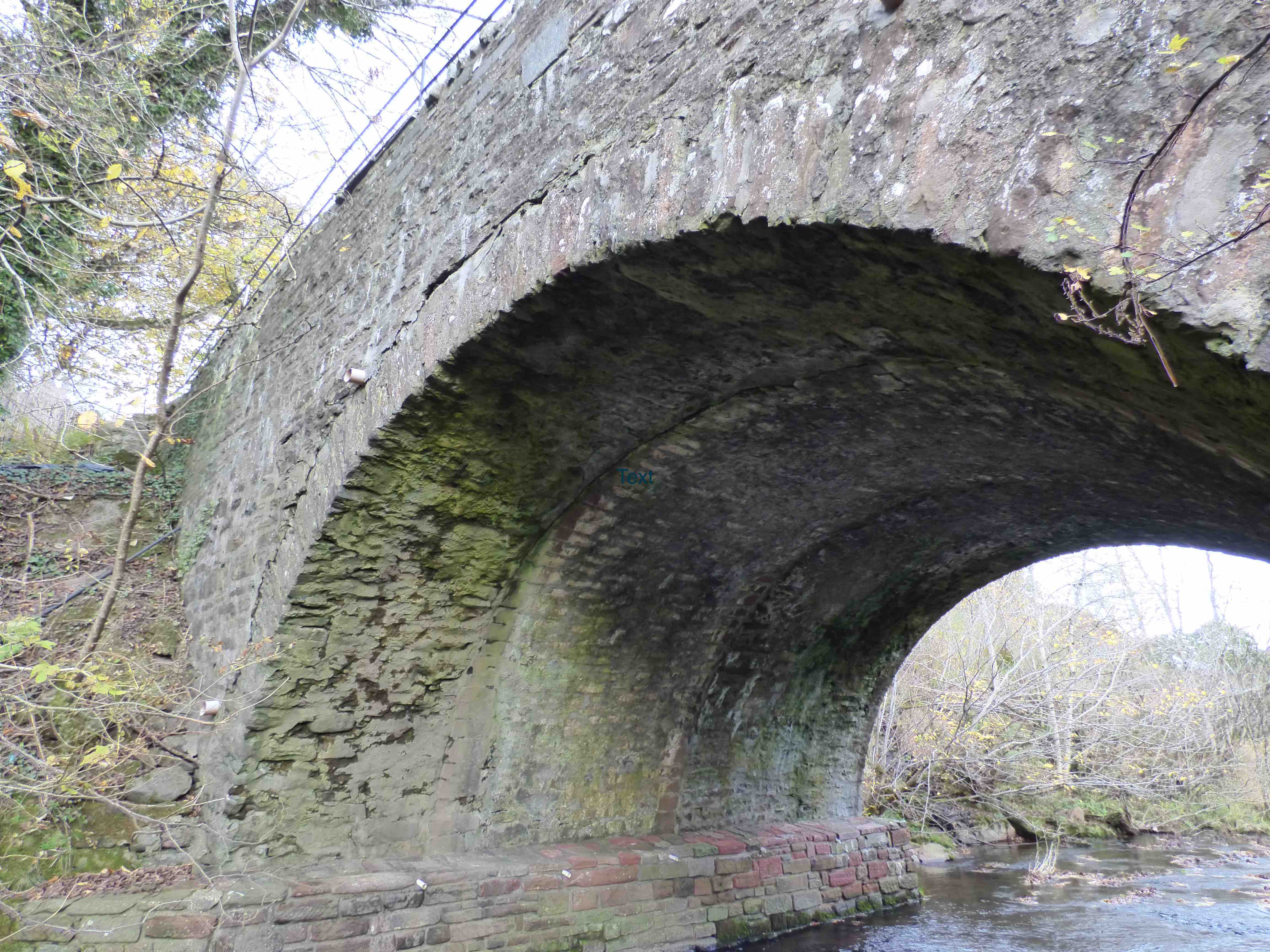
BISHOPS BRIDGE near Muthill
C.Perth Machany Water 287522,715369
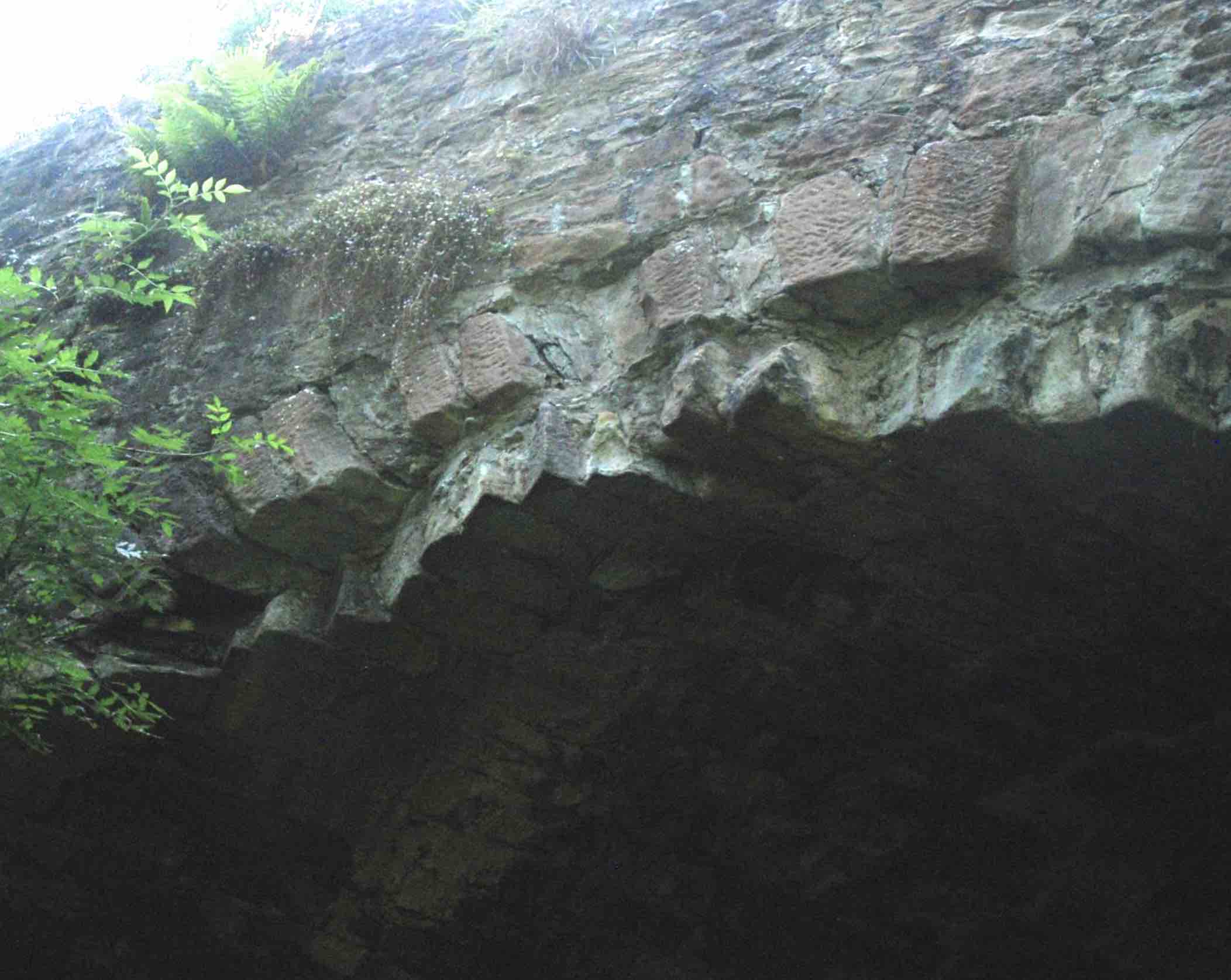
History: This bridge is on Pont's map only. It lies precisely on the line of the Roman road from Camelon to Perth (Bertha). There are clear traces of the Roman road 800m to the south at 287403 714825, including quarry pits. The road was Flavian (c.80AD) perhaps with an Antonine (c.140AD) over-build. There is no evidence of bridgework from this period. However, Bishop Ochiltree is reputed to have built a bridge here around 1420. He was Bishop of Dunblane and a close advisor to James I. He also built the bridge at Braco. Macfarlane describes Bishop’s Bridge in 1727.
Maps: Pont 21 (1600) Adair(1680s)
Currently:15th, 18th and 19th centuries. Single semicircular arched random hammer-faced rubble bridge with segmental flood arch. Voussoirs in dressed rubble. The bridge is 18th century with 19th century widening. However, within the soffit of the main arch there are three sandwiched arches. These are 13ft,7ft and 6ft respectively (distorted in the photo). It is possible that the centre one is of the 15th century. Certainly, none of them is an 18th century military bridge since the military road ran a kilometre or more away to the west. The arch is semi-circular, this design being preserved through later builds and widening. The bridge was not on Roy's map. Roy describes two crossings of the Machany Water a mile or so on either side: upstream at Steps there is the King's road bridge built by Major Caulfield; downstream at Ness there is a ford.
photo photo photo
_______________________________________________
BLAIRQUHAN HOUSE BRIDGE nr Straiton
C. Ayr Girvan Water
History: In 1750 the road ran parallel to the present road but 300m to the north, crossing to Straiton by this bridge. Blairquhan Tower House was 14th century. The castle was from 1570.
Maps:Roy(1750) Blaeu(1640)
Currently: An 18th century single arch segmental humped bridge with pointed parapets and haunches. Dressed and mainly coursed squared rubble spandrels. Voussoirs in rubble. Hood mould. Interesting corbelling at foundation level. It has the appearance of a late 18th century structure but with one or two older features.
photo photo photo.
_______________________________________________
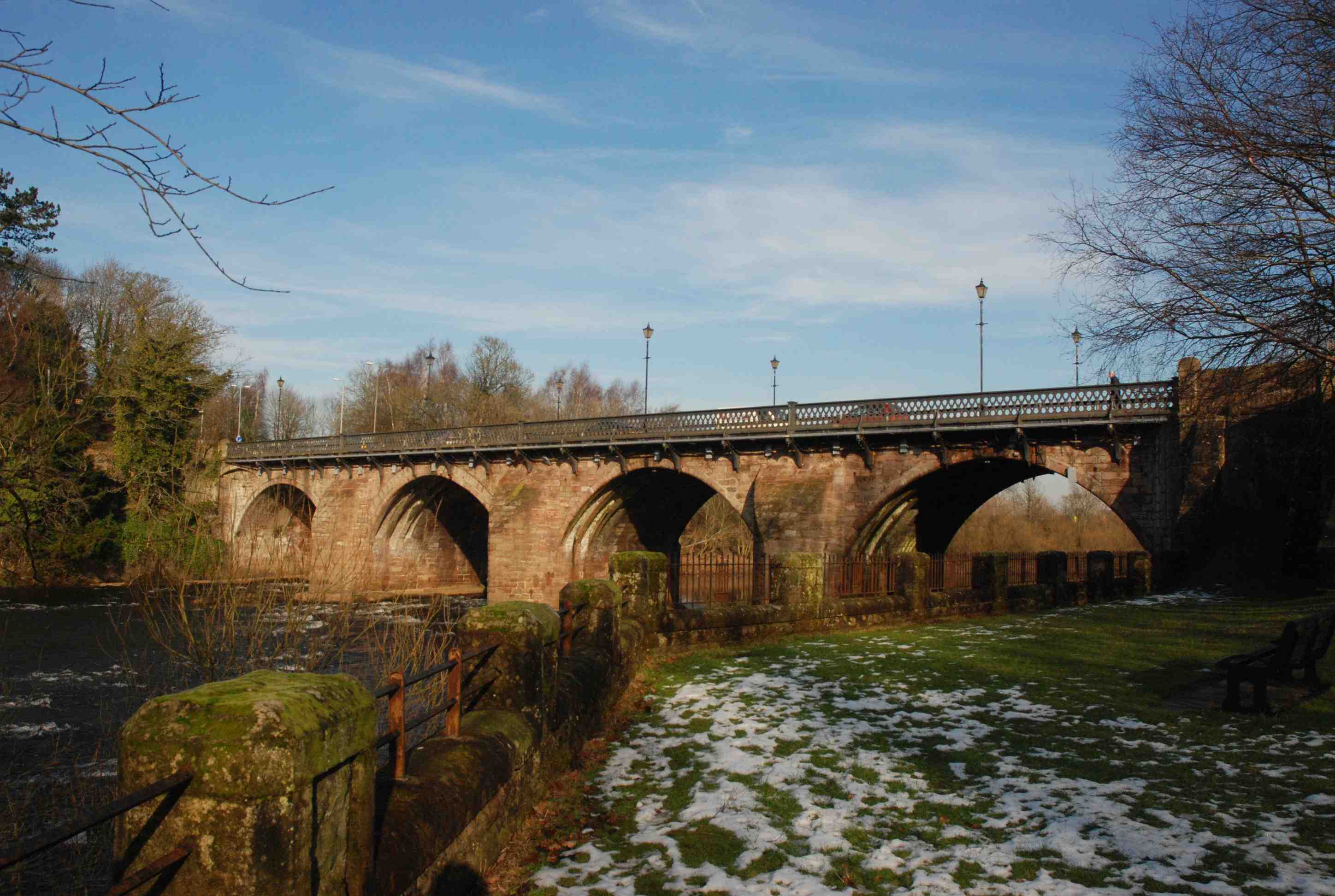
BOTHWELL BRIDGE nr Hamilton
C.Lanarkshire R. Clyde 271087,657757
History: Reputed to be 14th century. Written date 1490 (Inglis). Collapsed in 1645. Repaird by Act of parliament in 1646. Battle of Bothwell Bridge(1679): Charles II’s dragoons, under Monmouth and Claverhouse, routed 6000 Covenanters. Macfarlane(1720s) notes that the 'bridge belongs to the government but is set in tack to the toun' (the town gets the toll money). Widened and restructured again in 1826 and 1871. It appears that a previously 5 arched structure was reduced to 4 arches, the Hamilton arch being removed prior to 1720 when Macfarlane describes 4 arches. Skene describes a less elevated structure prior to 1826, and very much narrower with a central fortified gateway. The bridge carried the A74 trunk road prior to the motorway replacement.
Maps:Roy(1750) Adair(1680s) Pont 34 (1600) Blaeu(1640)
Currently: Early 17th century reconstruction of a pre-reformation bridge. Mainly 17th century. Four segmental arches, raised and ribbed. The bridge is humped and narrow (11-12 ft.) It now has four ribs on the un-widened side. Blocked-in coursed squared finely dressed pink sandstone spandrels and cutwaters.
Probably too restructured now to be classed as pre-reformation.
Link photo photo photo.
_______________________________________________
BOW BRIDGE Elgin
C.Aberdeen R.Lossie 320343,863251
History: Certainly present on Pont's map ( 1600) . Then a new bridge in 1635 (plaque). Too early for Statute Labour so probably by public subscription. Extensively rebuilt again in 1785. Lauder notes that it was one of the few bridges to stand firm through the 1829 floods; the river broke its banks instead. Today, this 18th century bridge is still taking traffic, and probably too much of it.
Maps:1750(Roy) 1600(Pont)
Currently:Appears largely late 18th century, probably from the 1785 restructuring. There is no evidence of widening. Single semicircular arch. Very well dressed rubble spandrels. Widely splayed entrances at both ends.
Date-stone "foundit 1630 finishit 1635" though little of this remains. Possibly some masonry on the lower spandrels. There is an odd 19th century abutted arrangement to one side, to support service pipes encased in aluminium.
_______________________________________________
BOYNDIE BRIDGE Inverboyndie
C.Aberdeen. Boyndie Burn. 366831 864450
History not known. Although the bridge is present on Roy's map(1750) it is very noticeably absent from Macfarlane's Collections (1725); it may well date to the 1730s or 40's. An unusual cast-iron plaque can be found in the Banff Museum relating to the erection of a bridge on Banff Links in 1919. It certainly cannot relate to this bridge which is from a much earlier period.
Maps: Roy(1750)
Currently: A small village bridge leading to a very ancient kirk. It is mid-18th century in style- a small two arched structure in well dressed un-coursed random rubble. There are whinstone rubble voussoirs but a better dressed overlying keystone. 13 ft spans. Small rounded cutwaters in ashlar may come from a later date. It may have been widened in the 19th century. ( Photos and information retrieved by Mhairi McKean,BPHS.)
_______________________________________________
BRACO BRIDGE see ARDOCH
._______________________________________________
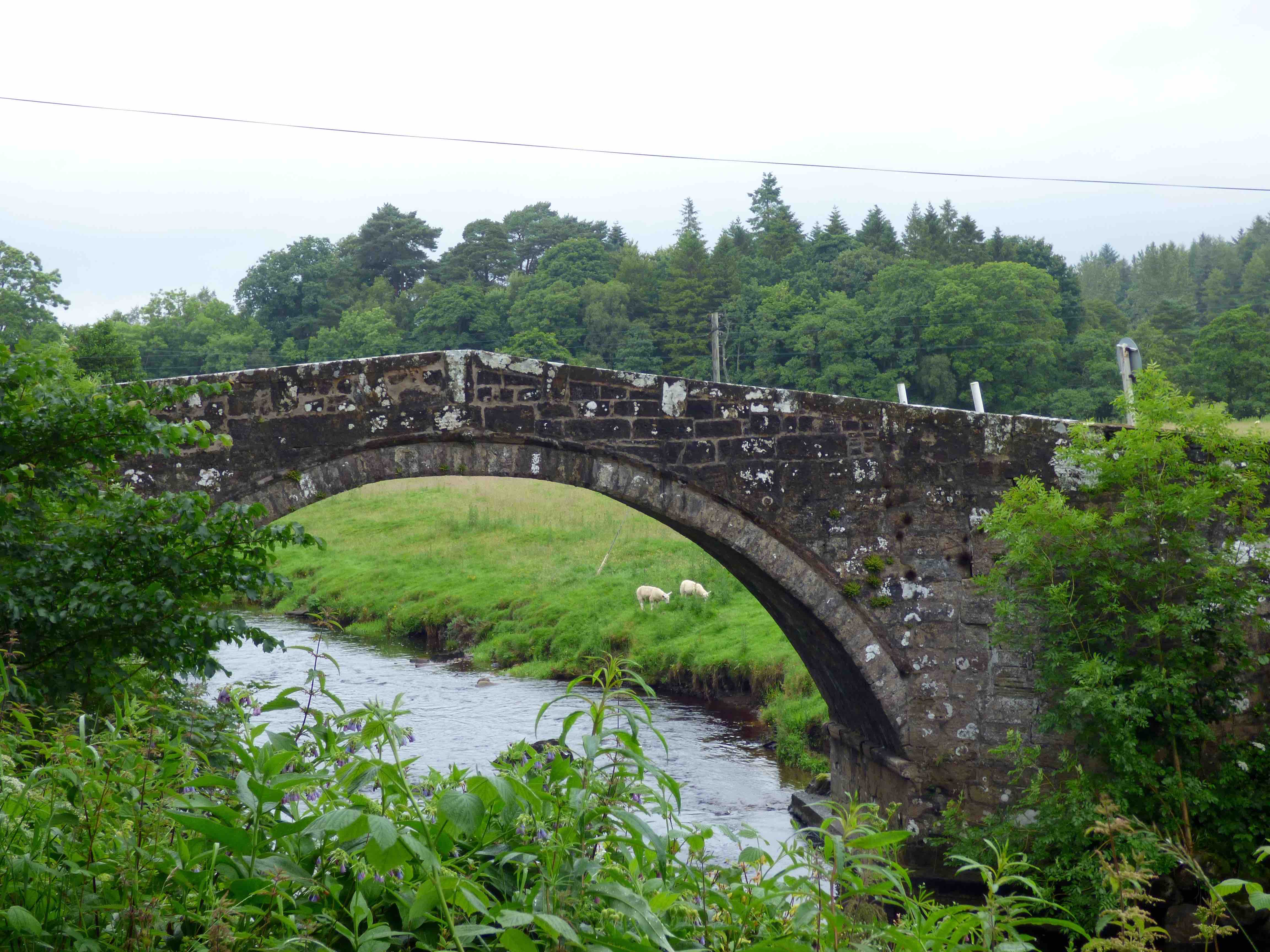
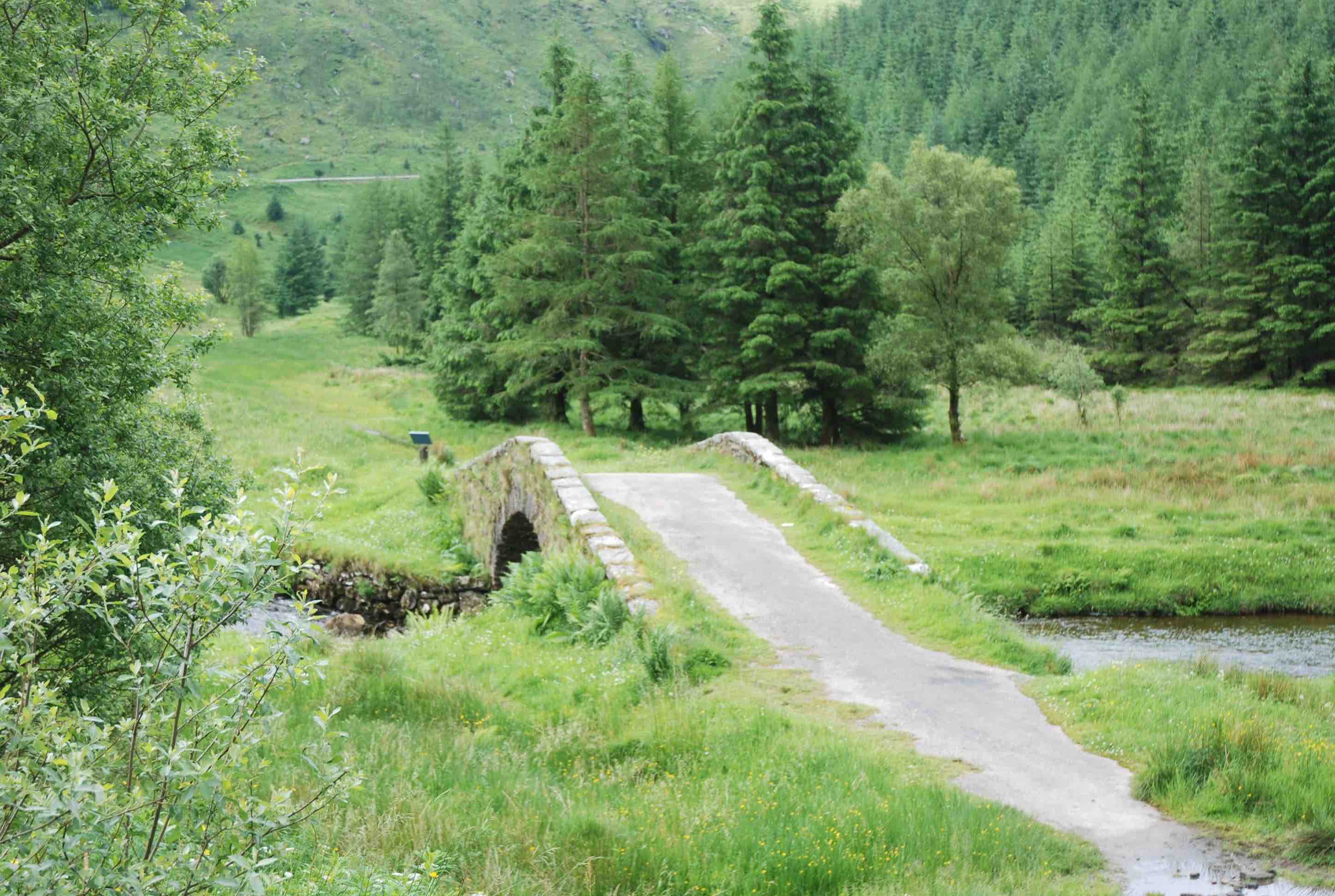
BRAELECKAN BRIDGE
C.Argyll Leacann Water 201951,702760
History: An ancient long distance drove road ran from Kilmartin and from Ford, through the hills between Aweside and Loch Fyne, aiming for Inverary. Well mapped on the OS and well documented by Haldane. This bridge sits on the road.
Maps:1750 but abnormal depiction.
Currently: 18th century humped single segmental arched bridge. Slightly stilted. Random rubble, pitch-dressed. Crude rubble coping. Rubble voussoirs which are radially aligned and of regular length. Slightly splayed. The bridge is well maintained. 10ft wide between parapets. 18ft span. It sits on the edge of a waterfall as can be seen in the photos.
_______________________________________________
BRECHIN BRIDGE
C.Forfar South Esk 360441,759263
History: Mentioned in the Charter Reg.Episcopatus Brechinensem: 1218-1222: sale of lands to provide upkeep for the bridge. The bridge is near the 12th century cathedral. There was a resident Culdees community who may have been responsible for earliest construction which is reputed to have been wooden. A masonry bridge from the 15th century- built by Bishop Carnnoch(1426-59). There are references to repairs in the 17th and 18th centuries. The north arch was completely rebuilt in 1786, along with west-side widening( Alexander Steven).
Maps:1750 1640 (Blaeu's full map of Scotland)
Currently: 15th century on the south arch, especially on east side which is slightly pointed with a beautiful corbeled parapet. Two arches, one segmental and one gothic. Squared rubble, sometimes coursed, sometimes weathered ashlar. Well dressed voussoirs especially on the west side. Clearly, there has been a lot of restructuring but 15th century (or earlier) work remains on the south arch. The most striking feature is the heavy denticulated string course. Cutwaters rise to refuges.
_______________________________________________
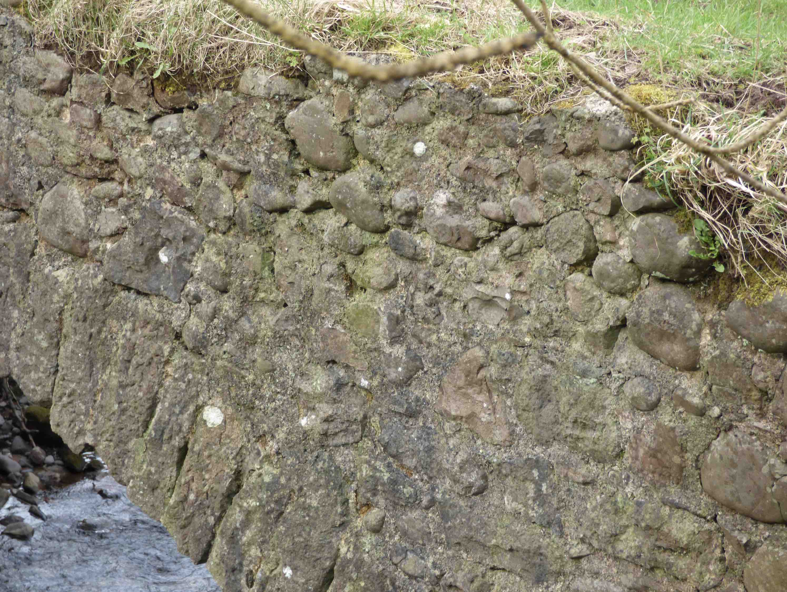
BRENCOILLIE BRIDGE
C. Argyll Leacann Water 202342,701900
History: An ancient long distance drove road ran from Kilmartin and from Ford, through the hills between Aweside and Loch Fyne, aiming for Inverary. Well mapped on the OS and well documented by Haldane. This bridge may have been on a branch of this, going south to Furnace and then crossing to Strachur.
Maps:1750 but abnormal depiction.
Currently: 18th century humped two segmental arched bridge. Random rubble, hardly dressed. Whinstone voussoirs which are radially aligned and of irregular length. Pitch-dressed rubble coping. Slightly splayed. Cutwaters on both sides. Filled oculus. The bridge is in remarkably good shape. 11ft wide between parapets. 16ft spans. It has been suggested that this may be later 18th century because of the oculus (characteristic of Smeaton and Mylne). However, its other features, along with its presence on Roy, strongly suggest early 18th century.
._______________________________________________]
BRIG O DOON Alloway
C.Ayr Doon Water
History:Possibly circa 1460 (Paterson) but this is unlikely from arch shape and span. First documented 1512. Rebuilt sometime after 1593 because it was declared ruinous. Comm. of Supply repairs 1720. Very extensive report in early 19th century (C. of Supply minutes), suggesting imminent collapse unless very major intervention was undertaken including wooden entering. A bypass was completed in 1815 which may have been the only response. It is not clear whether these essential repairs were done to the old bridge at this stage, or considerably later. Major repairs and support in 1972 and in 2011. Famous for skirmish between Cassilis and Bargeny(1601) and last verse of Tam o'Shanter(Robert Burns). Also featured in the 1947 musical, of that name, although the location was fictional.
Maps:Roy(1750) Adair(1680s) Blaeu(1640) Also on Gordon.
Currently:Large single 72 ft almost semicircular arch. Dressed ashlar voussoirs with un-ribbed soffit. Small slim hood-mould with the voussoirs reset from this. Spandrels and abutments in weathered yellow sandstone ashlar in lower parts and coursed squared rubble spandrels higher up. Partially faced random rubble at the crown with a small unusually fashioned coping. Now a major tourist attraction and footpath.
photo photo photo photo.
_______________________________________________
OLD BRISBANE HOME BRIDGE nr Largs
C. Ayrshire Noddsdale Water. 221153,661993
History: Just discernible on Roy's map is this old bridge on the approach to the Old Brisbane House. The house, now demolished, was called Kelsoland on Roy and on Blaeu's map, and dated from 1636. The Kelso family had owned the estate since the 13th century. In 1671 the Brisbanes acquired it. Their most illustrious descendant was Thomas Brisbane, Governor of New South Wales in 1821, and after whom Brisbane is named. There are no details of the building of the bridge which lies just opposite Midton (Middleton) on Roy's map.
Maps:Roy(1750) Not on Blaeu.
Currently: This is a beautiful little early 18th century segmental arched bridge. Rubble voussoirs and undressed random rubble spandrels and walls. Squared and coursed rubble abutments. 6 ft wide. About 22 ft span. Small 18 inch parapets. Gently humped and slighted stilted. Overgrown and dilapidated.
_______________________________________________
BRUNSTANE BRIDGE nr Portobello
C.Lothian Brunstane Burn 331467,672581
History: Also known as Maitland Bridge after John Maitland who built the current Brunsane House in 1639. This was the estate bridge for the house which was occupied by the Earl of Abercorn in 1746. Records of 1641 show a toll of 1p per horse and 2p per cart applying to all traffic between Musselburgh and Maitland, and to any traffic bypassing between these bridges and the sea. The toll suggests a road to Edinburgh crossing the bridge. The stream marked the boundary of Edinburgh City. This is one of the oldest bridges in Edinburgh. It is also a skew bridge and appears to be shown as such on Roy's map.
Maps:1750(Roy) Adair(1680s) Pont(1600) and 1640(Blaeu)
Currently: An 18th century bridge. Single semicircular arch. Skewed. In relative disrepair and very overgrown. Two orders of voussoirs. East side voussoirs crumbling. The is a 'false-skew’ and the stressed voussoirs are typical. Grey un-coursed and squared rubble spandrels. Long grey un-coursed random rubble approaches with buttressing.
This must be one of the earliest skewed bridges; they were very rare prior to the railways becuase they were difficult to build, poorly understood and not really considered safe. This very precious bridge is very neglected and appears to be decaying.
_______________________________________________
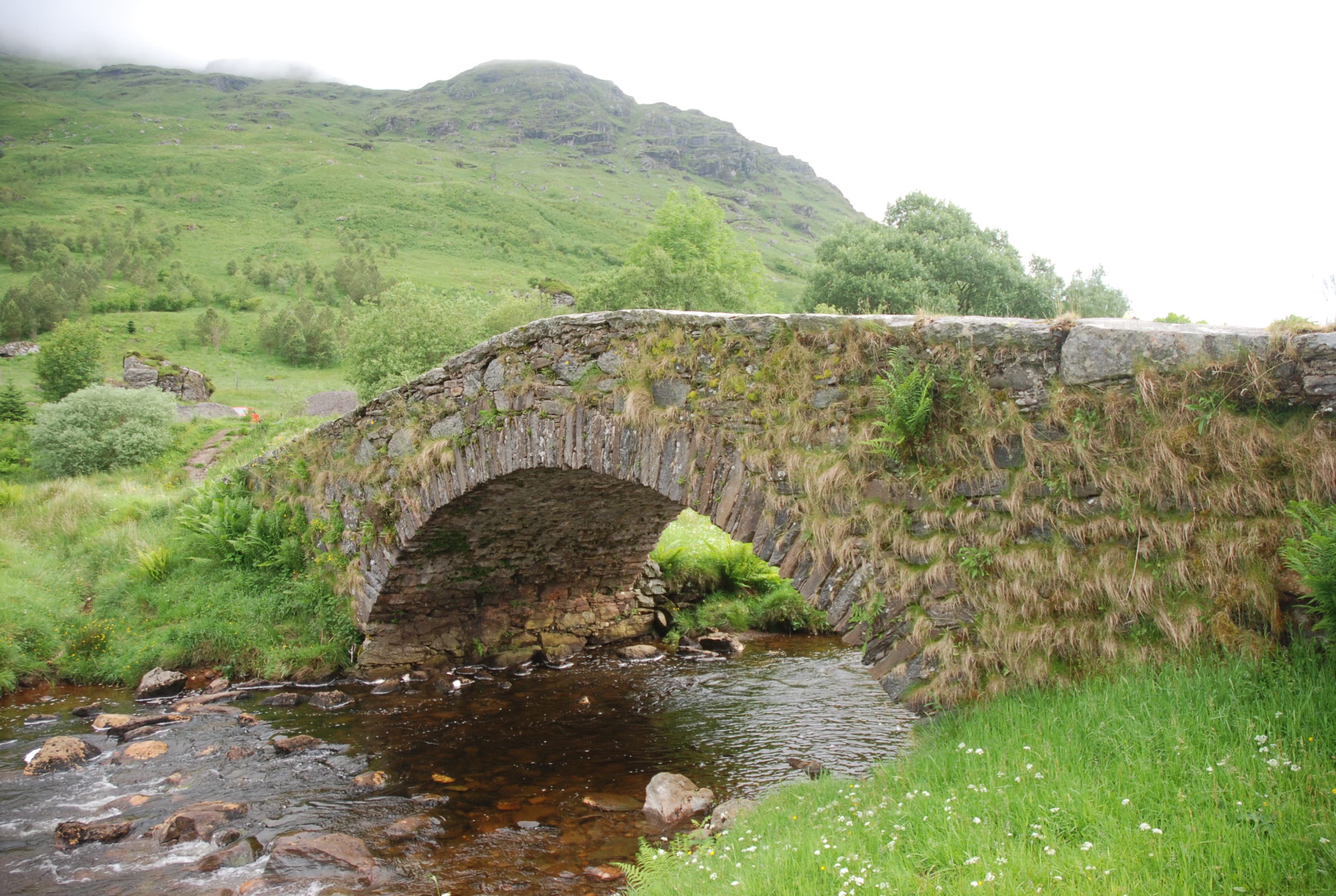
BUTTER BRIDGE Rest and Be Thankful.
C.Argyll Kinglass Water 223415,709511
History:1748 military. Caulfield. Dumbarton to Inverary road. This is a classic Caulfield bridge. Due east of the bridge are the slopes of Beinn Ime which is Butter Mountain in Gaelic. Thomas Clark, a Dunkeld mason, is thought to have been contracted for the build although Caulfeild is known to have had 10 masons directly in his employ. It may have been army built.
Maps:1750
Currently: Random un-coursed rubble bridge. Single segmental arch. Humped with parapets rising to the crown. Flat rough coping. Wide uneven whinstone voussoirs are radially aligned.